Del Aceite Greenway Nature Trail
Route Description
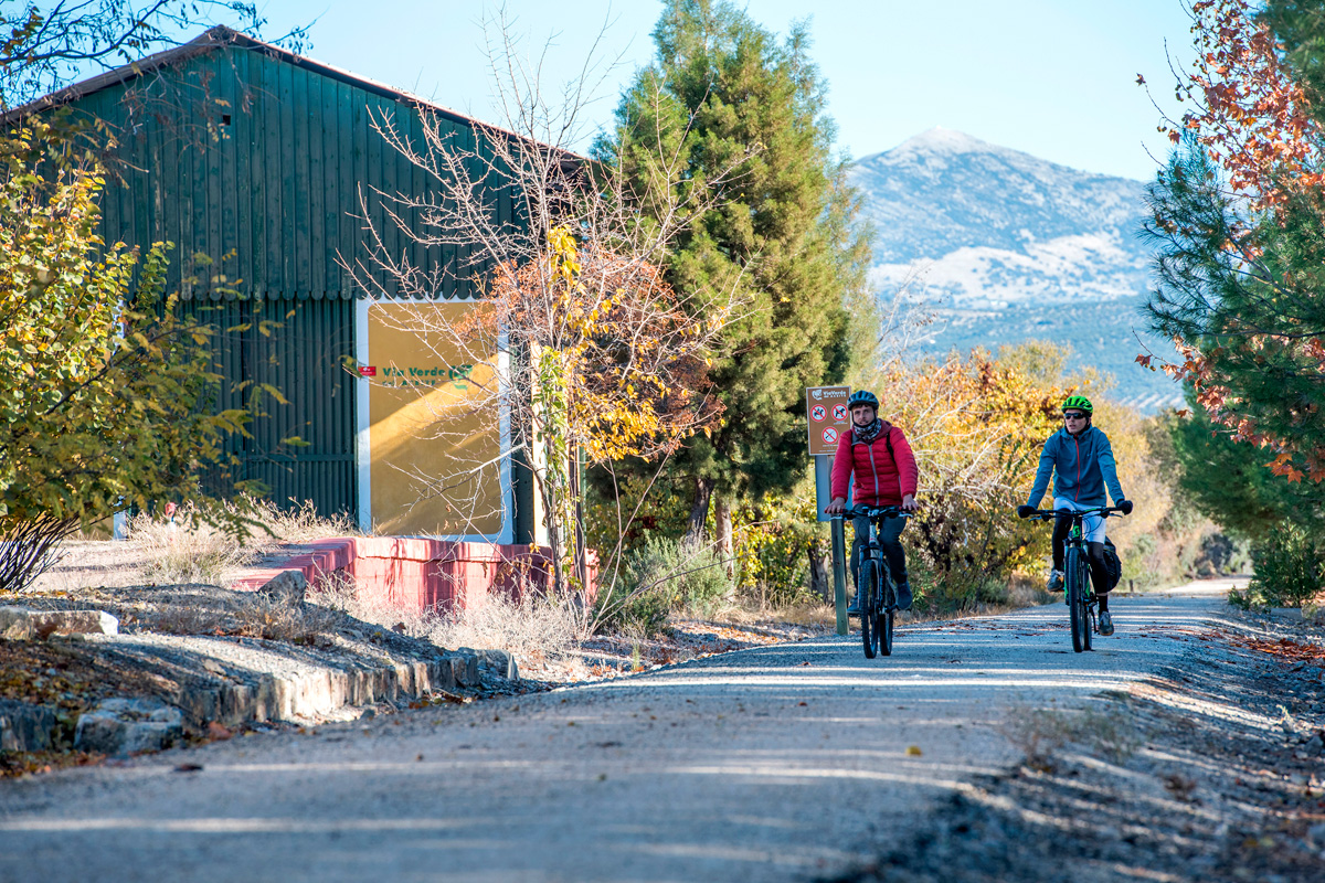 Jaén, dominated by the image of the Castle-Parador de Santa Catalina, is the place where the greenway’s km 0 is located. To find the starting point, we have to locate the Fuentezuelas sports centre in the northwest. The adventure begins at the junction of Calle del Pino and Avenida de los Aparejadores.
The first metres of the greenway run parallel to the active railway that heads towards Espeluy. After covering 1.5 km, we will separate from it and begin our ascent, avoiding the steep slopes of the Sierra de la Grana, crowned by Monte Jabalcuz. From there we can enjoy excellent views of the olive-growing capital’s urban area.
After around 2 km, the greenway is invaded by Jaén’s northwest ring road. However, a nearby underpass and some rural trails enable the greenway to continue on towards the route’s first station: Torredelcampo. Before arriving, at km 8, we will have the opportunity to alternate the greenway with the Los Torreones Archaeological Route, which is easily identified by panels.
From Torredelcampo to Martos
The A-316 dual carriageway invaded the railway route. To avoid the asphalt, the greenway crosses a metal footbridge (73 metres) over the road, enabling it to reach Torredelcampo Station (located at km 11) without any problems. We leave Torredelcampo behind and pass through the curved Caballico Tunnel (333 metres long, with lighting).
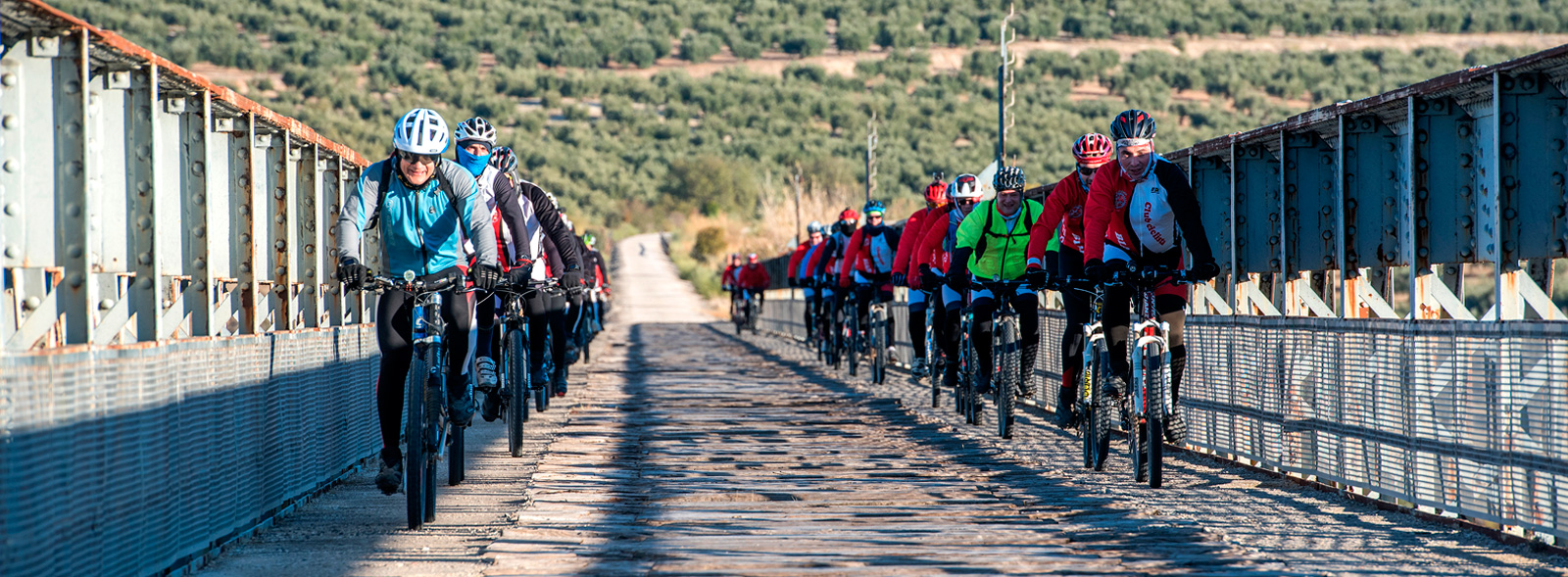
Located at km 12.5, the Piedra del Águila Bridge (104 metres) will be the first of a long succession of metal bridges. Supported by two stone pillares, its metal lattice stands out haughtily against the sea of olive trees in the surroundings. We recommend that you go down to its base; the view is breathtaking. A few kilometres later, after enjoying a splendid view of the endless olive grove and crossing another sobre, although smaller, metal viaduct, we approach Torredonjimeno.
Before arriving, and after having been surprised by the extensive building work that had to be carried out to drain and support these unstable slopes, we have to go through a tunnel (120 metres) and cross the A-136 by means of an overpass. We arrive at Torredonjimeno (km 15.6).
From here, our itinerary begins a winding route that allows it to gain height, in a parsimonious way towards Martos. At the beginning, we will cross over the approach road to Martos from the A-316 by means of a metal walkway. Shortly afterwards we will have to cross, once again (for the third time) the A-316, although, in this case, the greenway descends to a trail and takes advantage of an underpass. We approach the Martos crag. This bare rocky promontory, which rises up 350 metres above the town centre, is crowned by the remains of a castle. It used to keep guard over the entire valley and now serves as an altimetric reference point, indicating that we have crowned the "top" of the greenway. From here on we begin to descend, practically uninterrupted, to the Guadajoz River.
We will stop at Martos Station (km 23), which is being rehabilitated to accommodate new uses and services for today’s travallers. We leave Martos with a new encounter with the A-316. In this case, an underpass has been built for the greenway that allows us to easily cross the asphalt strip.
The solitude of the olive trees
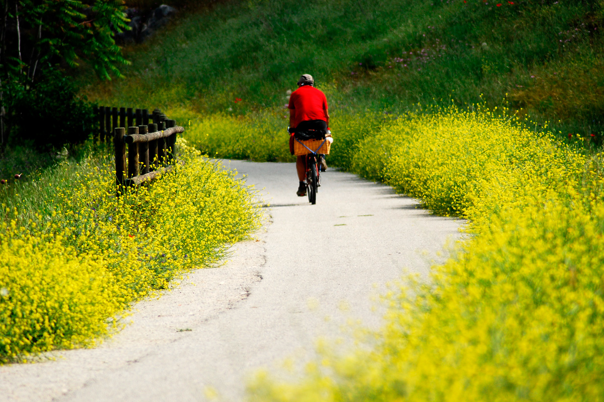 The sharp curves will continue to set the tone of the itinerary. Only embankments and trenches dare to break the perfect geometry of the olive grove. The green background is also broken by the sight of an old gypsum quarry located at km 26.5. Three kilometres further on we find ourselves back on the A-316, which we will cross by a footbridge. From here we continue our winding descent, contouring around the Capellanía Hill. After completing these bends, we come across the valley carved out by the Salado River. The railway crossed this channel by a daring, 208-metre-long metal bridge (km 34), supported by two ashlar pillars, being one of the route’s most majestic works. Little by little, rugged terrain replaces the hills, bringing us closer to the foothills of the Subbética mountain range.
And so, due to this rugged relief, we soon come across another spectacular viaduct, the one that crosses the Higueral Stream. Somewhat shorter than the previous one (133 metres), it gives way to gentler terrain. The solitary Vado-Jaén Station (km 37) was located in this area. Far from any urban centre –more than 7 km from the nearest– its creation was justified to provide a crossing point for trains. The very name of the station is entirely artificial, since it does not correspond to any place name in the area.
We continue the small ascent that began in the Higueral Ravine, a counterslope that ended the downhill trend that started in Martos. The slight climb ends 2 km from Vado-Jaén, thereafter resuming the descent that has no more interruptions until we cross the Guadajoz River.
Shortly after we leave the company of the A-316 and continue along straight stretches, featuring great panoramic landscapes thanks to the nearby Víboras Valley.
Viaducts on the way to the Guadajoz
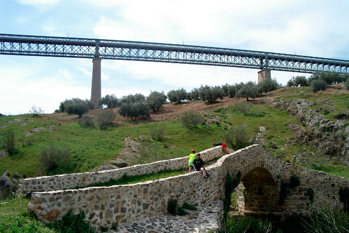
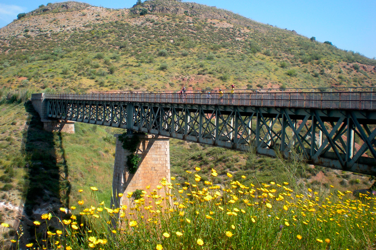 At km 42 the greenway crosses the Víboras River along another spectacular metal viaduct (224 metres) that rises up like a perfect viewpoint over the valley. As a curiosity, it is worth mentioning that, at the foot of the viaduct, there is another more modest structure, but with much more history. It is the medieval bridge over the Víboras, featuring a single arch, that formed part of an old road.
We continue the descent, passing, a few meters further on, by the abandoned railway ballast quarry of La Muela. On the way to Alcaudete, the greenway uses two more old metal railway bridges, crossing the Chaparral and La Esponela Streams, both of which are 70 metres long.
These single-span bridges, located at km 45 and 46 respectively, are part of a sector of straight stretches that lead to Alcaudete Station (km 48.3), the last in the province of Jaén. This station has been rehabilitated for new uses, although it has not been opened yet. The locality of Alcaudete is about 5 km from this railway site. Please note that the ascent up to the village is steep, although the castle crowning it is well worth the effort.
After the station we have a last encounter with the A-316, which we will be able to cross without any problem thanks to another metal walkway, this being one of the dangerous crossings that was solved a few years ago.
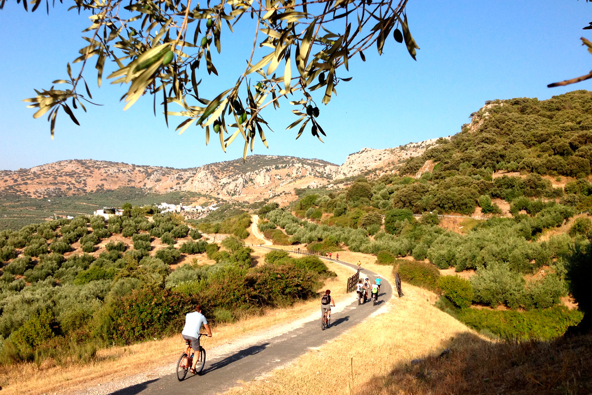
From now on, the route abandons the dominance of olive trees, giving way to a more natural terrain, featuring light-coloured Mediterranean vegetation. The natural value of the area increases as we pass by the Laguna Honda Nature Reserve (km 50.5). From here it is 3 km with two deep curves until we cross the Desjarradero Ravine at km 52 over another metal bridge (83 metres), which sets the stage for another spectacular and unforgettable viaduct over the Guadajoz River. (km 54.5) This incredible Meccano-like structure rises up on two articulated stone-and-iron pillars that support a large, 200-metres-long lattice. We should cross this bridge slowly. Not because it is dangerous, but because such a human feat must be crossed in an almost reverential spirit due to the spectacular, daring nature of this project that was executed more than a century ago. And as is usually the case, as soon as we cross the river we have to start pedalling to go up a gentle but continuous slope.
In the province of Cordoba
On the other side of this grandiose masonry work, the greenway continues through the province of Cordoba. The olive groves that had been the hallmark of the Jaén section do not leave us as we pass through Cordoba, but the greenway follows attractive curves and pierces the terrain in large trenches. From time to time it is worth looking back to enjoy the panoramic view over the gorge that the Guadajoz has carved out among the olive trees. This climb comes to an end after about 3 km at the so-called Collado de las Arcas. At this point you will see the remains of an old train stop, which, although it is hard to imagine, was used by another small train, with a very narrow gauge, that transported ore from some remote mines; here is where it transferred its cargo to Renfe wagons and returned, pulled by mules, to the mouth of the mine, located near the locality of Zamoranos.
But if this old loading dock was a surprise, the views of the Conde or Salobral Lagoon (km 59) will be much more so, with the greenway being the best vantage point to contemplate the lagoon located about 400 metres from the route. Thus, the help of good binoculars together with the information on the panels will enable us to discover more about the life of ducks.
We continue towards the next station and, surrounded by the customary olive trees, we reach the old N-432 road, which we cross by means of a comfortable footbridge to reach, after a gentle ascent, Luque Station (km 65). It has been converted into a restaurant featuring an original train carriage, where we can eat inside. There is also a shop selling local produce, an attached building that has been transformed into the Olive Oil Museum, and a large platform converted into a pleasant summer terrace.
Luque, Baena and Zuheros
We can take the opportunity to go up to the rocky village of Luque. An old dirt track ascends from the station to the village, crowned like so many others by its castle-church from "Moorish times." Not far, about 7 km away, is another of the most attractive towns in Cordoba: Baena. It used to be connected by branch of this railway that has also been upgraded as a greenway, which takes us to the gates of this interesting town full of attractions and excellent oil.
Next stop: Zuheros. A little gem. A mountain route at the foot of the Subbética crags will bring us closer to this lovely small village featuring of large number of attractions. The ascent up to Zuheros, declared one of the "most beautiful villages in Spain," has a more than stimulating reward. Strolling through the streets of this white village provides an abundance of sensory experiences, especially if we visit in spring, when the flowers are in full bloom. From the village square, with its secluded castle, we will have one of the best views of this greenway.
For fitter ones, there is another excursion that, in case you have not had enough, has even more slopes. The ascent itself will be a gift of panoramic views. This option takes us to the Cave of Bats, a karst cavity that Zuheros’s “oldest” residents used as a home; its stone walls feature some cave paintings depicting goats and other animals. The cave houses beautiful limestone formations and human remains of ancient settlers that make this extra walk worthwhile. After these attractions, let's return to our greenway.
The railway engineers have left us, as a final offering, one of the railway’s most attractive structures: Zuheros Bridge (104 metres) over the Bailón River. Located a few metres from the Zuheros halt (km 72), this bridge, which appears in all the catalogues of bridges with monumental value since it has a metal structure and curved shape. Three sections of straight beams allowed the rails to follow an asymmetrical arc with the straight lines of the beams. The bridge is also an exceptional viewpoint over the most beautiful perspective of Zuheros, with the walls of the fortress cut out above the ravine and the white hamlet sheltered behind its walls.
Doña Mencía, the tunnel and other large viaducts
 We are now in the domains of the Sierras Subbéticas Nature Reserve, and the route continues to climb calmly as we approach another village perched on a hill: Doña Mencía. Its name comes from the wife of a brave conqueror of the Middle Ages and, as in the neighbouring towns, a fortress crowns the town centre. The greenway takes us past this small, secluded station (km 75) that, as in the case of Luque, changed its past as a railway dry dock for that of a service space for cyclists and trekkers. The passenger building is a restaurant where you can make another stop on the way. And right next door, on the dock or rehabilitated warehouse is the Subbética Cycling Centre, a perfect place for whatever you need: information, routes, bicycle rental and repair, and a neighbouring motorhome area.
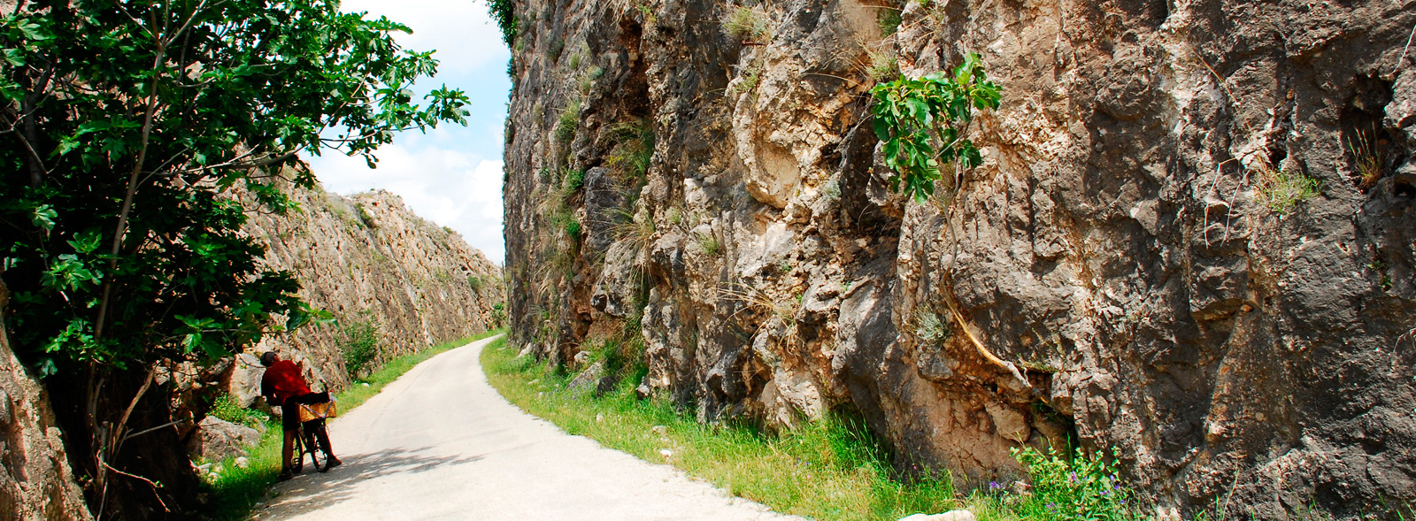
We continue on. We pass by a beautiful railway hut and our greenway now follows a route with almost no slopes, which was achieved thanks to huge earthworks. This greenway section is characterised by spectacular embankments and deep trenches, the latter supported by elegant ashlar walls. And so, passing through trenches and by embankments, and after crossing a bridge over the old Cabra road (which has almost no traffic after the construction of the A-316), we head steadily towards the Plantío Tunnel. This is an "artificial tunnel", i.e. one that is built to steady the terrain and not due to topographical conditions per se. After the tunnel, the terrain rises up and we come across some spectacular masonry works, such as the spectacular 132-metre-long Chasm Viaduct (km 83). This impressive iron matrix is supported by two pillars of ashlar masonry. The views are delightful, while the whistling wind blowing through the bridge’s iron girders provides the soundtrack for this almost magical space.
After one kilometre we will cross the road over another viaduct (25 metres long) with an evocative name, “Los dientes de la vieja” (“The old woman’s teeth”). We will cross the road two more times –a level crossing followed by one at a different level – and, soon, the urban area of the locality of Cabra appears at our feet.
From Cabra to the southern countryside of Córdoba
 A leisurely descent will allow us to glimpse an urban centre that features a rich monumental heritage with a castle and many churches (some of which were originally mosques). And we arrive at one of the most interesting sites of the entire greenway: Cabra Station (km 88).
Railway enthusiasts have an excellent open-air "museum" here, since this beautiful station features an elegant Mikado steam locomotive built in 1917 by the American Locomotive Company, as well as other rolling stock of interest such as another diesel locomotive and a wooden wagon belonging to the Spanish Railways Foundation’s collection. In addition, the passenger building houses a restaurant and work is already underway to build a future hostel.
There is also a children's play area with a railway atmosphere, which, along with the wonderful railway heritage, evokes this railway’s past. If you are accompanied by children, it will be hard to drag them away from this area that enables them to play at being stokers and engine drivers for a day.
We leave Cabra behind and another bridge brings us in the solitude of the fields, only altered by some crossings with trails, roads and level crossing boxes. The gentler terrain changes as it passes through the Alamedal Ravine, which is crossed by a daring 70-metre-long metal viaduct that flies soars above the Mediterranean thicket covering the valley. After the viaduct, we gradually leave behind the customary olive groves and, after a transition of vineyards (from the famous wines of the Montilla-Moriles Designation of Origin) reach the surroundings of the town of Lucena. The early Christian Basilica of Coracho, located on the outskirts of Lucena, is the prelude to a city that, in the times of the Caliphate of Cordoba, even became the independent Jewish Republic of Elissena. Churches and a castle dot the Lucena’s townscape. After the town, Lucena Station (km 99), which features a recreational area and children's playground, a restaurant with an adjoining building that houses a museum of classic vehicles (it is open to the public on weekends).
In a gentle descent featuring wide bends, crossing the occasional metal pontoon, we reach the last station: Moriles-Horcajo (km 109). Curiously, the locality next to the station does not have either of these two names, since it is the hamlet of Las Navas del Selpillar. The station features an elegant, well-preserved building that has been converted into a wine interpretation centre.
The greenway extends for another 4 kilometres through the Subbética mountain range, while the its last section –almost 8 km long– runs through the Córdoba’s southern countryside and brings us to the last station: Camporreal, located 4 km from Puente Genil, to which it belongs. The latter stretch is one of agricultural beauty, featuring gentler terrain where vineyards, sunflower fields and cereal crops are perceived drastically change the landscape. The scenery also features holm oaks, almond trees, reeds and scattered farmhouses, such as Cortijo Montecalcedo.
A corridor of oleanders indicates the end of our route. On the left, an industrial chimney from Cortijo de Santa Elena stands out over above eucalyptus trees as an example of olive oil industrial heritage, and on our right, Campo Real. All that remains from that railway settlement is six dilapidated buildings, including Campo Real Station, a railway site that was shared with the active Córdoba-Malaga railway line. From this point we can advance 6 kilometres to reach the town of Puente Genil following the recent signage that enables, in addition to a visit to the town, the railway connection at both ends (in Jaén and Puente Genil) of what is the longest greenway in Andalusia and the second longest in all of Spain.
