Alcoi Greenway
Route Description

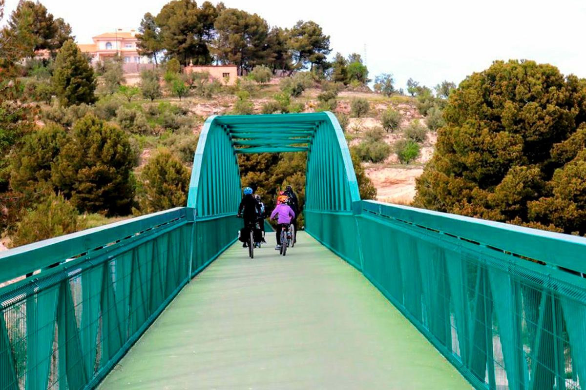
The proposed route begins at the train station of Alcoi, the town of bridges, nature reserves, and the Moors and Christians festivals. The old railway route that runs through the town –about 5 km longs– has been rehabilitated with the construction of a cycle-pedestrian path, i.e. a bike lane that is also for pedestrian use.
Thus, and with this pleasant novelty, we head from the station along the bike (and pedestrian) lane towards the east. About 400 m away we find a rest and service area for cyclists just before a vehicle traffic bridge. At this point the route of the itinerary separates from the cycle-pedestrian path, turning 90º to the right towards the old railway bridge, which crosses the Xorrador Ravine parallel to the road bridge. A tunnel (with lighting) awaits us at the end of the bridge. After exiting the tunnel, we return to the cycle-pedestrian path. We pass another road bridge along this route that also includes the cycle path over the Uxola Ravine. We follow the road and go through 3 more tunnels with lighting to reach the Batoi neighbourhood, where this more urban section of the lane comes to an end, thereafter entering the greenway itself and its more natural surroundings. A small seating area with a fountain and tables marks the beginning of the greenway.
The Polop viaducts and the Batalla Ravine

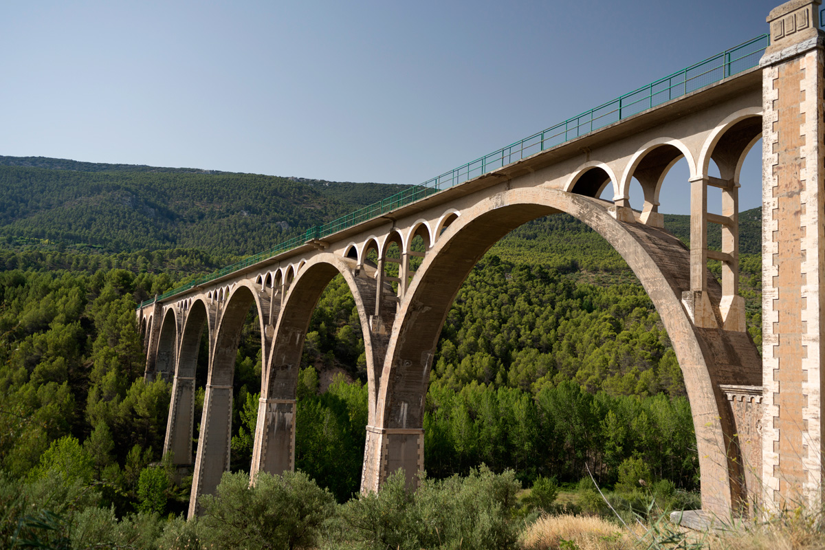
From km 5 of the route, the greenway is prepared for access by people with reduced mobility thanks to a strip of green asphalt. However, please note that the first section is open to local traffic for residents who have properties in this area. We start the tour in a beautiful place called El Salt that appears after the first tunnel, where we find a small fountain. Next, we go across a viaduct that crosses the Barchell River, a curved tunnel and the viaduct called the Bridge of the Seven Moons. Stopping at this point is a must so that we that we can contemplate the size of the structure: it is 230 m long and 46 m high, featuring imposing views of the town of Alcoi, the Font Roja Nature Reserve and the Serra de Mariola Nature Reserve. If we are lucky, we will see bungee jumping and the most daring may even want to have a go themselves.
Such a lyrical name has a very simple origin: in this area, the spans the bridges are called moons; in this case there are eight concrete arches that support the viaduct deck. The fact that it is called the Bridge of the Seven Moons and has 8 is due to a historical confusion, since the bridge that has seven moons awaits us further on between the long tunnels that cross the Font Roja Nature Reserve.
And after crossing this beautiful work of masonry, a rest area awaits us. Along this stretch we can see a landscape full of crops and incipient riverside vegetation. The uniformity of the fields of barley, wheat and olive trees on the terraced land contrasts, however, with the riverside poplar groves. The greenway continues with a gentle slope where small tunnels alternate – all with lighting – with areas with thick vegetation, until you come out (at km 13) to the municipal sports centre and a large esplanade with an adjacent recreational area. It is a good time to recharge your batteries and rest, as there is a bar service (except on Mondays and in August) and if you want to spend the night, a few kilometres along the Font Roja road, there are several holiday cottages.
To reach this point you will have taken a lovely walk along a beautiful eight-kilometre uphill route going around the town of Alcoi. The sports centre will serve as a prelude to the passage through the Batalla Ravine, which is barely seen, as it is crossed by the three longest tunnels of the line, which are almost joined together (two of them are 900 and 1,000 m long, respectively).
At the exit of the first tunnel we have a small viewpoint overlooking the Sierra de Mariola and the Castle of Cocentaina. The second has a striking window on the side, which illuminates the darkness of the railway cavern in an almost magical way. By now the greenway is running through the Carrascal de la Font Roja Nature Reserve by means of these three tunnels and the Sant Antoni viaduct, located between two of the tunnels, at the foot of the mountain range of the same name that forms part of the nature reserve. This haughty viaduct was built to cross the ravine (also called Sant Antoni) that converges downstream with the Batalla Ravine, through which the Molinar River runs, another of the tributaries of the Serpis River –it is the bridge that was originally called the 7 moons since it does have 7 spans.
At the Malany Pass

After the third large tunnel, after km 16, the greenway goes out into the highlands and plains at the foot of the Carrasqueta Pass. Another rest area, located next to the road from Alcoi to Alicante, awaits us at the exit of the tunnel. From here on, the surface of the greenway becomes compacted earth, while the landscape turns into agricultural expanses that have been cultivated since ancient times by the first settlers of these lands, in which small patches of holm oak stand out.
Soon we pass by La Sarga, a hamlet of Jijona or Xixona, near which there are some very interesting cave paintings, declared a World Heritage Site. This valley area is known as La Canal and along the greenway we can come across tractors and other agricultural vehicles. We pass under the N-340 road leaving the country house of La Sínia on the right and continue in an easterly direction surrounded by cherry trees and other fruit trees. After 2 km, the track begins to narrow and becomes a path since the railway platform is impassable. The actual greenway stops here, but we will give you some helpful information in case you decide to continue.
After 1.5 km, the path takes us to the service road of the A7 motorway, which we must follow in the direction of Ibi. After 1 km we see a bridge over this highway, a bridge built to serve the cattle track that crosses it. For safety, we take the bridge to change the service road from the south to the north and thus continue along it towards Ibi. As soon as we leave the bridge, we go from the municipality of Alcoi to the municipality of Ibi. Following this service road we reach a roundabout where there is again direct access to the old railway platform. Up to this point we will have traveled 20 km. It should be noted that in Ibi there is a small 1.5-km section that has been prepared as the Ibi Greenway, coinciding with Avenida de los Hermanos Grimn and which runs almost parallel to the CV806 road. A convenient way to access the town of toys.
From Ibi and until we reach the Maigmó Pass, where we once again enjoy the facilities and benefits of a well-prepared greenway (Maigmó Greenway), sections of the motorway service road alternate (not without some complexity and difficulty, both in terms of continuity and slopes) with sections of the old unrestored railway line. At all times, special caution and care must be taken because although we are travelling on a fairly wide service road (two four-metre lanes) with very little motor vehicles, there is some traffic due to local residents and agricultural machinery from neighbouring farms. Therefore, this 33-km-long connection between the two sections of the greenway must be faced with a certain dose of adventure and physical stamina. As it is also constantly changing, as new sections are being prepared, we leave it up to the intrepid and seasoned cyclist or hiker to find the continuity of this route up to the top of the Maigmó Pass. As a point of reference, it is worth noting that is passes through the town of Castalla, presided over by its rocky castle.


