Arrazola Greenway
Route Description
 Por el valle de Atxondo
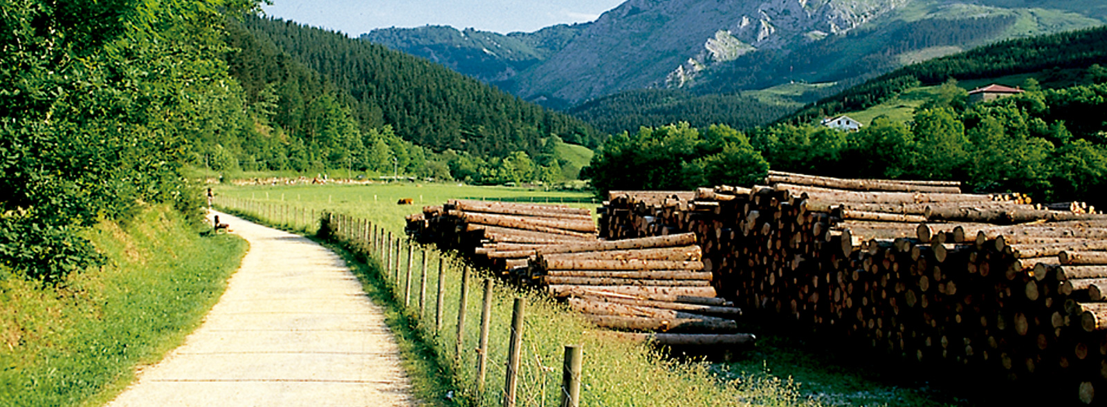
The municipality of Atxondo —literally “next to the rock”, in reference to the rocky summit of Anboto— is formed by scattered farmsteads (caseríos) and the villages of Axpe, Arrazola and Apatamonasterio. Crossing Apatamonasterio along the BI-4332 road, you’ll find the town hall, the church of San Pedro, and the frontón (Basque pelota court) on the right-hand side; opposite the frontón, on the left, a small square opens up around a large tree. From here, Ziarreta Street leads to a recreation area equipped with benches, an outdoor fitness circuit, and a fountain, all shaded by walnut, alder, maple and ash trees along the River Arrazola. This is the starting point of the Arrazola Greenway, developed by the Provincial Council of Bizkaia.
From the rest area, a concrete bridge crosses the river, offering an attractive upstream view of a small dam and an arched, medieval-style stone bridge. On the far bank, several paths diverge: left towards a marked long-distance trail (GR); straight ahead, the course of the old railway runs level and straight through green meadows.
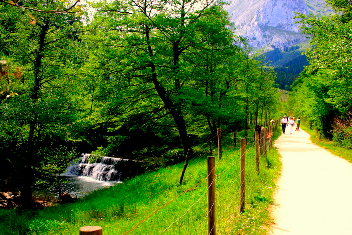
The path meets the river once more beneath the shade of tall plane, alder and ash trees. For a short while, the river and the greenway share their course under a leafy “tunnel” of hazels and willows. But for a clear picture, once it emerges from the tunnel of vegetation, the railway embankment leaves the river behind and draws closer to the mountain slope that rises steeply on the left. The eye climbs up through lush vegetation: from the belt of oaks, alders and ash at the foot of the slope to the dense pine forest higher up, culminating in the summits of the Memaia. From here, the greenway runs along the left-hand side of the broad valley, an open space affording sweeping views of the pine-covered hills opposite, and beyond them the imposing ridge that culminates at Anboto (1,331 m), stretching north-westwards.
Barrio de Marzana
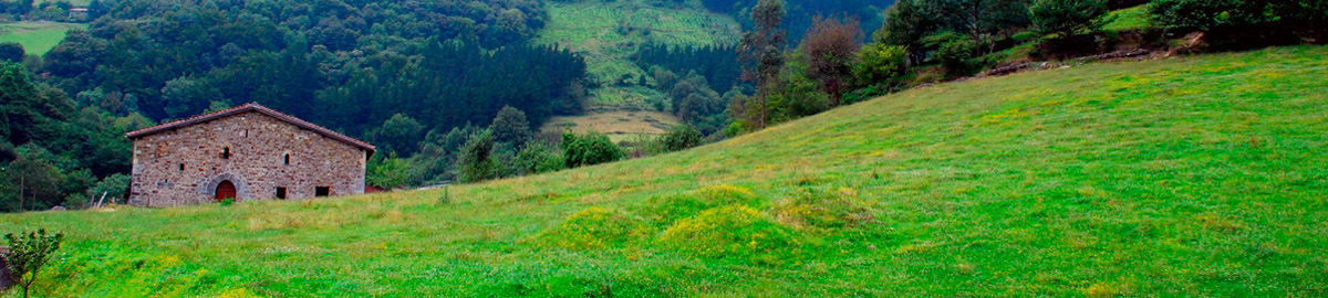
At kilometre 0.8, tall plane trees line and shade the path as it approaches Marzana (also known as Marzaa), the most emblematic hamlet of Atxondo. Its central square, shaded by large linden trees, is surrounded by the church of San Martín, several traditional caseríos, and a 16th-century Renaissance tower. A fine stone fountain offers the chance to quench one’s thirst. It is well worth taking a short stroll through the neighbourhood, with its venerable heritage and the caserío Etxezarra, whose Gothic doorway originally belonged to the Marzana tower. Marzana also had a loading facility for the mines on the hillside above.
Leaving Marzana, the greenway continues along the left-hand side of the valley floor, crosses the BI-4332 road at grade, and passes an area with toilets, picnic tables and children’s play equipment (km 1.3).
Soon after, the path crosses the river for the second time (km 1.6). Here the Arrazola valley narrows, pinched by the slopes of Imietamendi hill (348 m), which closes in to form a gorge. In this constricted passage, the gradient of the greenway increases slightly, running alongside the fast-flowing river which tumbles noisily beneath a dense alder wood.
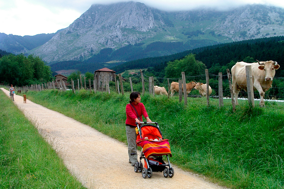
Emerging from the gorge (km 2.1), the landscape opens out once more: a broad green valley dotted with stone farmhouses, framed between the wooded Memaia and the limestone ridge of Anboto. The greenway then rises onto a curved embankment to cross the small valley carved by a stream flowing down from Axpe. This artificial embankment, built to level the way for the trains, now serves as an excellent viewpoint over the Axpe valley. Beyond the stream, the greenway again crosses the road to Axpe at grade. Here it is possible to turn left along the road to the chapel and hamlet of Santiago, where several fine restaurants uphold the reputation of Basque gastronomy.
Back on the greenway, the path climbs more noticeably, terraced into the mountainside on the right, some height above the riverbank. This section offers broad views across the valley with its scattered farmsteads, and is shaded by hazel, oak, pine, chestnut and alder trees that provide refreshing greenery in summer and rich colours in autumn. The elevated path continues along a long, high embankment leading to a bridge over the BI-4332 road (km 3), at the entrance to the hamlet of Arrazola. Here, a convenient fountain once again provides drinking water, and the spot offers a fine view of the San Miguel church tower and the caserío of Urrutia (16th century), one of the oldest in Bizkaia, with origins in the Gothic-Renaissance period.
On foot or by bike among mountains and legends
This overpass above the road is also the best vantage point from which to admire in full the eastern face of Mount Anboto, its steepest and most dramatic slope. Here lies the cave of Anbotoko Mari, the Lady of Anboto, the goddess of Basque mythology who personifies Mother Earth. Legend has it that Mari delights in remaining in her cave, adorned with golden objects and precious stones, where she combs her long blond hair with a golden comb; that she sometimes abducts disobedient young women, keeping them for seven years while they learn to spin; or that she changes shape at will — appearing at times as a tree with a human face, at others as a woman with goat’s legs and the talons of a bird of prey.
The route winds around the outskirts of Arrazola, perched on the mountainside above the Ibarra tower and mill (18th century), which still preserves its machinery. It then leaves the village behind among colourful orchards, passing the farmhouse of Ollargane, whose façade bears the name Pedro de Albayalde and the date 1519 — the oldest stone inscription in Bizkaia.
At the end of this stretch, the old railway bed crosses the Arrazola river once more and reaches the hermitage of San Roque (km 4.5), located at the very head of the valley. Shaded by centuries-old plane trees, the hermitage is surrounded by benches, a fountain, and a large car park often used by patrons of the restaurant housed in the imposing farmhouse of Makatzeta, on the opposite side of the road. The popular hermitage of San Roque features a humilladero (wayside shrine) with the typical wooden-barred door through which the saint can be seen. A sung mass and pilgrimage are held here on the saint’s feast day, while in former times locals also gathered on St Gregory’s Day (9 May) to bless the water that would later be sprinkled over the vegetable gardens to improve the harvests.
From the hermitage there is a clear view of the Ojo de Bentaneta, a karst cavity formed by the action of water on Anboto’s limestone. Legend says that when the sun sets, Atxondo still receives one final ray of light through this opening.
The greenway now enters the wildest and final part of its route. From the hermitage of San Roque it plunges directly into the gorge at the head of the Arrazola valley, hemmed in between the pastures rising towards Anboto and a wooded mountainside thick with ash, acacia, alder, birch, pine and walnut trees that shade the path.
In such a narrow space, the greenway and the crystalline river run side by side, climbing together until they reach the station of Errotabarri, also known as El Tope (km 5). Nearby are the remains of calcination kilns and a small mining settlement. The old station itself has been restored from its ruins to provide a recreation area with toilets, picnic tables and a fountain. From here, the more curious can extend their walk along the forest track that delves deeper into the Arrazola ravine, leading half a kilometre further on to the mines where iron and copper were extracted until 1920.