Bidasoa Greenway
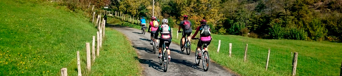
Route Description
The proposed 42 km route runs from Oieregi (Navarra) to Behobia–Irún (Gipuzkoa), just a stone’s throw from the French border. It is recommended to follow it in this direction, taking advantage of the gentle downhill slope that follows the River Bidasoa from inland Navarra towards the Bay of Txingudi.
Today the itinerary is in excellent condition and forms part of the European cycle route network EuroVelo, as a section of EuroVelo 1, the Atlantic Coast Route, which begins at the North Cape in Norway and is being extended all the way to southern Portugal. It also belongs to the cross-border project Ederbidea (“beautiful path” in Basque), which links the cities of Bayonne, Donostia–San Sebastián and Iruña–Pamplona via greenways.
Señorio de Bertiz
Until the route is eventually extended to Elizondo, where the Tren Txikito once had its terminus, there could hardly be a better starting point than Oieregi, right beside the Señorío de Bertiz Natural Park (km 0). This semi-natural, semi-landscaped park is well worth a leisurely visit in its own right. Bikes must be left at the entrance, but once inside you can take your time wandering its peaceful paths and soaking up everything this unique natural space has to offer.
After visiting the Señorío, the greenway heads west along a well-prepared path, skirting the park boundary. It first crosses the NA-210 road (San Juan Bautista Street) and then the NA-121A via a safe underpass. The route then runs parallel to the road, passing behind a service station before reaching the charming square of Legasa, a small village in the municipality of Bertizarana.
After skirting a cluster of large warehouses, the greenway veers into the shelter of leafy woodland, reaches the River Bidasoa and its riverside forest, and soon afterwards arrives at Doneztebe/Santesteban (km 6.1). Here, the path crosses the town, already pointing northwards in search of the river once again — a companion that will remain by your side for the rest of the journey.
The greenway reappears in Intzakardi Park, on the outskirts of the town on the Bidasoa’s left bank, right where it is joined by its tributary, the River Ezkurra. Beyond the bridge, a wide concrete platform carries the route onwards, with benches providing a welcome rest stop. This is also an important junction: from here, EuroVelo 1 – Ederbidea continues across the mountains that divide the valleys (that’s the Pyrenees for you!) to reach the Plazaola Greenway.
On the way to Sunbilla
It is worth noting that this section of the greenway is not reserved exclusively for walkers and cyclists — a few vehicles also use the old railway track to reach neighbouring farmland, so it’s wise to stay alert.
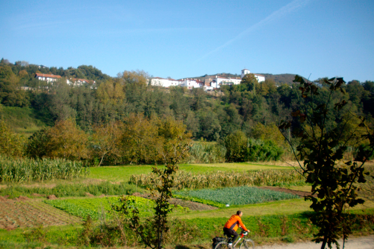
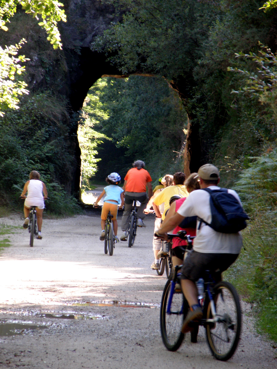
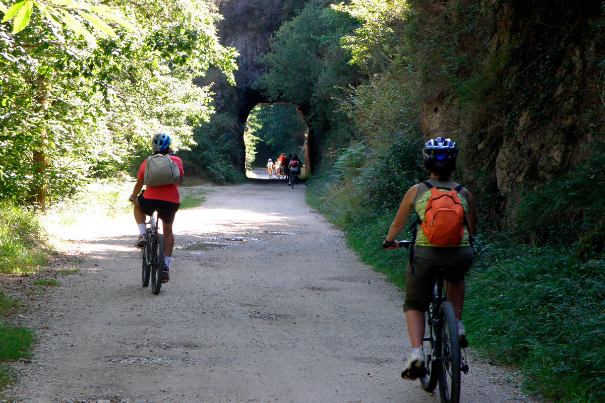
The route winds into dense woodland, threading its way through two tunnels (neither particularly dark), and after 4 km it emerges at the village of Sunbilla (km 9.6). The settlement straddles both banks of the Bidasoa, linked by a magnificent medieval bridge. The village houses are especially charming and well worth pausing to admire. Indeed, throughout Baztan, Malerreka and the Cinco Villas you will find picturesque villages and farmsteads, their windows and balconies bright with flowers that bring colour even to the greyest of days.
The Salmon of the Bidasoa
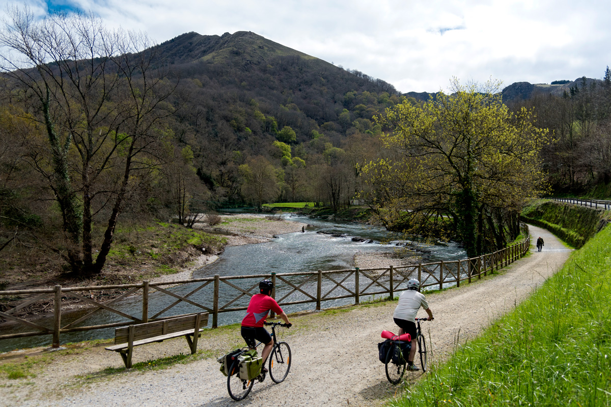
Beyond Sunbilla, the greenway enters a narrower stretch of valley where the river cuts more deeply between the mountains. About 2 km after the village, the concrete surface gives way to packed earth, but remains in excellent condition. Here the route passes through a 208-metre illuminated tunnel, refreshingly cool inside.
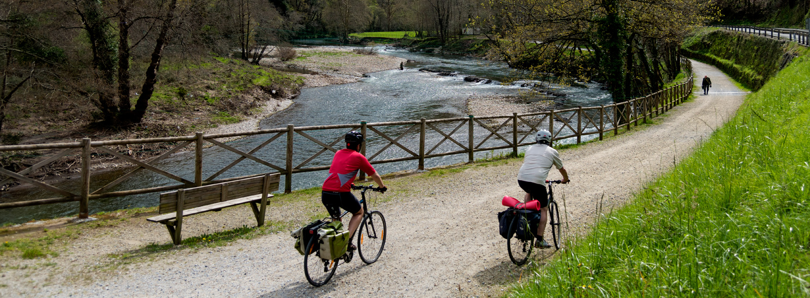
All the while, the river runs close beside the trail, never far from view. Every so often, small weirs appear along the course, built to feed hydroelectric plants. Special care has been taken to preserve the river’s rich biodiversity: to allow fish to overcome these artificial barriers, fish ladders have been installed, enabling them to swim upstream. The Bidasoa has long been renowned for its salmon. Though its heyday was in the last century, the river is still the scene each year of the remarkable upstream migration of a small but hardy salmon population. About halfway along this section lies another highlight: the Zubigain footbridge (km 12.5).
 Beside Bera
Between meadows and woodland, and on the opposite bank from the busy main road, the greenway continues peacefully. From Sunbilla the route follows the river without entering any other village until it reaches Lesaka and Bera. A few solitary ruins, today used to store piles of woodchips from a timber yard, are all that remains of the old Igantzi station (km 21.1).
From here, the trail heads towards Lesaka junction (km 25), passing through the illuminated Onbordi tunnel (160 m). The area around Lesaka junction, once home to the station, has since been reshaped by the arrival of a petrol station, a lorry park and a hotel. From here, it’s possible to take a short detour from the greenway (2 km) into the village of Lesaka, a delightful town with two medieval towers and beautifully kept traditional houses.
Beyond the junction, it continues alongside the Bidasoa through an area of great natural charm, passing caseríos and meadows. Soon, it dips beneath the N-121A road through a safe underpass — a relief after so many crossings elsewhere! From here, the path straightens, and across the river on the right bank you will catch sight of Bera. Although the greenway doesn’t technically cross into its municipality, at km 28.3 it passes very close by. This handsome town is renowned for its flower-filled balconies and window boxes, which lend even greater charm to its already distinctive houses. Bera, birthplace of the Baroja family, lies across the river, which can be reached via the beautiful medieval bridge of San Miguel. At its centre, a stone plaque in English and Spanish commemorates the British fusiliers who died defending the crossing against French troops during the Peninsular War.
From here, our route continues north towards the muga (the Basque word for border) with Gipuzkoa. Around the neighbourhoods of Alkaiaga and Zalain-Zoko (Lesaka), the surface is asphalted, and it is not unusual to encounter the occasional car from local residents.
Towards the border at Endarlatsa
A little further on, the trail reverts to a compacted earth surface and enters one of the most spectacular stretches: the approach to Endarlatsa. Here the Bidasoa narrows between sheer slopes, forcing the railway to pierce the rock through a series of tunnels. In total, five tunnels were excavated, one of them a 195 m curve. Another features a curious side opening towards the river, forming a precarious —if dramatic— balcony over the gorge.
At Endarlatsa bridge (km 33.8) the river becomes a natural frontier, a role it will maintain until its mouth. From here, the greenway continues for just over 8 km more, ending at Behobia (Irún).
Final Stop: Irun
Endarlatsa itself is little more than a hamlet with a couple of farmhouses, but it once marked a strategic crossroads between Navarra, the Basque Country and France, and played a key role in the old railway. The original Tren Txikito, precursor of the Bidasoa railway, started out here. British mining companies established their operations in the area, and such was its importance that Endarlatsa even had its own halt, located on the Navarrese side of the border. The building, still in good condition today, can be seen on the left just before passing under the arch of the old road bridge.
Endarlatsa was also a defensive site: its name is linked to a surviving watchtower and the bridge that once crossed the Bidasoa at this frontier point. And from here on, the river becomes a natural frontier with France.
Crossing the border here, the route enters the Aiako Harria Natural Park (Peñas de Aya). Its rugged rocky peaks are not only strikingly beautiful but also of great geological interest, as they form the only granite massif and the oldest rock formation in the Basque Country. With only one slope wide enough to accommodate it, the old road once took over the railway’s alignment. This forced a cleverly-designed diversion which brings the greenway closer to the river. A short ramp descends to a paved track, running beside the stone retaining wall of the old highway. Soon after leaving behind the comfy asphalt, the path swings away from the river and across an open meadow, giving wide views of the surrounding mountains on the French side of the valley. It is precisely there that many Spaniards fled during times of hunger and repression. The Bidasoa has often been a river of escape and exile, clandestinely crossed in both directions throughout history.
Further on, a bend in the river brings you to the abandoned San Miguel halt (km 36), an imposing tall building shaded by magnificent plane trees. Out of sight lie its main façade and the ore loading bay that once fed the trains with the minerals extracted from the hillsides above. To exploit the San Fernando mining concession, the Las Tres Coronas railway was built, named after the Peñas de Aya (Aiako Harria) on the French side of the border. The line began at Aireko Palazioa, a striking mansion with a canteen and workers’ lodgings which, in time, came to be known as the Palace of the English. At an elevation of some 500 metres, the line ran for five level kilometres to Mount Pagogaña, where two powerful inclined planes descended towards the San Miguel halt. Wagons would run down these planes to unload their ore into the waiting carriages of the Bidasoa railway.
A little further on, beyond the Laminarri viaduct of the new road, the dramatic gorge opens up, climbing towards the summit of Pagogaña, where the remains of the fort of the same name stand, built in the aftermath of the last Carlist War. The greenway now runs alongside an old road, and after a short descent followed by a rise, an area of rest is reached (km 37).
Here, the mountainsides draw back once more and the valley floor widens. Across the border in France, the imposing mountain barrier is clearly visible, with the col des Joncs, the col d’Osin (Osinkocelaia) and Xoldokogaina standing out. On the riverside lie the scattered hamlets of Ihiztoki and Arroupea, their whitewashed walls framed with timber and stone. Between them stretches the alluvial plain, dominated by maize fields and small vegetable gardens.
As the valley comes to an end (km 38.5), the route rises to road level and emerges at the large roundabout giving access to the industrial zone of Zaisa: the conurbation of Irún begins. With no possibility of following the railway’s original alignment, the route skirts the Irún transport hub. Contrary to what one might expect, warehouses, loading bays and hundreds of lorries remain hidden behind a thick fringe of shrubbery. Enclosed within a green tunnel, the greenway grows greener still – a paved and illuminated path where fishing spots double as charming viewpoints over a tranquil river, now already under the influence of the maritime tide.
La isla de los Faisanes
The route passes beneath the A-8 motorway bridge and comes out at the Pausu bridge (km 41.6). This bridge allows passage from one country to the other, linking Behobia with its French counterpart. This could well be considered the end of the trail, but the cycle path continues a little further downstream, crossing the gardens beside the Sacas Town Hall, a small customs post that remained in use until the mid-19th century. The greenway comes to its true conclusion at the Isla de los Faisanes (Island of Pheasants, km 42), a tiny islet in the middle of the Bidasoa that separates the banks of Irún and Hendaye. Since the Treaty of the Pyrenees, it has alternated sovereignty: six months under Spanish jurisdiction, and the other six under French.
For those still with energy to spare, it is well worth continuing on to Hondarribia, a coastal town with a fine beach and a superb historic quarter. From there, a remarkable route climbs the fearsome slope of Jaizkibel –“hellish” for the sheer steepness of its ascent. At its summit, former watchtowers now serve as lookouts, offering –when the mists allow– some of the most breathtaking views of the Bidasoa estuary. Another option is to follow the trail out to Cape Higer, at the north-western tip of the Bay of Txingudi, another splendid ending beside the sea.
Crossing into France on the Vélodyssée
At the Pausu bridge the route also connects with the continuation of the EuroVelo 1 into France, where it becomes the celebrated Vélodyssée –the French section of the EuroVelo 1 Atlantic Coast Route. Stretching for 1,200 km, it is the longest cycle touring route in the country. It traverses Aquitaine, the Loire region and Brittany, linking Hendaye with Roscoff. Tempted?
Sponsored by: