Greenway Nature Trail of the Renaissance (Reolid-Segura)
Route Description
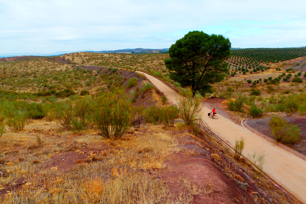 We continue the journey that began in the city of Albacete through this second section of greenway following the Linares-Baeza – Utiel Railway. We should remember that there is discontinuous 16-km section that has not been upgraded between the town of Alcaraz and Reolid.
This route could be described as very wild, being completed made up of nature and landscapes. Note that most of the villages, and with them the possibility of obtaining supplies, are a fair distance from the route. The starting point starts at the old Reolid Station. From there to Bienservida, on the border with the province of Jaén, we have a gentle 19.5-km route through the valley of the Guadalmena River. This watercourse begins in Alcaraz, and is always to be found a short distance from the greenway, giving rise to a gentle and pleasant landscape featuring, above all, the presence of the holm oak, the main species, but also by the presence of scrubland species, in addition to wooded pastureland, cereals and olive grove crops as we approach Andalusia.
This trip will allow us to enjoy interesting panoramic views of Sierra del Relumbrar and Sierra de Alcaraz, which are in the first kilometres of the greenway.
On the way we will cross 2 tunnels, one of which, Reolid Tunnel, is located almost at the beginning and is 520 metres long! Although it has lighting, it is not a bad idea to bring along lights. The town of Reolid is on the left of the route, but it is hardly noticeable because, on coming out of the tunnel, we will have already passed by the entire urban centre.
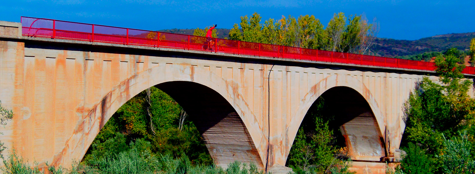
In the first 3 km the greenway advances almost parallel to the national road, from which it departs at km 6 to cross over the Sequillo Stream thanks a 3-arched bridge that features excellent panoramic views of Sierra del Relumbrar and Sierra de Alcaraz on both sides of the route.
Villapalacios is the next town, being preceded by a rest area and the old station (km 10). Cereal crops and olive groves have started appearing. The short, second tunnel (44 metres) precedes other railway infrastructures such as the 3-arch bridge that crosses the La Mesta River and the old single-arch railway bridge over the Peñuelas Stream.
We arrive at the old Bienservida Station (km 13) and travel parallel to the N-322 road until we cross it over an elegant footbridge (km 16), which is another landmark on the greenway that is designed for our safety and convenience.
We will cross the Turruchel River over a single-arch bridge. Wooded pastureland and pines mark the last metres before entering the province of Jaén (km 20). Two signs with opposite directions indicate the end of the Sierra de Alcaraz Greenway Nature Trail and the end (or beginning) of the Segura Nature Trail. In fact, the itinerary continues without interruption following the Linares-Baeza – Utiel railway line, in the region of Andalusia, for another 27 km as far as Arroyo del Ojanco along what is known as the Segura Greenway.
Towards Sierra de Segura
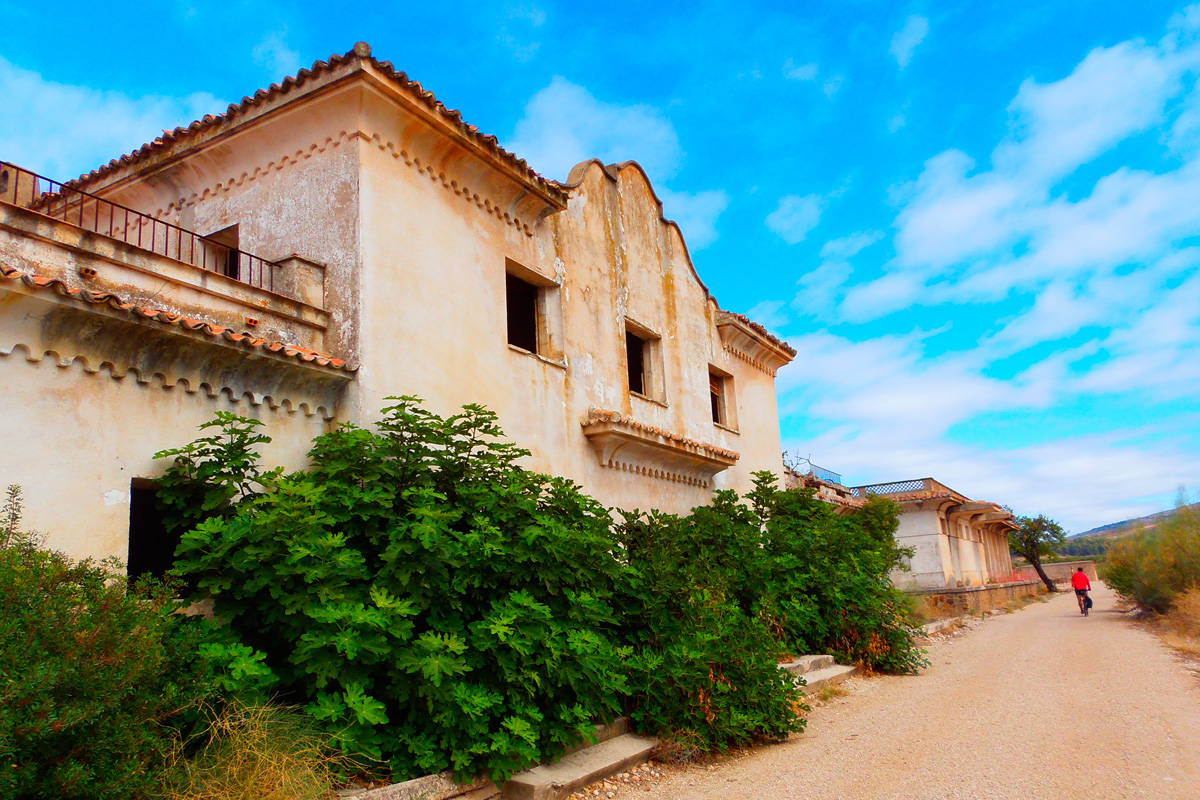
 The next station is Villarrodrigo, far from the town but with a rest area. Surrounded by fields of herbaceous crops and wastelands where brooms and holm oaks proliferate, the greenway advances as far as the Santa María farmhouse. The ruins of the houses and the wildness of the place convey a feeling of great desolation. From here we enter the absolute domain of the olive grove. However, we are on our way to one of the ends of the Sierra de Cazorla, Segura and Las Villas Nature Reserve, whose last foothills are crossed by the greenway.
Towards Génave Station, the greenway features long straight stretches surrounded by olive trees and wastelands. The panoramic views are extensive. On the right, Sierra Morena declines in height and the view opens up. We can see the province of Jaén disappear into the horizon and even glimpse, on clear days, the Campos de Montiel in Ciudad Real.
Génave Station (km 28) has a rest area, a car park and access from the Génave road. A little further on, the greenway plunges underground. Génave Tunnel (277 metres) at km 29.5 is straight but lacks lighting, so it is advisable to bring along lights! We continue alternating between two high embankments, which are like viewpoints overlooking the deep valley at the side, and then enter a large trench featuring high rocky walls that bends to the right.
It is advisable not to miss the next rest area, an idyllic place for stopping (km 33). The green colour and shade of the pines make it an oasis. Pine groves abound in this undomesticated setting, with large pine trees embellishing the route as far as the hamlet of Bonache (km 34.8). The route then bends, being obliged by deep valleys with steep slopes.
Puente de Génave Station (km 36) follows the same architectural model as the other stations. However, it also features a livestock loading dock next to which a rest area has been prepared. After passing the station, the original railway route has been blocked by the N-322 road. A gravel trail leads to the transversal JV-7001 road. With the railway route now gone, the alternative is to share with other vehicles, for a few metres, this road that has little traffic; it rise up on the left to an overpass that crosses the N-322 road towards La Puerta de Segura.
As a privileged witness to this interruption –which is clearly signposted– there is an old steamroller raised on a peculiar pedestal. It is an overpass that used to cross the old railway.
Next to the greenway, within sight of the hamlet of La Agracea (km 37), there is a shooting range with a bar. This is our only chance of stocking up in the vicinity of the route.
 As we continue on, we see more clearly the deep cut in the mountain range on the southern horizon (left), a deep cut opens up. The Guadalimar River has carved a way through Sierra de Segura, where La Puerta de Segura is strategically located. And at the bottom of this gorge, we can see the castle and town of Segura de la Sierra perched on a mountain, dominating the territory of the Sierras de Cazorla, Segura and Las Villas Nature Reserve. However, as we can guess, it is not near. It is 21 km from the greenway.
It is now time for a long section through a landscape of hillocks and hills, dominated by aligned olive grove and alternating wastelands where brooms proliferate, dotted with isolated pine trees and groves. Also, in the distance, on either side, there are high mountains where olive groves reach up to the dense pine forest crowning the peaks.
In such rugged terrain, the railway follows long straight stretches, featuring a succession of high embankments raised up alongside the valleys of streams, trenches to overcome elevations along the way, and cut-and-cover tunnels where the earthy walls of the trenches are too soft.
Another peculiarity will be the original stone kilometre posts of the old railway that are marked with “B-U,” which stands for Baeza-Utiel.
The next tunnel, or cut-and-cover tunnel, passes under the JV-6301 local road. Shortly before entering it, we can choose to take this road on the left that leads to Puente de Génave. From this town there is a new 5-km bike lane that runs parallel to the A-310 road and goes to La Puerta de Segura, the town at the entrance to the heart of the nature reserve.
Starting from km 44, we see how the route of the old railway has been occupied along 1.5 km by the access to a biogas plant. The alternative is a parallel route that, by avoiding the overpasses, goes up and down several ramps. We can also choose to go along a comfortable asphalt track. Although it is not solely for cyclists or trekkers, at least it makes this section accessible.
A little further on, at km 45.5, we come across the most significant element of the route, the viaduct over the Guadalimar River (175 metres), a monumental concrete structure, supported by 5 wide arches, that turns out to be an exceptional viewpoint overlooking the gallery forest alongside the river. The Guadalimar is also the lowest point on the itinerary.
From here, we will ascend during the last kilometre in search of the N-322 national road, where the route ends (km 46.5) right next to the road’s “kilometre 217” sign.
We are just over two kilometres from Arroyo del Ojanco and one from its abandoned station. Although there is no greenway carpark on the left side of the road (towards Albacete), there are panels and signs that identify the starting or finishing point.
Our route ends here. However, there are already projects underway to extend the greenway as far as Villanueva del Arzobispo. 26 km more that, we hope, will soon be added, giving rise, in the future, to a continuous route of more than 70 km between the provinces of Albacete and Jaén.
