Mutiloa-Ormaiztegi Greenway
Route Description
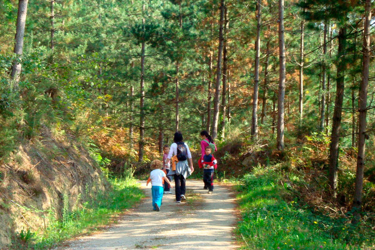
The old railway’s origin is linked with the mining deposits of Mutiloa and Zerain. The countryside route is completed and enriched by touring the Mining Interpretation Centre, the three large calcining furnaces and the interior of a mining gallery on the Zerain Iron Mountain.
The Goierri region’s other attractions include Idiazábal cheese, the nature reserves of Aralar and Aizkorri-Aratz, villages with a rural flavour and the monumental ensembles of Segura, Ordizia and Igartza (Beasain).
Along the Troi Bidea Route, towards the beginning of the greenway
The Mutiloa-Ormaiztegi Greenway is entirely mountainous. It advances along the mountainous slope, far away and well above the urban centres included in its name. However, such a wild and elevated setting has a disadvantage, or advantage depending on how you look at it: in the Barnaola or Barrenola hamlet, the beginning of the route, there is nowhere to park vehicles.
There is a very beautiful approach route, but it requires a certain level of fitness since it has nothing to do with the flat conditions that characterise railway lines. Even so, it is highly recommended. The steep Troi (Troiko Bidea) Route goes up from the village of Mutiloa to the hamlet of Barnaola, next to the lively Troi Stream (Erreka Troi), delighting lovers of mountain trails.
However, those who need to access the route by vehicle have two options. From the village of Ormaiztegi a paved track (signposted) goes up to the end of the greenway; and at the halfway point of the route, near the hamlet of Liernia, there is a level crossing between the greenway and the Mutiloa-Ormaiztegi road.
The road coming from Ormaiztegi (GI-3572) leads to a crossing when it reaches the small, peaceful town of Mutiloa. The road on the left splits a little further on into the roads leading to the towns of Zerain and Segura. The option on the right passes by the outstanding church and leads to an asphalt track that goes up the Troi Valley towards Barnaola. Despite the presence of a “blocked” sign at the beginning, the GI-4571 road provides access to the scattered neighbourhoods of Lenkaran and Ergoena, of which the Barnaola hamlet forms part.
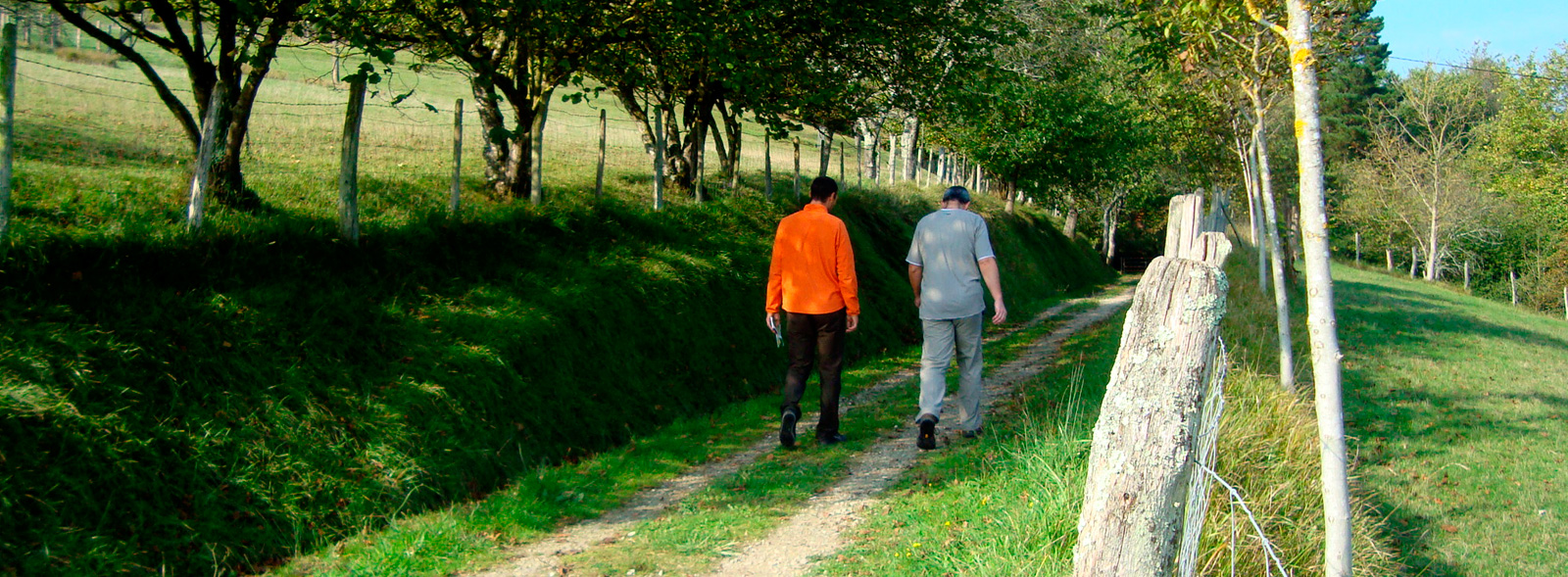
 From Mutiloa via the Troi Bidea Route. The church faces the village square, where you can park your vehicle. Then, either on our feet or on our bike, we place ourselves in front of the asphalt track that goes up to Barnaola. The Troi Route, or ascent to Barnaola, has two very different parts. The first half of the ascent features the same asphalt track that, with hardly any traffic, climbs decisively between slopes of green meadows and scattered farmhouses. In the pastureland we can see plenty of the Latxa sheep that abound in the mountains of Aralar and Aizkorri. The milk from this native breed of the Basque Country produces tasty Idiazábal cheese. We are precisely within the designation of origin that is called after Idiazábal, where we can visit the Idiazábal Cheese Interpretation and Tasting Centre.
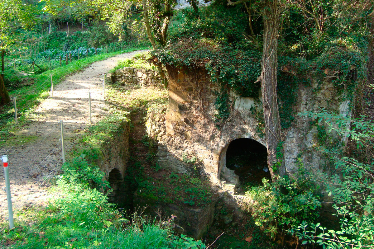
Halfway up the ascent to Barnaola, a path separates itself from the road, on the left, and invites us to leave the comfortable asphalt. We will not miss it. At the beginning of the path there are old stone waterwheels reaching into the water and a bridge to cross the crystal-clear stream. In addition, a timely panel indicating the Troi Bidea Route prevents us from getting lost. On the other bank a steep concrete slope rises very high above the stream, from which we will get dizzying views behind the appropriate protective railings. Then, in an equally pronounced way, the concrete surface descends to the level of the stream.
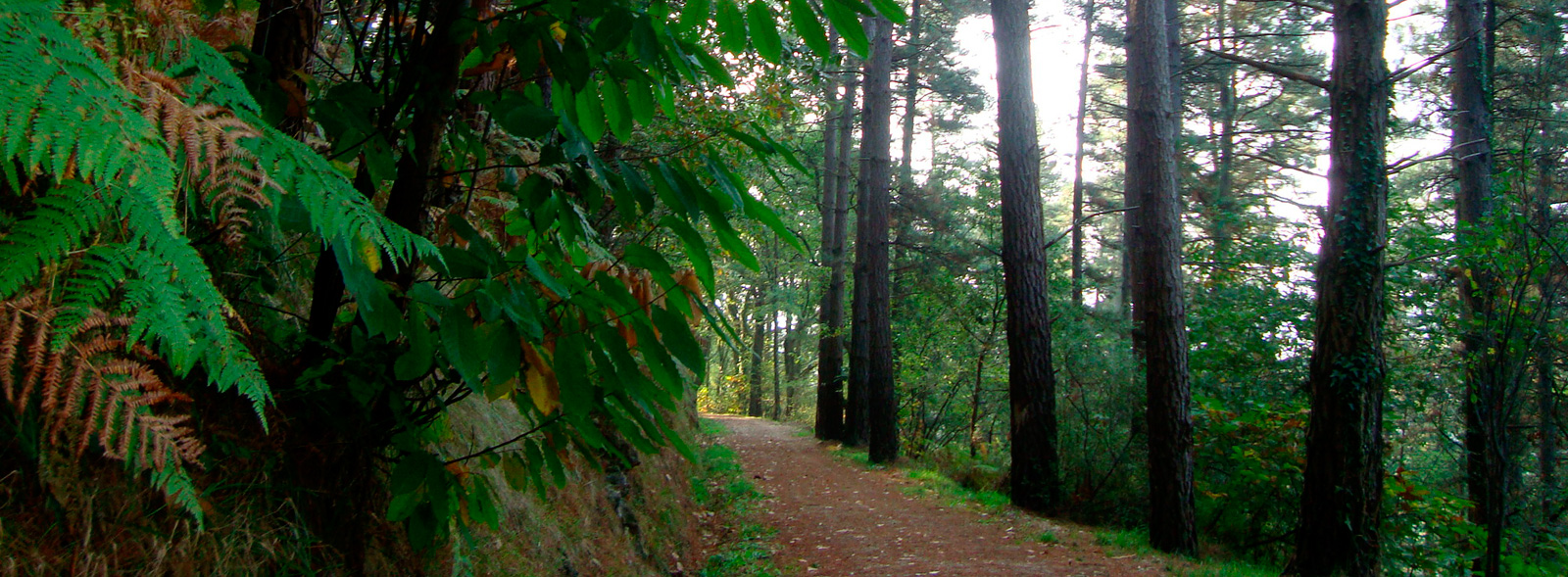
Once we overcome this short, tough slide, there comes a reward. Once paired with the stream, the Troi Route gifts us with one of the day’s most beautiful sections. It turns away from the road and into the forest: the dense canopies cover our steps with darkness. The dampness from the river and the shade dominates the atmosphere, giving rise to green mosses and ferns. The sonorous stream joyfully and brightly flows down the valley. Autumn fills the dense summer greenery with ochre colours. The setting comforts our senses and attenuates the mountain climb in which we are immersed.
The first signs of the mining activity that gave rise to the railway appear at the end of the route. In the heart of the valley there are a series of tall, thick masonry walls. These are the dikes of the settling ponds, built to hold back the mining sludge in the Troi.
The hard ascent and Troi Route end in the hamlet of Barnaola, where the minerals from the Mutiloa and Zerain Iron Ore companies arrived for subsequent loading and transport by train. And where the Mutiloa - Ormaiztegi Greenway now starts.
 The old exploitation and treatment areas of the Mutiloa mining deposit are located above the hamlet of Barnaola, on the steep slope of Monte Aizpuru. The traces of the mining past are evident on a slope lacking trees, with a lunar appearance due to its dumps and clearings. The most important extraction area was Peatza, on both sides of the road that links Zerain with Legazpi. In the treatment area, further down, next to the hamlet of Monastegizar, are the remains of the mouldboard, water tank, mineral deposit and the washing place. In the vicinity of the Barnaola hamlet was the company's headquarters; we can still see the remains of an old ore loading dock and a large unloading hopper. This complex, a paradise for mining enthusiasts, can be reached by going up the trail that begins in the left side of the hamlet of Barnaola. A sign indicating the way to Monastegizar Peatza guides curious ones.
Hamlet of Barnaola
The Mutiloa - Ormaiztegi Greenway (Mutiloako bide berdea) starts in Barnaola. To the right, a flat, asphalted track extends from the hamlet to the local road that comes from Mutiloa. On what was the old platform of the Mutiloa mining railway (Mutiloako Meatze Trenbidea) we will reach a barrier, which we should close after passing through, and the road crossing. After the crossing, the greenway is extended by a compacted earth surface that leaves aside the dilapidated railway depot (Makinetxe) and, a little further on, an overpass in the same condition.
The first section of the route runs along terraces on the sunny or southern slope of Monte Izturi, featuring magnificent panoramic views of the Troi Valley and Mutiloa. The entire route runs under the cover of leafy trees. Pines dominate this wooded area, although some scattered oaks, false acacias and other leafy trees add ochre shades to the autumn.
The dilapidated Potxueta overpass was supported by a small but high trench. On the northern slope the view extends through a wider valley covered with meadows, through which the road to Zumárraga runs and the Estanda Stream flows. The greenway changes trend. Now in a slight descent, it continues to be covered by trees.
Liernia mountain pass
At the Liernia mountain pass (km 2.5), the greenway crosses the Mutiloa-Ormaiztegi road (GI-3572) by means of a level crossing. The pass opens up and offers magnificent views of the valley of the Burdas Stream and Ormaiztegi (on the left), as well as the Troi Valley and beyond. Rising above Mutiloa, on the right, we see the silhouette of the impressive mountain barrier formed by the Sierra de Aizkorri and the peak after which it is called. The second hight point at the top of Gipuzkoa is just 16 metres lower than the Aketegi (1,544 metres). It is clear why this region, the Goierri, which features the highest peaks in the Basque Country, is considered to be the highlands of Gipuzkoa. In addition, it has two exceptional areas: the nature reserves of Aizkorri-Aratz and Aralar.
The Liernia mountain pass is also a strategic point from the point of view of obtaining supplies. After the crossroads, there is direct access to the rest area and the Liernia neighbourhood, consisting of a restaurant, a rural house, a chapel and several farmhouses.
A few metres from the junction is Liernia Bridge (Lierniako Zubia), where two rails remain on purpose at this point as a testimonial reminder of this route’s nature and railway origin.
After the bridge, the greenway continues in a slight descent along the west face of Monte Mugata-La Española. During the Carlist wars and the Spanish Civil War, a defensive system was built on La Española that, due to its strategic location, controlled the adjacent valleys. On this mountain, next to the hamlet of Zelaundieta, one the Carlist general Tomás Zumalacárregui’s great victories took place, in which he immobilized the troops of Carratalá, Espartero, Lorenzo and Jauregi.
Far from dramatic settings, La Española features one of the most beautiful stretches. The railway route sticks to the steep slope, winding its way through the mountainous relief. A dense pine forest surrounds the curved railway line and restricts all sight. Further on, the thickness of the pine forest is intensified with leafy ochre autumn hues. The closed hillside pine forest is joined by oaks, chestnut trees, birches and hollies.
A little further on, the views open up to the wide Estanda Valley, and the two railway viaducts of Ormaiztegi. A few details regarding these magnificent engineering works: The old metal viaduct (1864) was built by Alexander Lavalley, predecessor of Gustave Eiffel. This engineer knew how to make a wide, comfortable, light and very safe bridge with his masterful use of iron, a construction material that was then new and turned out to be revolutionary due to the possibilities it offered. The strategic value of the viaduct is enormous, with military conflicts being its main enemy. During the Spanish Civil War, the Altos Hornos de Bergara workers cut the bridge with blowtorches to prevent the National troops from advancing. The Francoists arrived the next day and executed them by firing squad at the cemetery wall next to the bridge. During its reconstruction, it was reinforced in 1941 with the concrete pillars that make up its current appearance. After 131 years of continuous use, when rail traffic was a hundredfold higher than originally expected, a new concrete one was built in 1995.
On the way to Ormaiztegi
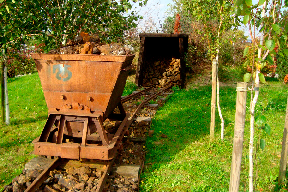
Finally, the greenway divides into two short branches. The right one, with rails still on the ground, ends in front of a clearing. The left ends in front of the asphalt track that goes up from Ormaiztegi. Here the mining companies’ railways separated, leaving a siding in between: the Cerain Iron Ore on the right and the Mutiloa on the left. Each company headed towards its facilities down the slope. The journey concluded by dumping the loads towards their respective treatment and export areas on the slopes of Damborre and Lointzi, where chutes, warehouses, calcination furnaces, overhead cables and tracks followed; an industrial complex whose restoration is expected to be undertaken later on. The mining process concluded with the ore being loaded onto the Norte Railway at Ormaiztegi Station, for its subsequent transfer to the Bay of Pasajes/Pasaia, where it would be shipped to England.
Although outside the jurisdiction of our modest mining train, it would not hurt to go down the asphalted track to Ormaiztegi and stand under the two railway viaducts that cross the Estanda Valley. The old metal viaduct of the Norte Railway is impressive due to its size, technique and history. Without underestimating the new concrete one, a structure that is also colossal. The two form a couple that is difficult to match.
The trip ends here, but to be fair this route should be completed with a visit to the mining complex of Aizpea, in the municipal district of Zerain. The Iron Mountain mining operation in Zerain goes back a long way. Although it was exploited industrially at the beginning of the 20th century, it has left us the series of buildings and structures that we can see today. The Aizpea neighbourhood, three kilometres from Zerain, features the so-called house of the English or engineers, built in 1900 to house the quarries’ engineer and accountant, the place where the raw ore was stored, the coal mine, three large calcination furnaces used to purify the iron and the mining galleries themselves. They are also the remains of the two railways that hauled the ore to the furnaces, and the two aerial cables that transported the iron to the hamlet of Barnaola (Mutiloa) and the railway station in Ormaztegi.
The Iron Mountain has been declared a Monumental Site, which is currently being studied. The Aizpitta Mining Interpretation Centre has been created in what is known as the house of the English in order to explain the culture of iron: the first floor houses features a video on the history of the quarries and the life of the residents. The ground floor explains the historical context and provides details about the inhabitants’ lives. For example, we can learn about the number of workers or the salary they earned thanks to panels and touch screens. The tour also includes a visit to the three large calcination furnaces and the Polborina mining gallery.
And if you liked the greenway, don't miss the Goierri region’s other attractions. In this complete map >> you will find general information about the Goierri Mining Park, its 2 mining deposits and the 4 routes that can be followed, on foot or by bike, and which connect the different mining areas: The Mutiloa - Ormaiztegi Greenway and 3 other trails that enable you to explore this special area. 15 km full of landscapes, culture and mining heritage in the highlands of the province of Gipuzkoa.
