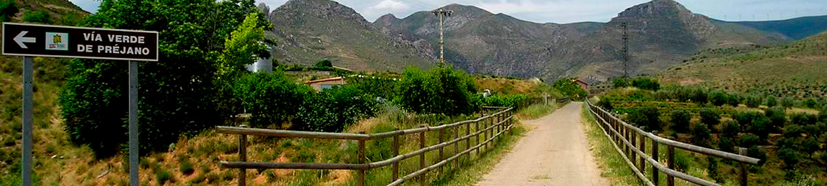
Préjano Greenway
Route Description
Along the branch of the Cidacos Greenway
Our proposal consists of 5 km to the village of Préjano, along the actual Préjano Greenway itself, and 4 km along the Cidacos Greenway: from Arnedillo to the place where both routes converge.
Four kilometres further on, after crossing the Préjano road for the third time, we arrive at the old Préjano-Ariñano loading station, currently occupied by a livestock farm. The station had depots, an office building and robust loading bays to transfer the coal extracted in the Préjano mines to the Calahorra-Arnedillo railway.
At Préjano-Ariñano Station, the main line and its mining branch to Préjano separated. The Cidacos Greenway continues, along the main line, towards Calahorra. On the other hand, the route of the mining train, which from now on will guide our steps, ascended about 200 metres and entered an 80-metre-long tunnel carved out of sandstone. This straight tunnel, which is actually a narrow gallery designed for the passage of small wagons, was the first that this railway branch came across on its way up to the mines. However, today, both the tunnel and that first section preceding it are impassable. We have the following alternative in order to get around them: we will continue along the Cidacos Greenway and, about 400 metres from the loading station, we will take a trail to the right that, 250 metres higher up, reaches the route of the Préjano Greenway.
 On coming to an intermediate point on the greenway, we will go back, to the right, along the old route. After about 300 metres away, we arrive at the actual km 0 of the Préjano Greenway, located at the exit of the old tunnel that provided access to the loading station. In this way, the section to the start of the route will have to be round trip, if we do not want to miss anything.
Retracing our steps, we will cross, naturally for the second time, the Ombillo Ravine along a pontoon beautifully made out of ashlar masonry. We will be able to enjoy this structure more peacefully from a small rest area that has been prepared in its vicinity. Here there is also a small section with steps that, if we feel like it, will enable us to go down to the bottom of the ravine.
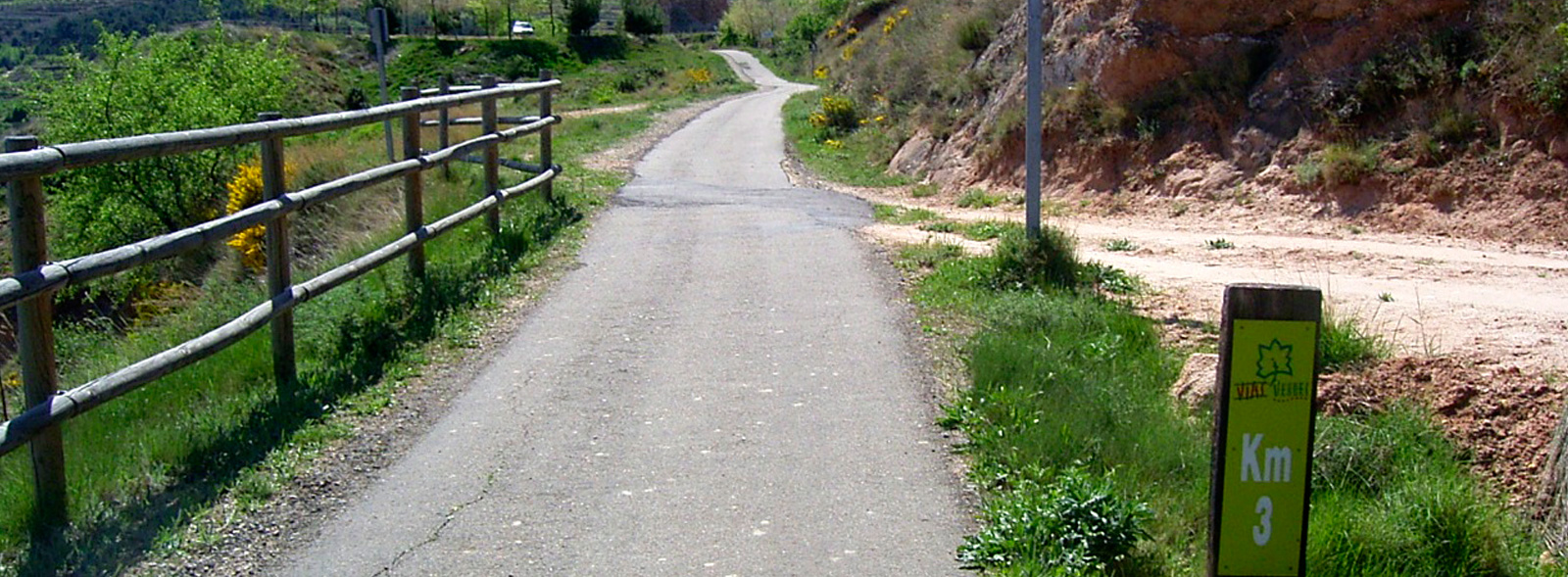
After this ravine, the route begins a 2-km-long stretch featuring a gentle ascent leading to the Préjano road. It passes by fruit trees and enables us to enjoy exceptional views of the Cidacos Valley. The route has railings to improve its safety, especially if we are accompanied by children.
At km 2 we cross the local road to Préjano. After crossing, we arrive at another rest area, that of Las Viñuelas.
A little further on, a patch of pine trees, which marks a change in the landscape, indicates the presence of the recreational area of Préjano. This area includes a small car park for those who want to start the route at this same point.
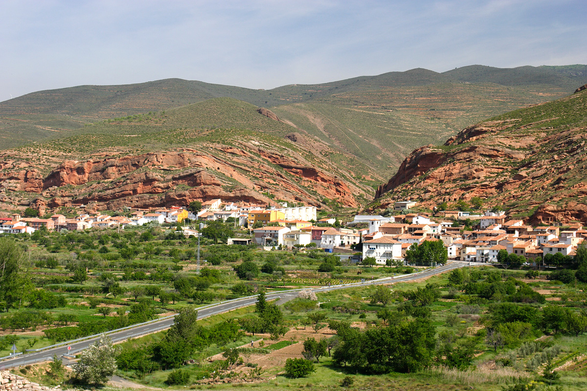
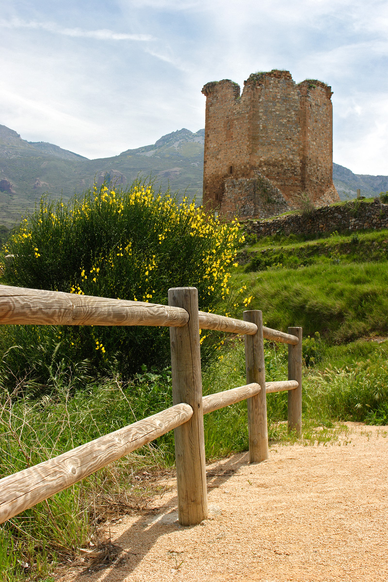
From the greenway we can clearly see the tower of Préjano Castle, which is undoubtedly the most important building in its modest town centre.
At this point the greenway takes a sharp turn to the right, heading towards the route’s second and last tunnel. This is the Préjano Tunnel, which is 80 meters long and has lighting. On coming out of the gallery, the greenway reappears in front of a small ravine that is crossed by a narrow bridge, which is the original mining railway bridge. Its height, compared to its width, is astonishing: 6 metres.
In pursuit of the fossil tracks in Valdemurillo
After crossing the bridge, the route converges with a rural road. This is followed by a 700-metre stretch that takes us to the esplanade of the Palomares Loading Bay, which has been turned into a rest area.
The greenway continues along a rural road for another kilometre, to the site of dinosaur footprints in Valdemurillo. This section, which has slightly steeper slopes than the previous ones, passes next to the last rest area: that of Pozo de San Antonio. About 100 metres further on, at km 5.1, the greenway ends where the path leading to the Valdemurillo site –about 20 minutes away– begins.