Vegas del Guadiana Greenway Nature Trail
Route Description
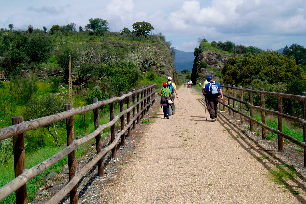
The Vegas del Guadiana “Vía Verde” begins at Villanueva de la Serena Train Station. From this station paired with the train tracks, the continuous stretch formed by José Gallardo Street and Paseo Castelar runs towards the tanks that supply the locality and Ronda de la Hispanidad with drinking water.
Beside the flyover on the road to Don Benito (Ronda de la Hispanidad), the Madrid-Badajoz railway line and the Villanueva de la Serena-Talavera railway line, whose building work was never completed, split. This point (marked as “km 1”), which features a rest area, is where the greenway begins and acquires its characteristic appearance.
Departing from Villanueva de la Serena
Leaving Villanueva de la Serena behind, the greenway turns right and enters a deep, damp red-coloured railway trench. This section crosses the Zújar canal and its parallel road (km 2.3). However, the linearity of the railway route is interrupted by a wide, compact dirt track crossing it (km 5). Since the impassable railway platform is overgrown with undergrowth, the greenway abandons the original railway route, turns right and continues along this dirt track, sharing an unchanging landscape with other vehicles. Without leaving the dirt trail, we come to a second transversal trail: the left branch takes us to a level crossing with the busy BA-060 road (km 6.3). To avoid any confusion, there are signs indicating the turn-offs.
Crossing the Guadiana River
On the other side of the road, the dirt trail becomes an asphalt road leading up to the hill called El Ventorrillo. Here an impressive panoramic view opens up before us. The greenway goes down a steep slope towards the Guadiana, enabling us to see the striking viaducts that, supported by aesthetic concrete arches fastened to robust pillars, cross the large river. The descent and asphalt end when we reach the first iron viaduct (km 7), connecting once again with the original railway route. Here the section shared by other vehicles also ends and there begins a section supported by three tall viaducts, which are extended by means of a tall embankment.
The first rice fields and Special Protection Areas
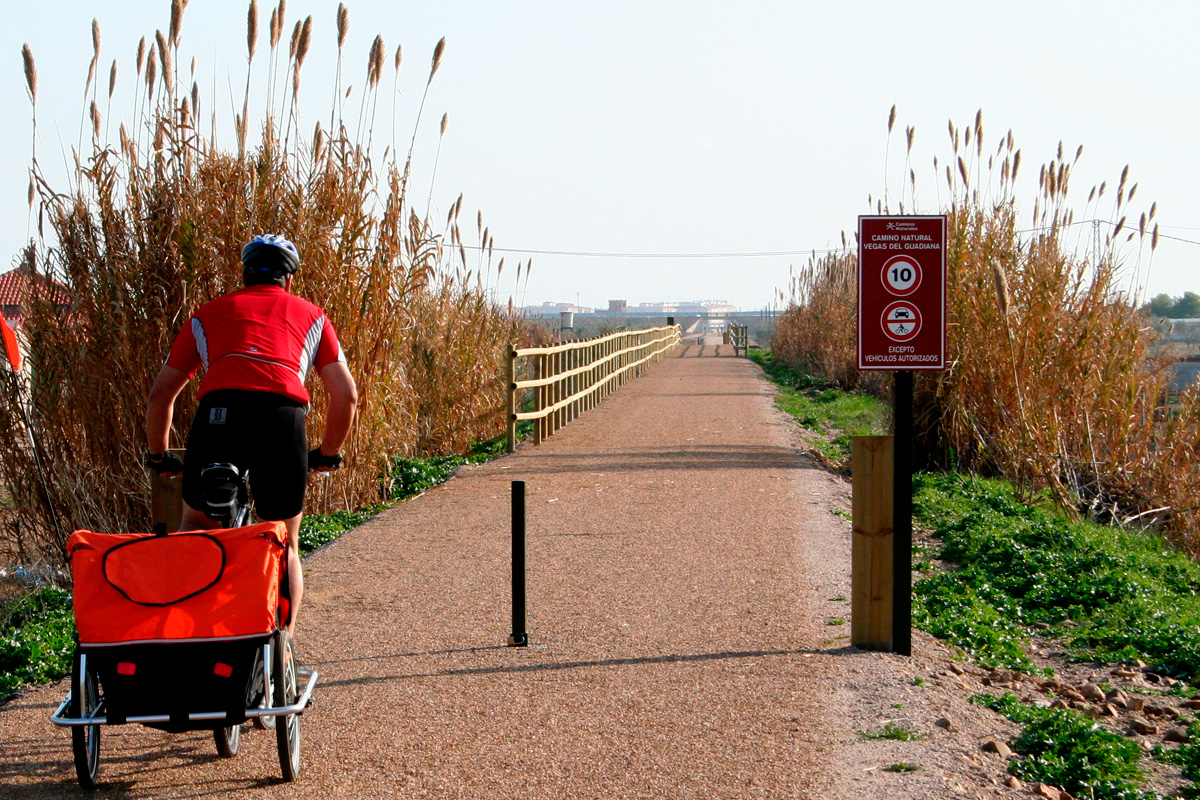
The almost aerial section above the plain of the Guadiana ends at an underpass below the N-430 road (km 8.2), leading to an open landscape made up entirely of farmland. The greenway will soon cross the homogeneous landscape of the waterlogged rice fields of Palazuelo and Guadalperales, a Special Protection Area for Birds (SPA) that features, depending on the season, green tides rocked by the wind or land ploughed by tractors followed by a troop of storks and egrets; an invariable landscape of flat horizons that the route crosses like an infinite straight line. That is why every event is celebrated by the senses. At km 9.6, the ruinous Rena Station appears and, further on, its loading bay crowned by stork nests, the first of many along the way.
After passing the station, the greenway ascends alongside rows of fruit trees on both sides, gradually becoming an embankment leading to the bridge over the Gargáligas River (km 10,4); this setting is shared by anglers and birds, featuring a bird-ringing station. At km 13, a flyover rises up on the road leading to the district of El Torviscal, about 300 m from the greenway; and at km 17, another flyover appears, after which the silhouette of the locality of Palazuelo filters thorough a green tapestry, formed by the black poplars and eucalyptus trees populating the banks of the Ruecas River.
Through wooded pastureland and rice fields
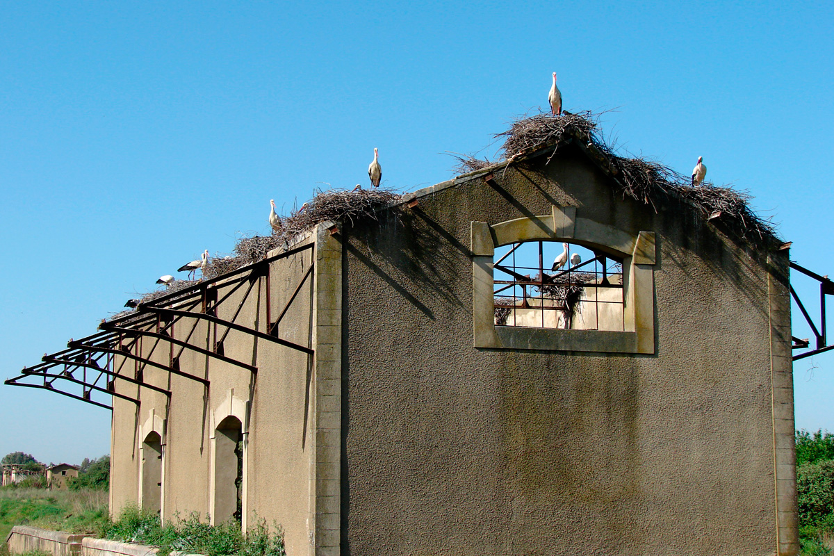
At around km 19, the greenway enters the province of Caceres and we come across Campo Lugar Station. The striking and ghostly brick passenger building still has a certain elegance. The roofless depot is decorated with stork nests, while the rest area provides travellers with a pleasant place for enjoying a break along the way. At this point, and discontinuing the plain’s inherent linearity, the greenway turns to enter two long, tall trenches with soft walls covered by brooms, rockroses, brambles and lavender; they are divided by an embankment providing an exceptional view of the Ruecas River and its trail of ash trees, holm oaks, bulrushes and eucalyptus trees. It then turns to the right, along the Dehesa hillside, before entering an endless straight section featuring modest embankments and trenches.
In this stretch, we will come across the abandoned town of Cristóbal Colón (km 23.3), where cows and sheep graze in the wooded pastureland, the entourages of storks and egrets appear behind the tractors in the meadows and red partridges rush off in our presence. The colonization towns that emerged from the Badajoz Plan were also rationally distributed in the territory.
Each locality had its own arable lands. People used to talk about the "cart" module, the maximum distance that a peasant could cover by cart to get to his farmland. Some of these villages have evolved and enjoy great vitality, others failed miserably and ended up depopulated. Cristóbal Colón is one of the latter cases.
Through the rice fields of Madrigalejo
We cross, successively, the Orellana canal, its service road and the bridge over the Ruecas River (km 25). The water from the canal passes under the greenway thanks to a syphon and continues along another canal as far as Madrigalejo. This locality, located 4 km from the greenway, offers refreshment, food and accommodation. Running alongside the canal is its narrow, winding and flat service road, which makes it easy to access this small town.
Back at the bridge over the Ruecas, we witness a new change of scenery: the flat rice fields are back again; the railway platform now goes through these fields on top of a medium-sized embankment featuring views, far in the distance, of the wall keeping the Pizarroso River inside the Sierra Brava Reservoir; this forms a very important ecosystem due to the presence of ducks, coots, stilts, herons, cattle egrets, cranes or white storks –a real birdwatching paradise!
Dehesa del Monte
The metallic footbridge crossing the EX-355 road announces the arrival of Madrigalejo Station (km 29); from here, the route enters another long, flat straight stretch through the Special Protection Area called Llanos de Zorita and Sierra Brava Reservoir. This infinite straightness takes its first steps through the wooded pastureland called Dehesa del Monte, a carpet of white and yellow spring flowers where storks fill the branches of the holm oaks, sheep graze and the cuckoo sings. It is certainly a pleasant interlude in the rice field.
At km 31.5, the original route of the railway line comes to a sudden end. On the left, the high embankment of the Hito pool has put an end to the original itinerary, which is now flooded and covered by tangled vegetation. A wide trail running parallel, which is shared by vehicles, is provided as an alternative in order to continue on. At the foot of the Casa de Cerralbillo (km 35,4), the greenway leaves the alternative trail; we cross a small canal running through a culvert and return to the original route of the railway line.
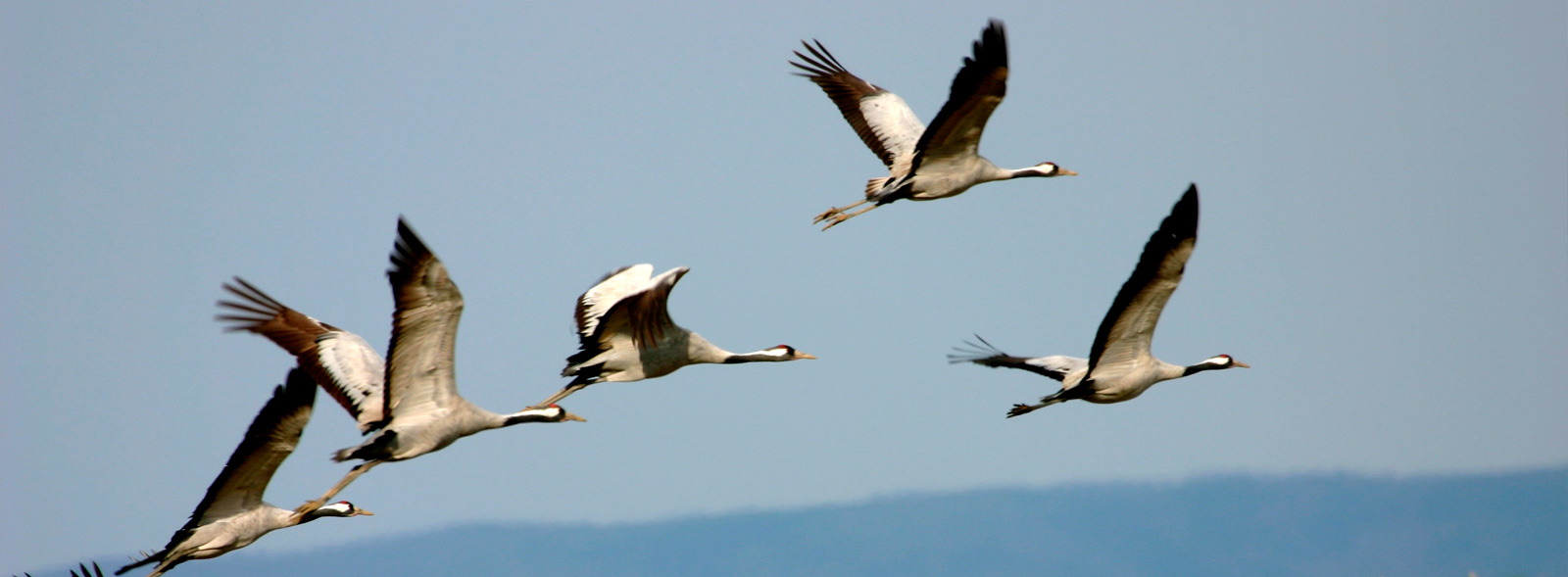
We have left behind the tilled land, rice fields and plains for good. Ahead of us lies a long, flat straight stretch through gently sloping wooded pastureland, the ecosystem where many common cranes choose to winter. From now on, the greyish crane with long legs and neck, black head with a red spot on the nape of the neck and a white line that descends from the eyes, deserves the traveller’s respectful silence and attention.
Common cranes prefer good temperatures, peace and the rich gastronomy of Extremadura for the winter. For this reason, they have established their second home preferably in the regions of Las Vegas Altas del Guadiana. No more and no less than 2,000 km of fluttering and long thermal glides are what they undertake to spend a third of the year in the ecosystem that they like so much: a balanced combination of sun and wetlands, with large extensions of waterlogged rice fields and spacious, wooded pastureland. They set up their nests on the banks of rivers, reservoirs or ponds, leaving their roosts very early to savour the buffet offered by the holm oak forest: local dishes based on invertebrates, sprouts, seeds and the star dish, the one that is not available in the cold north: tasty acorns.
With this new incentive, the greenway goes deeper into this scenery featuring a view of the Cabos Negros hill, the wide crowns of the holm oaks full of stork nests, the hello and goodbye of the Ruecas River and the sudden appearance of the tall embankment that supports the Dehesas Canal (km 38). This will be an exceptional hillock throughout the extension of the endless straight stretch and the wooden pastureland surrounding the greenway.
The plains of the Ruecas River
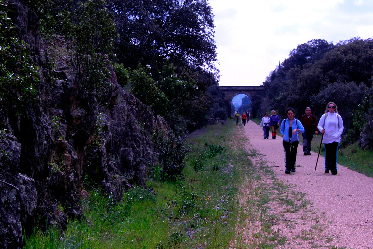
The ruinous station of Zorita Lavadero (km 41.1) owes its double-barrelled name to the distant locality of Zorita and the “lavadero” (washing place) linked to the nearby, derelict Convent of Malillo. Under the ownership of the Monastery of Guadalupe until the 19th century, Malillo was used by the Guadalupe monks for resting and for breeding merino sheep.
After passing the solitary station, the greenway follows the winding course of the Ruecas River as far as the tall embankment at km 44, where the river splits into two: the right-hand course, the Ruecas itself, flows towards the concrete wall of the reservoir of the same name; the left-hand course (the Grande stream) will accompany us to the end in Logrosán.
The mountainous area
The greenway bends alongside the Grande stream through wooded pastureland featuring a higher density of holm oaks. Upon reaching the flyover at km 46.3, it heads towards another long straight stretch with a moderate slope. There is a series of medium-sized embankments after km 47, which provide us with a more aerial view of this tongue that carpets the stream in spring. The straight stretch ends in a huge trench excavated out of rock at km 49 and the scenery changes: the gentle slopes are replaced by a wild Mediterranean mountainous area of scrubland, populated by little and great bustards, partridges, thrushes, rabbits, hares, wild boars, and red and roe deer.
Arrival in Logrosán
The route of the railway line continues with a view of the Guadalupe mountains on the horizon; the greenway crosses the Grande stream (km 53) and goes up the slope of the San Cristóbal mountains, passing by several posts crowned by finely balanced stork nests. Later, the route turns right and crosses through trenches surrounded by small vegetable gardens and farms. These are the first signs of urban life before entering the final straight stretch leading to the town of Logrosán, adorned by the silhouette of its belfry.
Finally, the greenway ends in the old station of Logrosán (km 57.7), where the last rest area enables us to get our strength back, before going up the ramp leading to the town centre. The station was conceived as a provisional terminus of the railway line. The passenger building stands out in a line with no two buildings being the same. The station features a motorised turntable to turn locomotives around and a water intake, which is still visible, to supply the steam boiler.
Although the greenway ends here, it is possible to continue. However, it is more difficult from here on since the “Camino Natural de Las Villuercas” route, which links this greenway and La Jara “Vía Verde,” no longer follows an old railway line. It is an itinerary of almost 70 km between the former stations of Logrosán and Santa Quiteria, Toledo, with a branch reaching as far as Guadalupe, whose Royal Monastery of Santa María de Guadalupe is a World Heritage Site.
This route was awarded the Blue Flag Trail distinction in 2024 by the Association of Environmental and Consumer Education (ADEAC), a prize and recognition for the conservation and restoration of trails and itineraries, transformed into valuable resources for environmental interpretation and education, as well as for enjoying nature through sustainable recreational, sporting and tourist activities.
