Cidacos Greenway Nature Trail
Route Description
 Our route starts in the imperial Calahorra (km 0), on the banks of the Ebro. There, the railway from Calahorra to Arnedillo began its journey next to the station of which nothing remains. The greenway begins in Cidacos Park, in an initial section shared with vehicles that ends in a recreational area where we can see remains of an aqueduct that supplied water to the Roman town of Calagurris. From here the greenway runs parallel to the local LR-134 road and, after about 6 km, we reach the old halt at the Livillos River. It is worth noting that near the greenway there are several wetlands of great interest for birdwatching enthusiasts: the La Degollada ponds, the Recuenco Lagoon and the Perdiguero Reservoir.
The greenway continues parallel to the LR-282 and, before the entrance to Autol, it crosses the road to continue as far as the old station, where we can refill our water bottle. The greenway does not enter the urban area of this Rioja Baja town, but we cannot miss Cidacos Park, where El Picuezo and La Picueza, two geological wonders in the form of rocky monoliths more than 45 metres high, will catch our attention.
We leave Autol through the Gollizo Tunnel (km 12.4), which is almost half a kilometre and has lighting, and continue towards the town of Quel. This section runs past vegetable gardens, so it is not uncommon to come across vehicles on the route. Although some of them are authorized to drive here to access their vegetable gardens, please be very careful.
We enter Quel (km 15.2) along a comfortable riverside route. The silhouette of the castle crowning the town stands out. The municipal district is name after it, since Qalat means castle in Arabic. The route continues through the rich fertile plain of Cidacos until it enters the footwear town of Arnedo (km 20).
From now on it is time to follow the Cidacos upstream. About 14 km that are a good example of the transition between the landscape of the fertile plain and that of the mountains. In Arnedo and, to avoid the town’s urban and more industrial area, a new route was designed in 2018 that is safer and more pleasant. The alternative route runs parallel to the river and its thickets. Coming from Quel, at the Francos Bridge we will go to the left to descend parallel to the left bank of the river. This section is very popular with both walkers and cyclists since it is very close to the town of Arneda and Cidacos Park. The route continues with Arnedo on the right and here we can see, high up, the consolidated remains of a Visigothic castle that can be visited with a local guide. We can also stock up on anything we might need in this town.
And if you have time, and you don't mind making a small detour, it is worth arranging a guided tour of the Caves of a Hundred Pillars, on the hill of San Miguel. It is a network of tunnels and passageways carved into the rock that dates back to the Middle Ages. In the early medieval period, it most likely housed the Monastery of San Miguel.

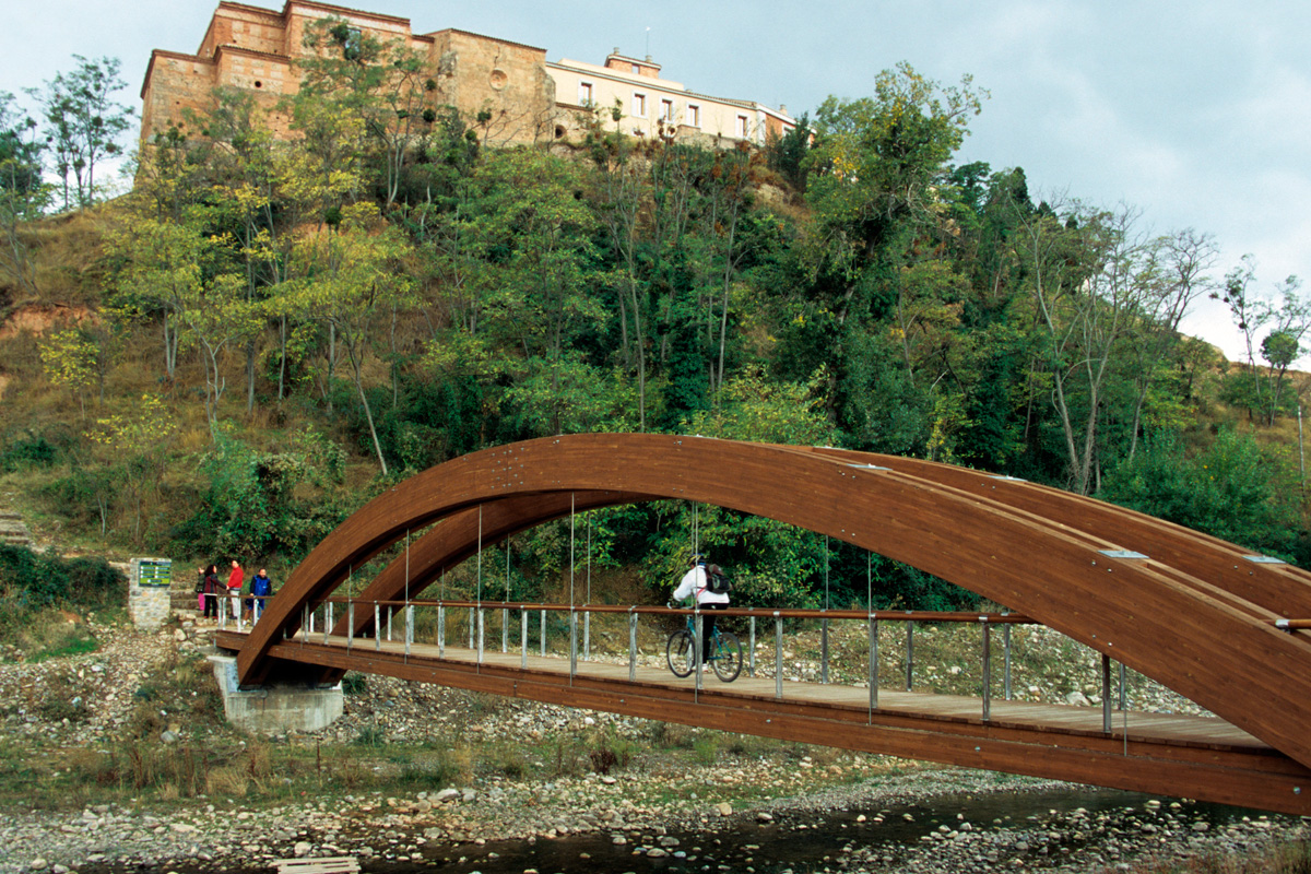
Two kilometres ahead, a modern footbridge leads to the Monastery of Vico (km 23.9), a place featuring a beautiful balcony overlooking the valley surrounded by mountains. Our Lady of Vico is the object of great devotion in this region. You can visit the old baroque church and the crypt, chapel and old sacristy that contains works of art of great value, which have been preserved by the Cistercian Community that now lives in the monastery.
Back on the greenway, we advance along a new section, just over a kilometre long, shared with vehicles until we reach Herce (km 26.9) and its station, with a fountain, that has been converted into a youth hostel. At the top of the rocky outcrop protecting the town of Herce, you can see the silhouette of the ruins of an ancient Islamic fortification. In the vicinity of the castle there is also the Chapel of El Salvador and a viewpoint featuring a wide panoramic view of the valley.
After Herce, the greenway runs through an extensive and rich lowland area full of vegetable gardens and crosses a bridge over the Cidacos River. From here the route rises slowly and, at Santa Eulalia, crosses the road that goes to Préjano, running through some sections in trenches. Shortly after, on the left we can take the alternative Préjano Greenway or continue our way along the Cidacos Greenway.
At km 30.4 on the Cidacos Greenway, we pass by Préjano Station, while advancing near the local LR-382 road. We cross the road several times until we reach a viewpoint featuring a good panoramic view of the Cidacos Valley, the Arnedillo crags and the alignment of rocky cliffs of Santa Eulalia. Little by little the landscape becomes boxed in and the wide fertile plain of the river narrows, taking us into a narrower and rockier setting.
At this point, the greenway enters one of the route’s most spectacular sections: the Arnedillo Canyon and the rugged relief of the Natura 2000 site called "Peñas de Arnedillo, Peñalmonte and Peña Isasa." This protected area is the home of numerous birds of prey that nest in the rocks, including Bonelli's eagles and Egyptian vultures, as well as golden eagles, eagle owls, vultures and peregrine falcons.
In the vicinity of the Peñas de Arnedillo, we can visit the griffon vulture interpretation and observation centre, popularly known as the Mirador del Buitre (Vulture Viewpoint), located in the quarry’s old loading dock, 800 metres from Arnedillo. At the centre, visitors can observe live the behaviour of the griffon vulture colony and their chicks, thanks to a monitor installed in the room that captures the images sent by a remote-controlled video camera located on the crag. Did you know that there is a similar centre on the Sierra Greenway in Andalusia?
We continue on our way and the route crosses a bridge over the Cidacos River before entering that last tunnel, which has lighting and leads to Arnedillo. The interior of the tunnel stands out due to the wall-lining technique that was used, featuring small side arches made of bricks. However, those who prefer natural light to this gallery’s lighting, should know that there is a side path that makes it easy to avoid the tunnel.
On the other side of the tunnel we immediately reach the old railway station. The veteran building presents an impeccable image, since it was rehabilitated a few years ago and is now used as a municipal swimming pool. A good way to end the day in hot weather.
In front of this complex, on the other bank of the river, the steaming pools of the Arnedillo thermal baths are quite a spectacle, especially in the cold winter dawns. The water temperature can reach 52ºC. For the more resolute ones, there are natural pools prepared for bathing, at different temperatures, in which you can freely enjoy these salubrious waters.
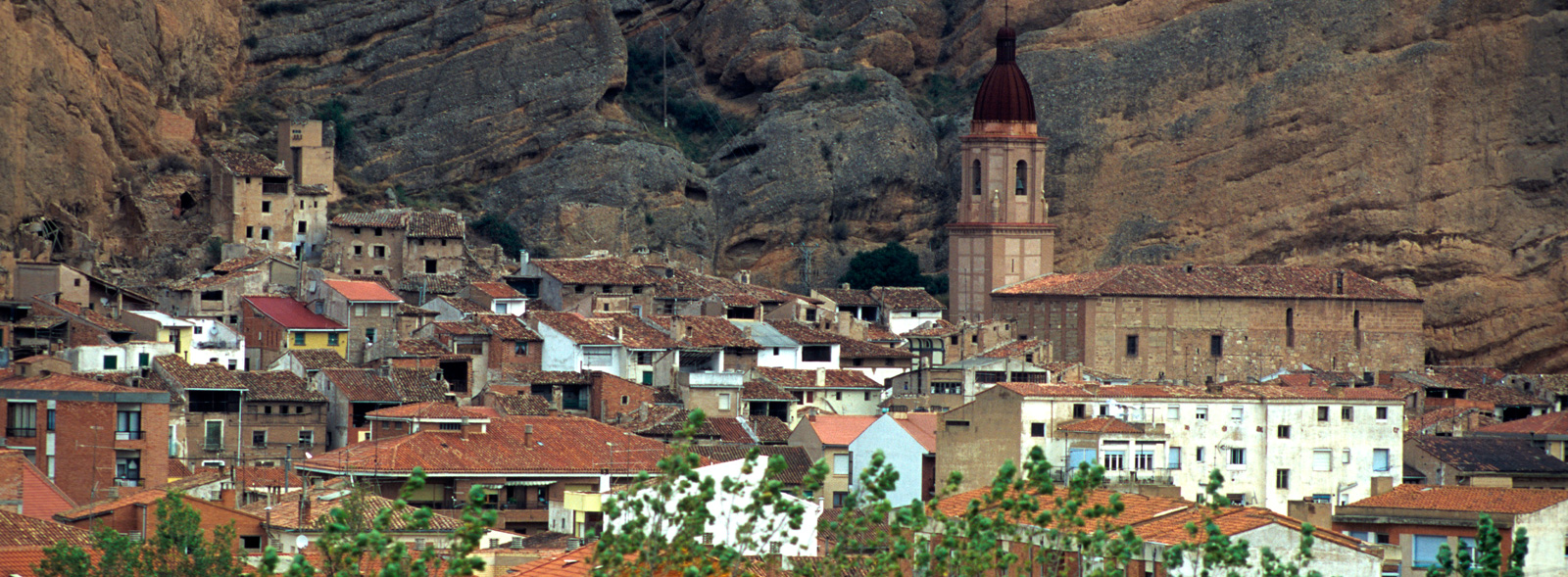
And we come to the town of Arnedillo (km 34), the end point of our itinerary that never disappoints visitors because, in addition to being nestled in a unique landscape between the La Hez and Peñalmonte mountain ranges, it features many tourist attractions. Trekking routes, numerous chapels, the hot springs spa, viewpoints and wildlife observatories are some of the resources that the town has to offer.


