Pas Greenway Nature Trail
Route Description
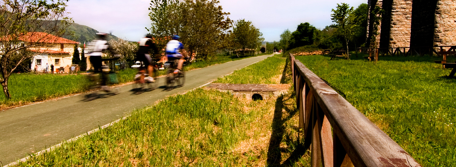
 The itinerary is made up of two clearly differentiated sections. At both ends —between Alceda-Ontaneda and San Vicente de Toranzo, and between Astillero and Obregón—, the Greenway is fully developed and well maintained. Between these, there are additional improved stretches, although they lack specific signage. These are located within urban areas in Puente Viesgo, La Penilla, and Sarón. In Sarón, the Greenway connects with a cycle lane running along the shoulder of the road that leads to the village of Penagos.
The Ontaneda Circuit
The first section starts in the town of Ontaneda, at the foot of the El Escudo mountain pass (puerto de El Escudo). We recommend starting in this place, as this way you can take advantage of the gentle downhill slope that, in 34 km, will take the traveller from a height of 178 metres in Ontaneda to sea level. Located in this town, we will look for the old station, now converted into a tourist office. The road is integrated into this area’s urban road network. A slight change in the colour of the asphalt together with some signs of the route indicate the Greenway’s itinerary. The route follows the perimeter path of Ontaneda Park, where you can also refill your water supplies.
We will head north and, after a short urban section, we will arrive in less than a kilometre to the streets of San Vicente de Toranzo. At km 2, we come across a timber processing plant that the road avoids by approaching the Pas riverbed alongside the cemetery. At this point, the Ontaneda Circuit, a circular itinerary that takes advantage of part of the Greenway, offers the option of return returning to Ontaneda by following up the Pas upstream, specifically next to the Alceda estate, where a spa is located. After skirting the thermal facility, we arrive again at Ontaneda Station.
From the iron bridge to the Franciscans in Soto
However, our suggested itinerary does not return to Ontaneda but continues along the original railway route to Santander. We come to the first iron bridge that crosses the Pas River. This iron framework will get us across to the opposite bank and enable us to take some picturesque photos of this spot.
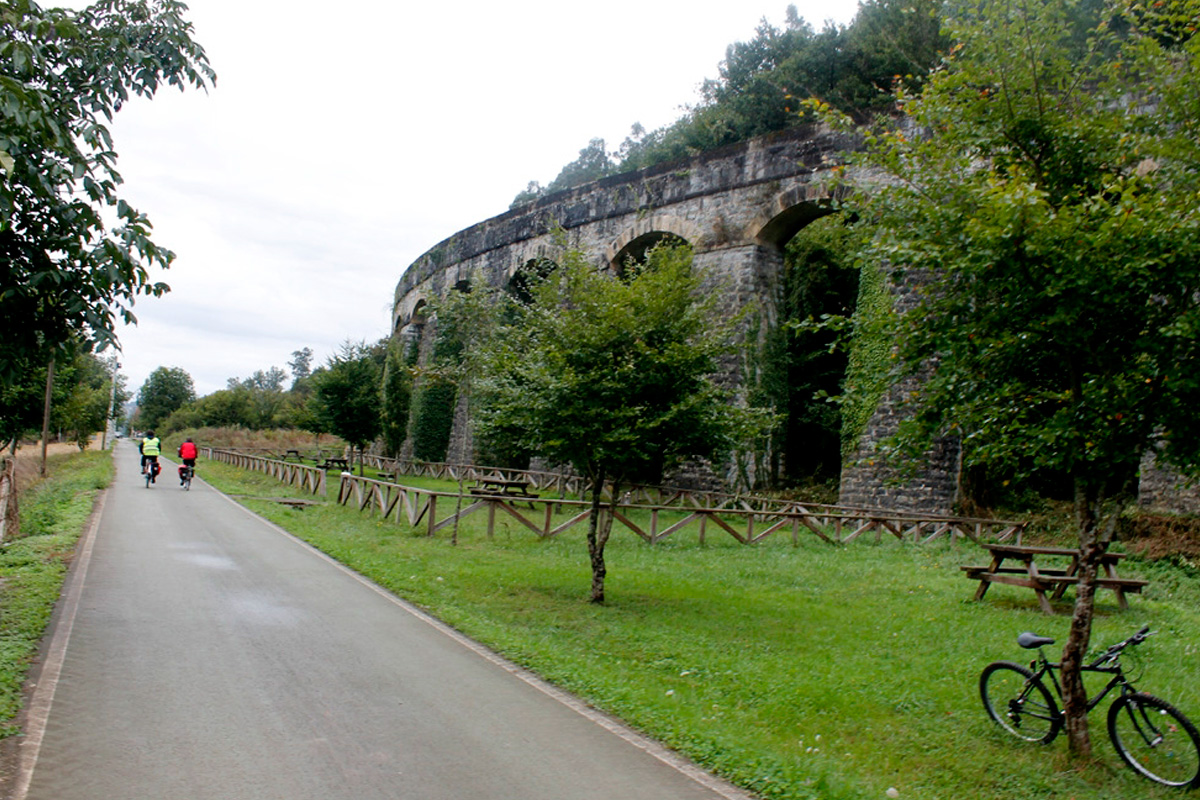
The asphalted section continues as far as the San Martín hut and stop. Thereafter, we will enter an area that features some of the most beautiful places on the way to Santiurde (km 6), the municipal capital. After passing the village, on the right of the greenway, you will be surprised to see an impressive series of stone arches. This formed part of an aqueduct carrying an old (and now abandoned) water pipe that used to cross the terrain in this elegant way.
The greenway continues parallel to the road. This section features in the horizon the Renaissance tower of the Franciscan convent in Soto Iruz, which, like a watchtower, watches over the region of the Pas Valley. In Soto Iruz, it is worth taking some time to explore the streets of this quiet village. Here you will find the old station, located at km 9, still standing at the foot of the convent tower, as well as the former convent itself, which is well worth a visit if it happens to be open for worship. After passing the station, the route crosses the road and continues alongside the convent grounds towards Puente Viesgo.
Fountain of health in Puente Viesgo
 After La Penilla we will approach a section where a quarry has cut off part of the mountain, slightly dirtying the landscape. Once we have passed the cut, we will be able to observe the waters of the River Pas a few metres away, splashing against some small dikes. In this same area it is worth stopping to contemplate an old washing place located on the side of the greenway that, although it has lost its original function, maintains the charm of the rural world’s recent past. Here an area has also been prepared for the little ones to play and the older ones to rest, with the sound of the river in the background.
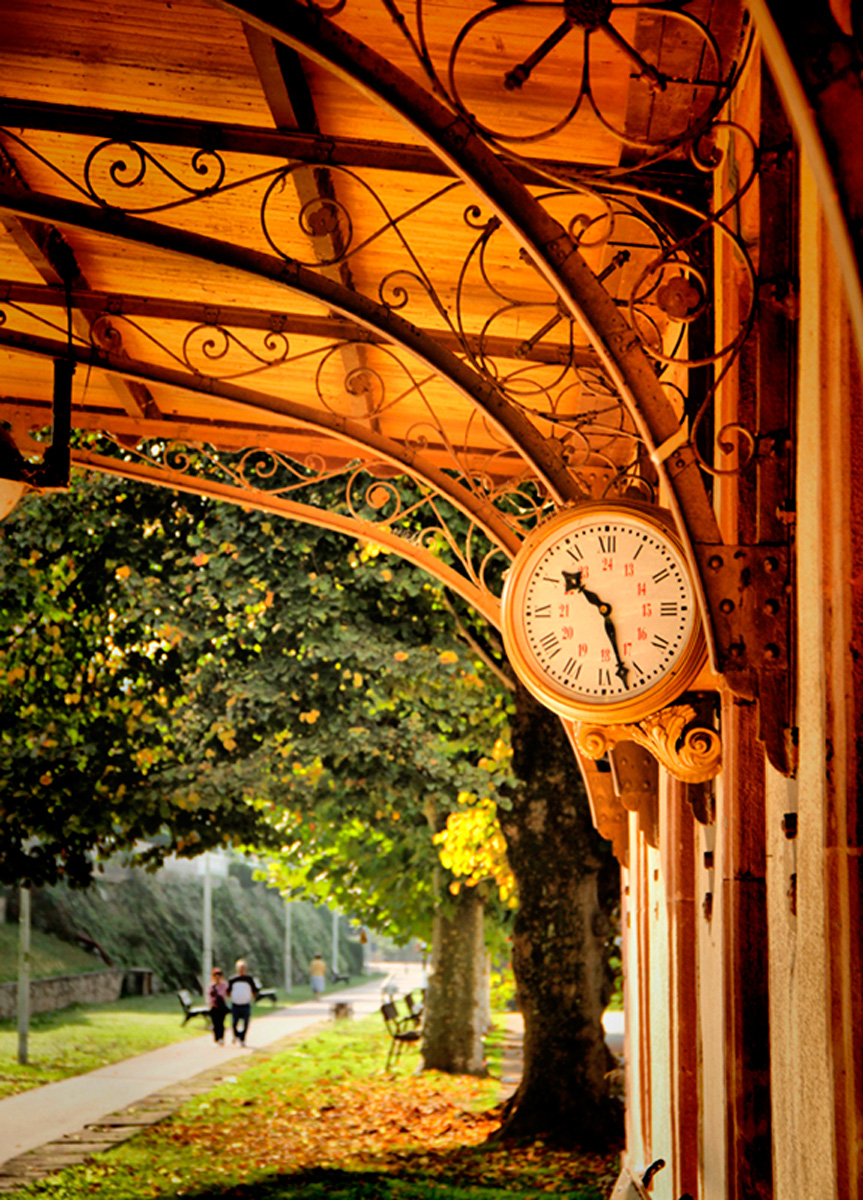
We arrive at Puente Viesgo Station (km 12), the most elegant one along this greenway. Today it houses the municipal tourist office and the visitor centre of the Natura 2000 Network. The station’s passenger building has been impeccably preserved, featuring a distinguished porch and even its platform clock. The proximity of a nursing home and the famous spa of Puente Viesgo to this station will make this a remarkably busy section.
Before continuing, we must stop in front of "La Reyerta," the elegant narrow-gauge steam locomotive. This model 030-T engine was built in Munich in 1912, and it was operational until the 1970s. It will be easy to play stoker for a day and dream of those trains of yesteryear. Puente Viesgo bids farewell to the visitor next to its charming Neo-Romanesque church erected in the twentieth century.
Through the Pisueña Valley towards Obregón
After passing through the centre of Puente Viesgo alongside the spa, the route leaves the course of the Pas River and curves gently eastwards until it reaches the Pisueña River, which we cross via a concrete bridge. On the other side of the river, we arrive at Pomaluengo (km 17), where the route continues eastwards, now heading upstream. In Pomaluengo, we pass beneath the junction with the A-8 motorway and continue alongside both the motorway and the former N-634 road, now largely urbanised and with limited traffic. In this urban section we should look out for a white building located on the right of the greenway. It is the former Pomaluengo Station, which has now been converted into the Castañeda Cultural Association of the Elderly, where there is a rest area ideal for a break. If you feel energetic, there is also a designated climbing area just outside the village, right next to the Greenway.
From here, the route continues parallel to the N-634. This almost straight road will accompany us as far as Sarón, with just one well-signposted crossing offering good visibility between Pomaluengo and La Penilla.
 A little further on, after a long straight stretch, the Greenway runs parallel to the road until it crosses it. We continue on the dirt track in a straight line bordered by trees until the next village, La Penilla (this is not a mistake: the same place name is used again), where the presence of a tree-lined walk indicates that we are going to pass through the site where the village station was once located. The unmistakable aroma of chocolate drifting from the nearby Nestlé factory signals our arrival in La Penilla.
We will leave La Penilla through a green space that gradually narrows between the road and the calm Pisueña River. The greenway makes its way through another very pleasant section to La Encina along a tree-lined path that passes next to the old Torrentero or La Campanilla mill and leads us to Sarón (km 23).
Right at the entrance to Sarón, we leave the original railway alignment and follow the town’s cycle lanes to reach the N-634 road, visible to our left. After crossing it, we continue along cycle paths running beside the A-8 service road, pass underneath the motorway, and reach the northern roundabout at the entrance to Sarón. Here, using the pavement, we cross both the access road into the town and the road towards Pámanes. These crossings are well signposted and offer good visibility, although caution is always advised.
Continuing along the cycle path on the roadside towards Pámanes, and just a few metres from the roundabout, we take the signposted route heading north. After passing beneath the Sarón bypass, a gentle climb leads us to the summit of Sobarzo, where a rest area offers beautiful views over the Pas Mountains and San Roque de Río Miera, now behind us, before beginning the descent towards the coast.
A greenway to the Bay of Santander
From the summit of Sobarzo, you can continue along the original route of the Ontaneda railway, which takes you through the village of Obregón along the paved Greenway. From there, the route approaches the slopes of Peña Cabarga on your left and reaches the entrance to the Cabárceno Nature Park (Parque de la Naturaleza de Cabárceno).
However, a more comfortable option is to leave the old Ontaneda–Astillero railway alignment and take the branch that veers slightly to the right at the rest area. This leads onto a recently restored section of the equally iconic Santander–Mediterranean railway. This route follows the hillside of Peña Cabarga and takes you through the Obregón Tunnel, the twin of the famous Engaña Tunnel, measuring 230 m in length and fully paved and illuminated.
Running at a higher elevation, this section offers magnificent views over the Villaescusa Valley. After passing above the entrance to Cabárceno Nature Park via an overpass, and crossing an elegant footbridge, the route rejoins the former Ontaneda–Astillero railway line, which continues towards the coast.
At the point where we reconnect with the Ontaneda railway, the future Morero Greenway also begins. This route follows the left bank of the Solía estuary, forming a circular itinerary as far as the entrance to Astillero.
Continuing along the Pas Greenway on the original railway alignment, we follow a further 6.3 km descent towards the sea along a track reserved for cyclists and trekkers, featuring fountains, rest areas and all the Greenways’ characteristic elements. We thereby descend through woodland and farmland that alternate with meadows where cows graze meekly on the slopes of Peña Cabarga.
On this route we will pass by the restored La Concha Station (km 29) as well as the nearby Rosequillo estate, an exceptional place to take a break, before finally reaching the Solía estuary and the Cantábrica Park in the Bay of Santander. This natural landscape is crossed by an old metal railway bridge, after which the greenway heads towards the town of Astillero (km 34), which marks the end of this unique route.
In this town, Feve trains, now integrated into the Renfe "brand," make it easier for us to reach the delightful capital of Cantabria, thus evoking the train passengers that used to come from the Pas Valley. It is worth visiting the Orconera loading dock, which has been declared a Site of Local Interest.
Finally, you can continue on towards Santander by following a continuous coastal cycle path offering beautiful views over the bay. Along this route, you pass through the marshes and wetlands at the head of the bay —an important habitat for migratory birds and riverside vegetation— before linking up with Parayas Airport, the Marina de Cantábrico, and Santander’s network of cycle lanes.