Plazaola Greenway Nature Trail
Route Description
 Since the first upgraded section of the old Plazaola railway route was opened in spring 2000 (5 km between Lekunberri Station and the Uitzi Tunnel), different initiatives and projects have been carried out during these more than two decades by a good number of institutions. At present, a total of 78 km have been upgraded for trekking and cycling tourism, reaching the city of Pamplona in 2024 with the addition of the last 9.65 km.
The adventure that lies ahead features beautiful, healthy walks full of attractions –in addition to an abundance of nature– such as countless tunnels, bridges and stations. Old passenger halts in Latasa, Lekunberri and Leitza now appear as stations with a lot to offer today’s travellers; tunnels such as Uitzi (2.7 km), the longest of many on Europe's greenways, the Otieta rural park, near Andoain, and the Leitzaran interpretation centre have become real landmarks of the greenway.
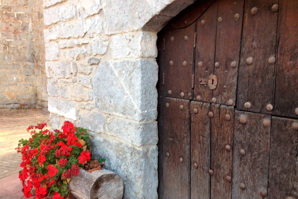
Along these 78 km, the old Plazaola railway passes through six beautiful villages that feature magnificent examples of traditional architecture, hamlets, streets, pelota courts, etc. Population centres that, as they did in the past with the railway, now provide access to the greenway. In most cases they feature services and resources that make the visit to this itinerary and its surroundings more attractive.
Before starting our journey, it is worth mentioning that, although this guide suggests starting in Pamplona, Navarre, the kilometre signs that mark the greenway originate in Andoain, Gipuzkoa, and then from the border between Gipuzkoa and Navarre another km 0 appears with regard to "Nature Trails."
We will therefore be deducting kilometres in this description. In any case, starting in Andoain is another very good option. You can get to this town in Gipuzkoa on one of the commuter trains on the San Sebastián line or via the bidegorris (cycle lanes) from the centre of the beautiful city of Donosti.
From Pamplona toward Sarasa and Irurtzun
From Pamplona (km 77), whose section to Sarasa is the most recent one (opened in 2024), the route begins by crossing four municipal districts in the Pamplona basin (Pamplona, Berriozar, Berriplano and Iza). Although this section runs close to the road, it enables us to travel very peacefully as we leave the capital of Navarre. After about 10 kilometres, we continue the route by passing through the small village of Sarasa (km 67.4) next to the N-240-A road. It passes through the municipal districts of Iza and Arakil, ending in that of Irurtzun. We are in the heart of the Pamplona basin, in a transitional Mediterranean landscape featuring large cereal fields, in which the greenway intermittently enters small groves of gall oaks and holm oaks.
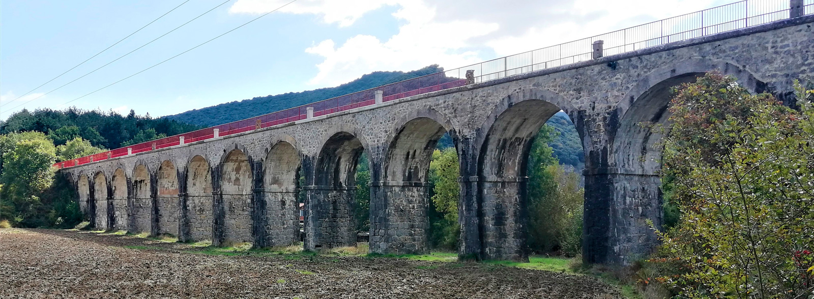
The A-15 motorway and the surrounding terrain do not enable the greenway to follow the Plazaola’s original route in several sections. As a result, at places such as Erice de Iza and Aizkorbe (collapsed tunnel), the greenway features sections with quite hard, steep slopes that exceed up to 10%. Even so, in this section –and after completing the section of slopes– we will be able to enjoy one of the most unique, living traces of the old railway: the Gulina Viaduct (190 m). It is the longest of the 37 bridges that crossed the Plazaola between Pamplona and Donostia-San Sebastián. It has 18 openings and is 13 metres high. To be able to enjoy it fully, you know what you have to do –apart from passing over it, you have to go down and see it in perspective.
The greenway provides access to sites of great beauty and natural and heritage value, such as the medieval Monastery of San Esteban (in Larumbe), which is one of the treasures of the place and also features spectacular panoramic views; or the Oskia Gorge, which was formed by the Arakil River.
We arrive at Irurtzun (km 57.8), the most inhabited population centre in the area and the place where the old Plazaola Station (which no longer exists) was located, and where there is a camper area. In addition, from this point you can access a well-known walk of great beauty in the area: the Balcony of the Vultures, a spectacular watchtower near the gorge of Dos Hermanas/Biaizpe.
Passing through Dos Hermanas, on the way to Lekunberri
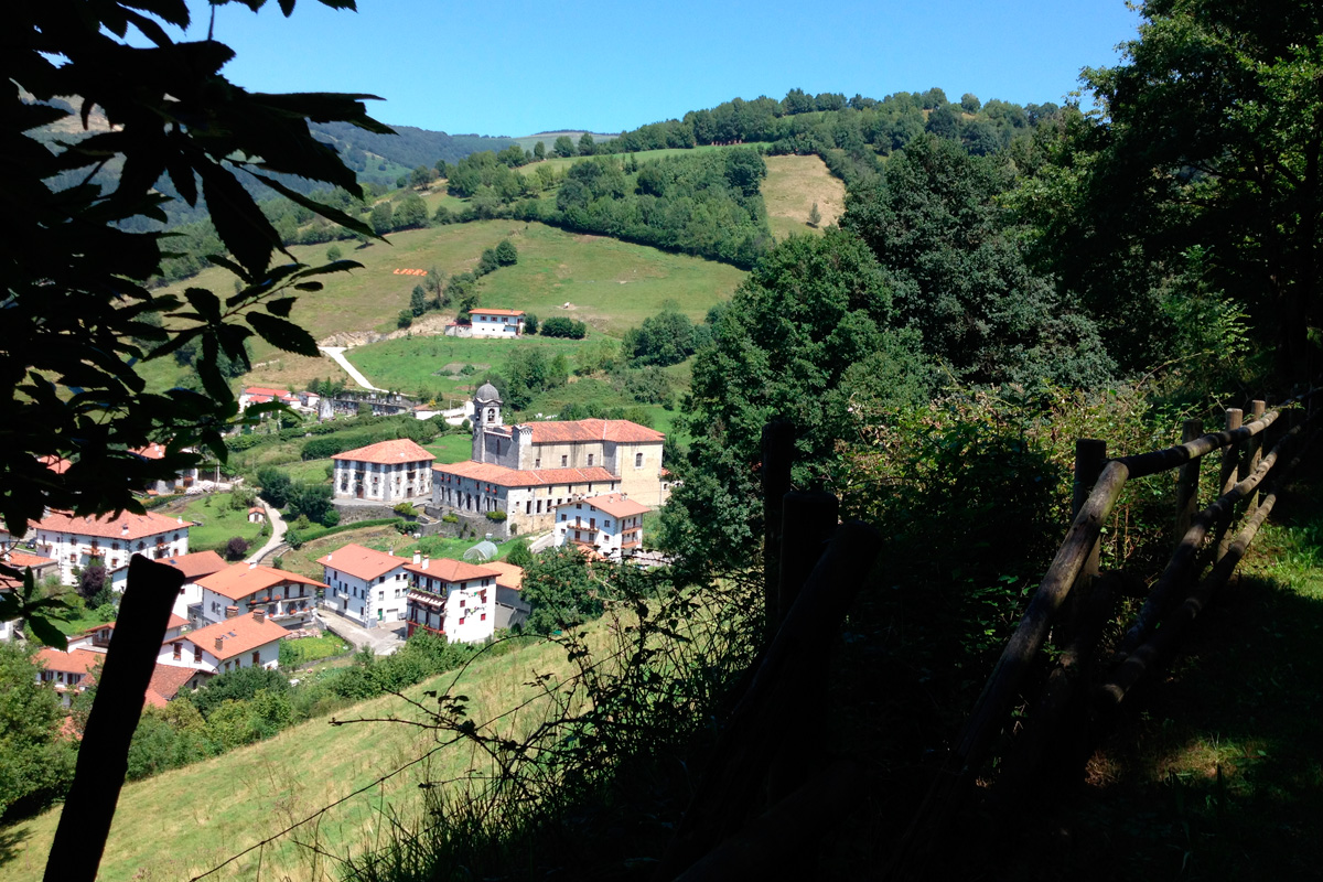 From the area of the old station, we enter almost immediately into the gorge of Dos Hermanas or Biaizpe. Two emblematic crags that constitute a geographical barrier that "slows down and traps" the humid winds from the north. From here on, the landscape changes completely. It becomes green and wooded in a beautiful mosaic of forests (especially beech groves), pastures, valleys, mountains, small villages, farmhouses, mighty rivers, etc.
At the beginning of this second stage of our greenway, a 950-metre section was opened in 2020 that runs along the NA-1300 road, the old Donostia-San Sebastián road that passes through two tunnels that are well equipped with signs and traffic lights. We have to be careful, but this fine solution enables us to continue on our way. However, throughout this area and as far as Lekunberri, we have to look out for the signs to make sure we don’t get lost.
Then, after crossing a robust footbridge over the Larraun River, we come to the Kaxarna rest area (km 55). From here, we can access the local trails of the routes called "Senda de los pescadores" and "Senda de Aixita", in the municipal district of Arakil; the latter leads to the remains of the old castle/bastion of the Kingdom of Navarre at the top of the larger crag of Dos Hermanas.
Continuing along the greenway we come to the small village of Latasa (km 52.5), where, after crossing the river again by another footbridge, we reach the old Latasa Station. At the end of 2019, the station's refurbished warehouse ("biltegia") was opened as part of the cross-border project called Ederbidea (which in the Basque language means "beautiful path," –what a fitting name!). It is now a logistics centre that promotes more sustainable mobility, serves travellers and promotes local products, becoming a venue for the area’s cultural and social life. Restaurants, culture, bike rental and workshop, information... whatever you need!
Latasa has thus become one of the greenway’s landmark, as well as the connection point between the Plazaola Greenway Nature Trail and the Bidasoa Greenway in the long-distance itinerary of the Eurovelo network, specifically Eurovelo 1 –see the Bidasoa Greenway section for more information about this route.
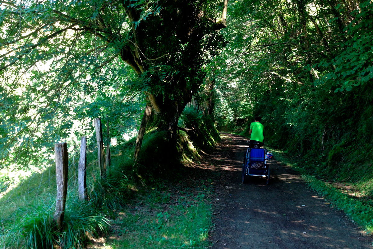
From Latasa, constantly in a northward direction, the greenway intermittently enters wooded areas or runs parallel to the NA-1300 road (for 1.8 km) until it reaches the Sanmigeltxo rest area (km 48). And from here, now in the municipal district of Larraun, the greenway enters, for more than 4 km, a spectacular forest featuring extensive remains of the old railway’s masonry walls and the Larraun River beside us. A truly spectacular area. This river, at the village of Mugiro, features a unique panoramic view of the Ixkier Waterfall (on our left), which also has a viewpoint and rest area made up of old, stone waterwheels. It is also worth going up to the village of Mugiro, featuring spectacular views of the Aralar mountain range, striking farmhouses blazoned with coats of arms, a pelota court and an inn. Some stairs to the right of the greenway indicate the way.
From here, we soon reaching the charming old station of Lekunberri (km 43), which, after passing the campsite, is another landmark of the greenway, and an essential service centre in the area of the Plazaola. The former station now houses the Tourist Office and the Plazaola Tourist Board; next to it, there is the Kantina building, which has been beautifully restored as a bar-restaurant. There are also toilets, bicycle rental and transfer services. While we're here, don't miss a walk through Lekunberri, which has a beautiful town centre featuring numerous traditional houses emblazoned with coats of arms.
 Towards Leitza featuring long, enigmatic tunnels
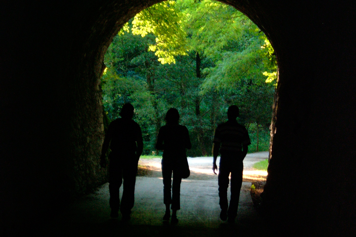
Leaving Lekunberri Station, the greenway continues towards Leitza without crossing any population centres for just over 15 km. This section features a good number of tunnels (up to 17!), including the longest ones of the entire itinerary, such as Uitzi Tunnel, whose 2,700-metre length makes it the longest of Europe’s greenways, and the Leitza Tunnel with a length of 650 metres. Although both tunnels have lighting, it is always recommended to bring lights on your bike, headlamps or flashlights in case the technology fails at some point. The Uitzi Tunnel marks the watershed between Cantabrian and Mediterranean waters, and passing through it will be an experience that will be high on our list of adventures for a long time.
And from here on... there are only 33 kilometres of pure descent left! What a joy!
Therefore, this continuous entering and coming out of tunnels makes this stage especially attractive; to a large extent, it runs through lush forests, cool spaces that, together with the galleries, are well appreciated in very hot weather. But not everything is forest; we will also go through clearer areas that reveal beautiful panoramic views of the valley and mountains.
And the latter is especially striking in the municipal district of Leitza, after the Uitzi Tunnel, where the greenway winds its way through the different valleys and watercourses, revealing a green landscape featured scattered farmhouses, pastures, forests and mountain areas that will almost certainly fill our photo gallery. The Erasote neighbourhood stands out since it features the emblematic "Stone Park–Peru Harri," a unique place inspired and created by the well-known harrijasotzaile, or stone lifter, Iñaki Perurena, where the tradition of rural sport and stone merge with other closely linked aspects such as Basque culture and language, mythology, farmhouses... Monte Kornieta is visible and identifiable from the greenway due to its wind turbines. In fact, a section of the route coincides with a beautiful itinerary that reaches as far as the summit of Kornieta (1,081 metres), revealing interesting megalithic remains.
The stage ends at Leitza Station, where, in 2020, the old warehouse was restored to facilitate the storage and running of a bicycle service. In addition, the passenger building is already prepared for a future logistics and service centre. Let's hope that this happy moment comes soon.
Leitza (km 28) is the largest population centre in the Navarrese section of the Plazaola. Its old town is a real gem. Stone mansions, flowery wooden balconies, large eaves, narrow cobbled streets, etc., mark an itinerary as picturesque as it is cinematographic, since this town has been the setting for films such as "Spanish Affair," "Dantza," or "La buena nueva."
Towards the border with Euskadi and Andoain
From Leitza Station to the border with Gipuzkoa (km 21), the greenway shares, in some stretches, access to Leitza hamlets and is asphalted, which makes it a very accessible section that is recommendable for people with reduced mobility.
The journey from this border towards the Leitzaran also features a change of landscape. The valley gets narrower and narrower while the greenway follows a winding route alongside the waters of the Leitzaran River, which, by the way, together with the waters of the Bidasoa, another Basque river in Navarre, are considered to be the cleanest in Gipuzkoa. This stream is crossed countless times by successive bridges, structures that are interspersed between the 32 tunnels (what a figure!) that pierce the valley slopes. One kilometre from the border, and just 50 metres from the greenway itself, we come across the Plazaola or Bizkotx Mines (km 20), the mines that gave rise to the Plazaola railway. For lovers of industrial archaeology, we recommend that you visit the signposted and recovered calcination furnaces (no less than 8 metres high!) and loading bays, as well as the ruins of the old canteen that are located in this area. To get there, just take a signposted track on the right. Highly recommended.
The Leitzaran River was declared a Protected Biotope in its Gipuzkoan section due to its high naturalistic value, in which its meandering course and the presence of the best alder grove in Gipuzkoa stand out, being the home of endangered species such as the Pyrenean newt, the Pyrenean desman and the European mink.
 Today, the Leitzaran Valley is the site of timber operations that are compatible with the area’s recreational use. In this respect, please note that we may come across the occasional truck transporting timber along the way at certain times of the year. With care and respect, there is no problem regarding the compatibility of this sustainable use of the forest. The waters of the Leitzaran have also been exploited since the beginning of the century for the production of electricity. Thus, successive dikes divert part of the river’s flow to channels through which, after crossing all of the valley’s winding slopes, the waters rush down pressure pipes to hydroelectric power plants.
The small reservoirs formed by these dams provide delightful places where we just have to stop. Precisely, one of the surprises of the greenway in its Gipuzkoan section is linked with one of these channels, thanks to a spectacular ashlar aqueduct (km 18) that crosses the valley perpendicularly, flying over the greenway and the river at a great height. Shortly thereafter, the channel’s waters rush into the turbines of the Ameraun power plant. The modest railway halt still exists here, with its platform and its freight dock.
Olloki or Ollokiegi (km 11) is a unique place due to the remains of the homonymous forge and train station with its water tank opposite, an old bridge and the Biskai and Karponea farmhouses. You can also see the ruins of a wood pulp factory, workers' dwellings and an underground hydroelectric plant. After running solely along the left bank up to now, at Olloki the greenway crosses the Leitzaran for the last time.
The greenway continues its winding path parallel to the waters of the Leitzaran in its search of the Oria River. A closed tunnel will force us to descend (along a wide track) to the level of the river, next to one of the several medieval bridges that cross this watercourse. The river is spectacularly enclosed, especially in the place called Matxinbarrena, where, in the midst of a chaotic ravine featuring huge blocks, the waters jump over a succession of waterfalls, dozens of metres below the greenway.
The highest point of the Matxinbarrena area is at the Sorgin-Bide mountain pass or Txapela de Bertxin (km 7), a landmark that indicates the entrance to the municipal district of Andoain.
The increasingly abundant presence of cyclists and trekkers lets us know that Andoain is near. After traveling 20 km through the spectacular natural landscape of the Leitzaran Valley, and before completing the last two km of the greenway before reaching the town centre of Andoain (km 0), it is worth stopping at the Otieta rural park (the natural gateway to the Leitzaran Valley). In this park you will find the Leitzaran visitor centre, which houses the interpretation facilities of this nature reserve and the greenway, as well as a tourist information point and an active tourism space where you can rent bicycles, go on guided tours of the greenway, of the area’s network of trails... and, of course, have a snack made up of local produce featuring fine cider and cheese. Do you fancy a bite?
In Otieta itself, a few metres from the greenway, the Unanibia Bridge (popularly known as the "witches’ bridge") is also a must-see. A spectacular masonry stone bridge with three spans over the Leitzaran River. After this essential stop, we face the last 2 kilometres of the greenway. To that end, we will cross the greenway’s longest tunnel in the Basque section; the Otieta Tunnel (almost 300 metres), which is asphalted and has lighting (Please note that is was closed in 2023 for maintenance!) If it is still closed when you go, you will have to descend from Otieta to the road (on the left) and, along the way, pass under the impressive Auzokalte Viaduct, then go up a path to the level of the greenway. It will be a short, but "hard," interruption to reach Andoain.
After the tunnel we will travel over the equally spectacular Auzokalte Viaduct (more than 100 metres). And from here, it is easy to follow the asphalt route, continuing slightly downhill until we reach the square where Andoain Town Hall is located, presided over by the outstanding silhouette of its church and the customary displays of skill with the ball on the pelota court.
After this 77-km trip, it is well worth paying tribute to the Plazaola!
If we want to continue as far as Donosti, nowadays the easiest option is either to take the commuter train at one of the two stations in Andoain or to continue from Andoain itself towards Urnieta-Hernani-Astigarraga –Donosti. This 14-km route is almost entirely made up of bidegorris, which, as you already know, is what bike lanes are called in this area.
