Tajuña Greenway
Route Description
 The starting point is located in the town of Arganda del Rey, a site which can be reached from the city of Madrid by means of Metro line 9. The starting point (km 0) is located at Avenida del Ejercito, 200 m from the metro station; however, we recommend a visit to the Arganda Railway Museum, located 4.3 km from the Arganda Metro Station.
Undoubtedly, visiting the small museum housed in the old station –which brings together an attractive legacy of vehicles and historical pieces, both from this line and others from the rest of Spain– and travelling on one of its historic trains is more than recommended. This railway site, managed by the Centro de Iniciativas Ferroviarias Vapor Madrid (C.I.F.V.M.), has made it possible to rehabilitate a 3.2 km section of the old Madrid-Alocén railway between La Poveda and Laguna del Campillo. It is the only historic railway line in operation in the Madrid Region, so let's go on a train trip! Narrow-gauge steam locomotives and small passenger cars travel along the surviving kilometres of the Tajuña railway for the enjoyment of its passengers.
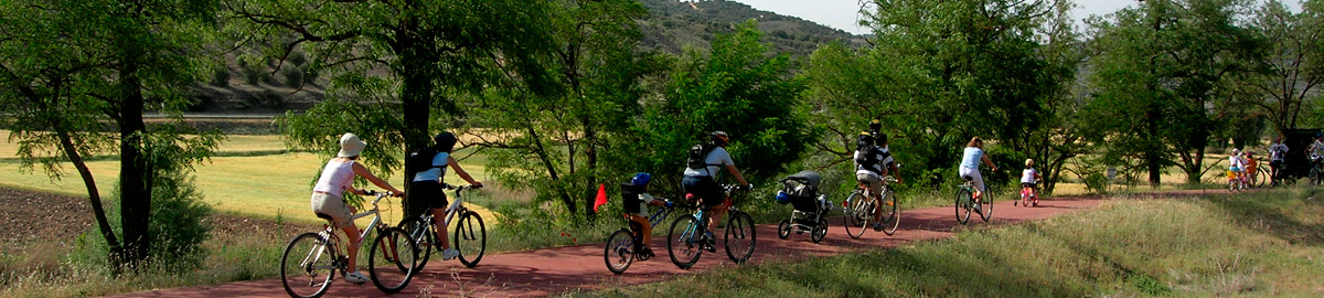
After this recommended visit we will take the La Poveda bike path that takes advantage of the railway levelling work. Careful! Shortly after we cross the M-300 road (km 0.5). At km. 3.7 there is an intersection with Avenida de Madrid. Caution at crossings! And on the right we have the Tajuña Greenway.
After passing the industrial area of Arganda and the Hospital del Sureste, the greenway crosses under the A-3 motorway beginning a moderate ascent that ends in the area known as El Alto and then borders an imposing cement factory. From here, a pleasant descent brings us in front of one of the best viewpoints overlooking the Tajuña Valley shortly before reaching Morata de Tajuña. It is worth noting that between Arganda and Perales there is another interesting educational route called "the secrets of the Tajuña Greenway," where the vestiges related to one of the most decisive battles of the Spanish Civil War, the Battle of Jarama, fought in February 1937, are highlighted.
Morata de Tajuña and the dips
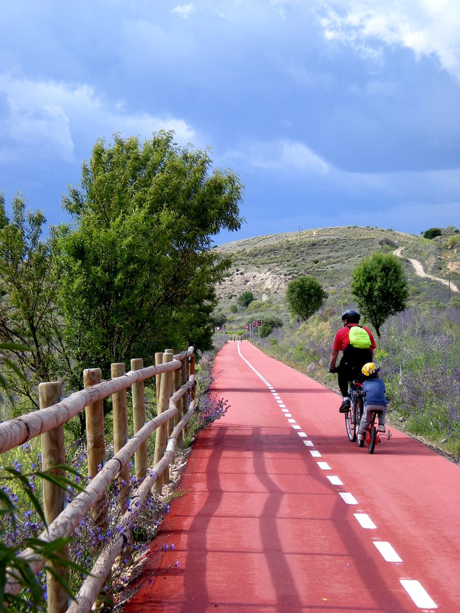 From Morata de Tajuña (km 14) to Perales we continue along a greenway with a unique red surface, a detail that would make the description of the route almost unnecessary, since on the ground it is completely impossible to get lost, except perhaps at urban crossings. Thus, in order to depart from Morata after a first well-placed sign, the next crossroads may make us hesitate: we have to continue to the right and downhill and, from now on, straight on until we leave the village. The signage of CiclaMadrid and that of the Uclés route confirm our route at all times.
We leave behind the houses of Morata de Tajuña and our route runs close to the M-308 road. This amusing section of about 7 km requires a little more effort since it features some dips that hinder the railway itinerary’s accessibility. These are due to the fact that the work of adaptation as a greenway did not completely restore the old railway level.
At km 20 you reach what was once a transfer station. These are the vestiges of Tajuña Station. Certainly, at present nothing remains of that station that connected with the trains that went up the branch to Chinchón and Colmenar de Oreja. So we will have to be attentive.
After crossing some striking trenches (absolutely vertical and with very beautiful gypsum outcrops) and crossing some more dips and ramps, we arrive at the first houses of Perales de Tajuña (km 23). At this urban crossing we will have to carefully cross a level junction with the busy M-308 road. On the other side of the junction we find the public school, built on the site where the Tajuña trains used to stop.
The Perales de Tajuña branch
In Perales the route has two alternatives: The first, partially crosses the town, following the M-506 road, then goes up towards the cemetery and from there it follow the old railway line that passes under the A-3 motorway. The second possibility is to follow a country track that surrounds Perales, passing by the swimming pools. This route, which is well marked, also takes us under the motorway, where we join the previous alternative.
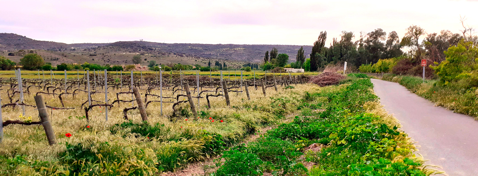
After passing the A-3, we just have to continue a few metres to the right along the shoulder of the access road to the motorway to finally connect with the trails upgraded as a "greenway," although they are not those of the old railway that take us to Tielmes along the south bank of the river. It should be noted that this section is for shared traffic with cars that access the adjoining farms. In these parts the greenway runs about 3 km between orchards, crops and cornfields. At km 28 of the route, we will find the junction with the road from Tielmes to Villarejo de Salvanés.
The fertile plain of the Tielmes and Carabaña
 From this point, the town of Tielmes is about 300 m away, on the other side of the Tajuña. In this section, from Tielmes to Ambite, some stations still exist, having been restored for new uses while bearing witness to a romantic past. An example of this is Chávarri Station, where in the past the wagons were loaded with thousands of bottles of the salutary "Carabaña water."
From the aforementioned crossroads, we will travel a few metres along the road, to the right, until we reach a track that, to the left, allows us to continue the route through the valley, passing by a small chapel bordered by shady areas that make it an excellent resting point. We must also mind the junction with the lonely road that connects Chávarri with Villarejo (km 33), the only point of possible danger on our journey through the valley.
At km 35 we reach the junction with the road from Carabaña to Brea de Tajo, in the vicinity of a bridge over the Tajuña, next to which stands one of the typical mills that marked this stretch of the river. In this place, located a few metres from Carabaña, we are offered an alternative to visit this secluded town in the southeast of Madrid, whose old train station is also still standing.
This new section has a pleasant surprise in store for us because at the point where we leave the side of the road to continue through the gentle meadows of the Tajuña River, we can connect with the Grand Tour CiclaMadrid (Stage 3) and with the 40-Day Train Greenway, a 14 km branch that leads us to Estremera among spectacular trenches, olive trees and fields.
On the Tajuña Greenway, we will continue parallel to the unrestored levelling of the aforementioned railway to reach Orusco de Tajuña (km 39), where we can make a stopover: the old train station still exists –although besie our route but in the village– and has been converted into an inn. In Orusco there was, during the Spanish Civil War, an interim railway junction with the 40-Day Train. From here, this route went up the moorland to reach, after a long journey, Torrejón de Ardoz. This route could also be upgraded as a greenway one day...
Setting aside future possibilities for now, the greenway currently continues upstream, crossing under the Orusco-Brea road. After passing under the asphalt, after a short time, we find the original route of the Tajuña railway again, which we will not leave until the end of the route in Ambite. This is one of the greenway’s most pleasant sections: we will pass under small overpasses, between groves, remains of old gypsum mines and, in some cases, over sections that are almost like cliffs above the river.
Little by little we are approaching the end of the route, Ambite (km 48). The greenway crosses a dense pine forest with a small recreational area. A beautiful place to contemplate this small town, the last in the Madrid Region before entering the neighbouring province of Guadalajara. Thus, we arrive at the old station, which houses an outdoor municipal swimming pool. It is a facility that, like the greenway, is designed for everyone: it has access for people with reduced mobility and features an elevator that facilitates immersion in the water. And, as if this were not enough incentive, the old passenger building houses a bar where you can recharge your batteries.
Towards the province of Guadalajara
 En Ambite we come across our first point of interest, the Vega del Tajuña Nature Centre, with its permanent exhibition featuring the highlights of the region's ecosystems, as well as a bike and tricycle rental service.
On compacted earth and after a first slope to reach the level of the railway platform, the greenway continues for 3 km, from the surroundings of the fertile plain of the Tajuña River, ascending little by little up the slope of the valley.
The second part of the itinerary is of greater interest since it goes through the area's most representative ecosystem, Mediterranean scrubland, with holm oak as the dominant tree species. The landscape also features some olive groves.
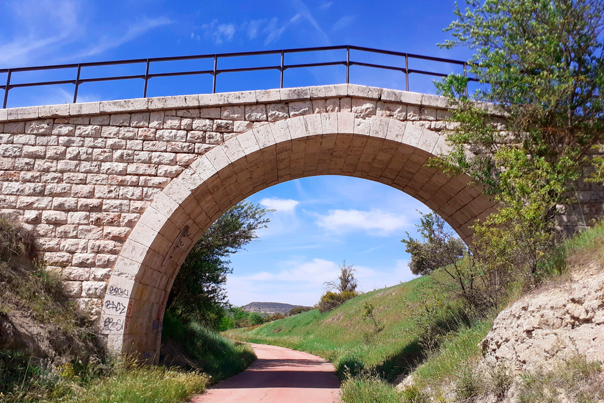
A little further on we will come across a flyover above the greenway, which was used in the past to cross the railway. We can still see the ballast (stone placed at the base of the rails), which the greenway now goes around. At the end of the Ambite section there is a viaduct that enabled the train to pass over the Perdiz Ravine. From this considerable height, we can contemplate spectacular scenery featuring the Tajuña River lowlands. The small riverside forest, in which black poplars stand out, dominates the valley floor, surrounded by mainly cereal crops.
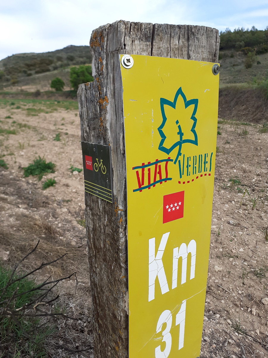
The Tajuña Greenway comes to an end here within the Madrid Region, but the route continues for a further 12.6 km into the neighbouring province of Guadalajara, reaching Pozo de Almoguera. This extension offers a new opportunity to keep enjoying this former railway line, originally built for agricultural purposes and used mainly to transport fruit and sugar beet.
.jpg) The connection between Ambite and Mondéjar on the Tajuña Greenway, made possible thanks to investments made by the local councils and inaugurated in November 2022, has removed the barriers between both regions. This achievement has strengthened the route, creating a continuous stretch of more than 66 km with outstanding scenic value
The connection between Ambite and Mondéjar on the Tajuña Greenway, made possible thanks to investments made by the local councils and inaugurated in November 2022, has removed the barriers between both regions. This achievement has strengthened the route, creating a continuous stretch of more than 66 km with outstanding scenic value
Resulta de gran interés destacar que este esfuerzo no solo beneficia a las personas locales, sino que también proyecta la vía como un futuro eje fundamental de la Ruta EuroVelo16 (Ruta Ibérica entre Lisboa y Pamplona, 1899 km), cuya integración en la red Europea de Rutas Ciclistas está prevista para el año 2028.
It is particularly worth highlighting that this effort not only benefits local residents but also positions the greenway as a future key section of EuroVelo 16 (the Iberian Route between Lisbon and Pamplona, 1,899 km in total). Its integration into the European Cycle Route Network is scheduled for 2028.
The section described here takes us into the very heart of La Alcarria, known as “the land of honey”, and almost instantly evokes the famous book Journey to the Alcarria (Viaje a la Alcarria) by Camilo José Cela, awarded the Nobel Prize in Literature in 1989, which recounts a ten-day journey through the lands of Guadalajara.
La Alcarria is a natural region located between the mountain ranges of the Iberian System and the plains of La Mancha, stretching across the provinces of Guadalajara, Cuenca and Toledo.
Now that you know a little more about the area, it’s time to get back on track and continue the journey.
On Foot or by Bike through La Alcarria
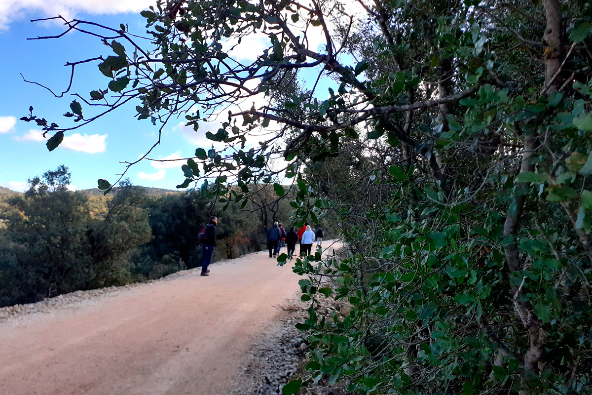
We continue along the route on a gentle ascent and will soon enter an area dominated by holm oak woodland, ideal for keeping cool during the hottest months of the year. As the kilometres go by, the landscape gradually leaves behind the flat river valley and ventures into the higher, rolling terrain of the La Alcarria plateaus (páramos de la Alcarria).
As we reach the outskirts of the town of Mondéjar, just after crossing the viaduct located at km 58.03, the greenway runs alongside some striking Gothic ruins on the right: those of the Convent of San Antón.
For over five years now, Mondéjar has been one of the focal points of the National Greenways Day, an event held on the second Sunday of May. To mark the occasion, this town hosts activities including walking and cycling routes, along with a gastronomic tasting of local produce—an invitation we warmly encourage you to accept.
 However, the town's significance extends well beyond its role on the greenway. In fact, it is a notable cultural and wine-producing centre of La Alcarria, proudly boasting its own Mondéjar Wine Designation of Origin (D.O.). It is an ideal place to savour the tranquillity of the countryside, with its cereal steppes, vegetable gardens and vineyards. The town’s monumental heritage is well worth taking time to explore, as it houses some of the earliest examples of Spanish Renaissance architecture. Among them stands out the Parish Church of Santa María Magdalena, whose construction in the early 16th-century places it among the first and most outstanding Renaissance expressions on the Iberian Peninsula.
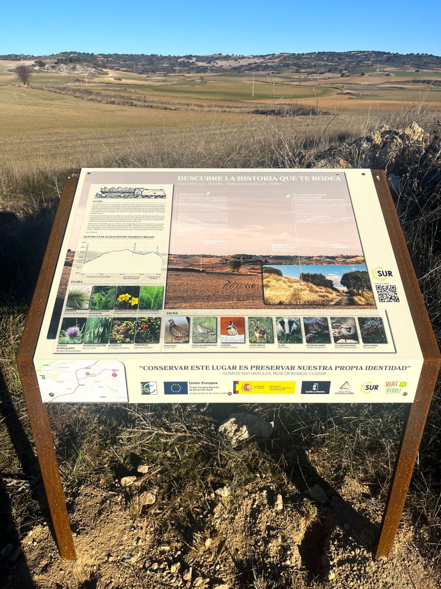
Leaving this first municipality behind, at km 59.2 the old Mondéjar railway station comes into view in the distance. Although it no longer operates, both the loading platform and the passenger building remain in good state of preservation. Just beside them, there is a rest area with information panels and picnic tables, perfect for taking a break and recharging your batteries.
We then continue along the route to tackle the next 8 km, which descend gently until reaching the last town on this route, Pozo de Almoguera. It should be clarified that, originally, the old railway line of the Tajuña Railway actually continued beyond this point towards Yebra.
Let’s take a closer look at Pozo de Almoguera. The village boasts a modest yet appealing heritage that complements its natural surroundings. From a heritage perspective, highlights include the Parish Church of San Martín and the hermitage of Our Lady of Los Remedios (Virgen de los Remedios), which houses most of the town’s religious carvings. As for its natural heritage, special mention should be made of the shepherds’ huts located in the Conchuela area (Paraje de Conchuela), traditional constructions of stone and mortar that bear witness to the rural life of the region and represent a distinctive local attraction.
Just a few metres away, the old Pozo de Almoguera railway station (km 66.4), though no longer in railway use, awaits the traveller and marks the end of the Greenway, symbolising the conclusion of this itinerary.
However, for those who wish to add more kilometres to their journey, this stop offers the chance to connect with an additional 14 km stretch along the “Tren de los 40 Días” Greenway, leading to Estremera (Madrid) and achieving a continuous greenway route of 80 km.
To round off the journey and quench the traveller’s curiosity, we should mention that one day the Tajuña Greenway may be extended beyond its current endpoint to reach the banks of the Tagus River (Tajo) at Entrepeñas, allowing visitors to continue enjoying the former railway line and the landscapes of the province of Guadalajara.
* This greenway was implemented by the Madrid Region, Ambite Town Council, FADETA Rural Development Group and Móndejar Town Council.