


Eo Greenway
Route Description
 The Eo River is a Galician river which, in its final stretch, serves as the boundary with Asturias, briefly winding its way into that region. This mighty Cantabrian river carved out a long valley that was used for centuries to connect the inland territories with the once-thriving port of Ribadeo. One of the river's travelling companions in its final stretch was a modest mining railway: the Vilaoudriz-Ribadeo line.
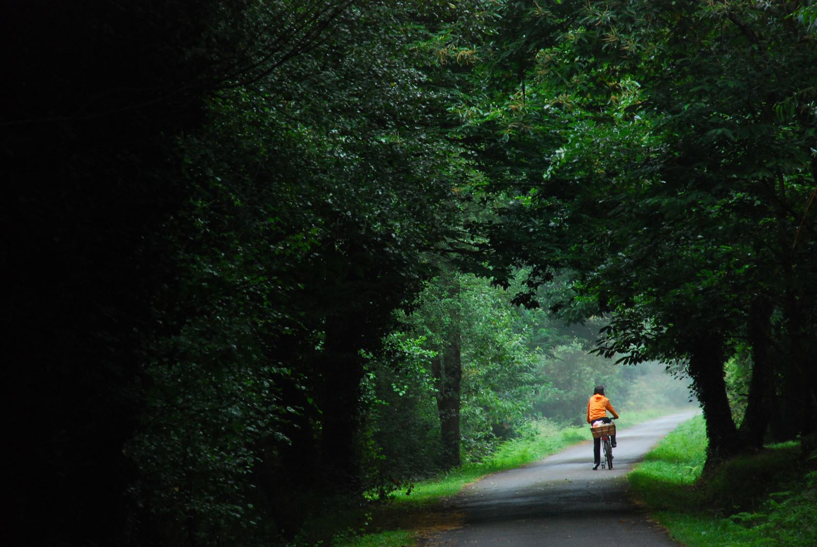
Ready your senses, traveller, because they will awaken along this route. You’ll be wrapped in the colours of the riverside forests, and intoxicated by the scent of eucalyptus. You’ll find prehistoric hillforts (castros) and dolmens, as well as early-20th-century mining archaeology. There are also see iron ore calcination kilns and mineral loading hoppers. Add to that impressive feats of engineering such as the magnificent Los Santos Viaduct and six illuminated tunnels that give you a real sense of what this old railway was like. And there’s yet one more treat: the beautifully restored A Pontenova station!
The proposed route follows the former railway alignment along a 12-km stretch between the Galician town of A Pontenova and the Asturian village of San Tirso de Abres. The remaining section, from San Tirso to Ribadeo, is interrupted in many places, making the route difficult — and in some parts impossible — to follow. Fortunately, in the not-too-distant future, the San Tirso–Ribadeo stretch may be restored as a greenway, together with the rest of the former railway all the way to its original terminus at Vilaoudriz (A Pontenova). But until that day comes, you can continue the route along a delightful 3-km riverside path from San Tirso to La Pena fishing preserve (coto La Pena). For now, however, we will stick to the section that is currently accessible.
And without further ado, let’s ease into the rhythm of the route.
From Ribadeo to San Tirso — but where is the railway?
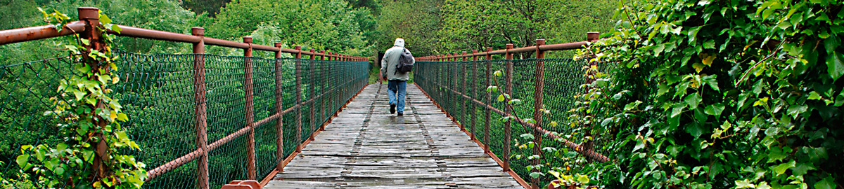
For the truly adventurous, the starting reference point of the route in Ribadeo is located next to the Los Santos Viaduct, a spectacular feat of engineering that spans the Eo estuary in its final stretch. Next to this bridge are the abutments of the old railway loading dock. This structure has been restored to its original appearance and now forms part of a new park. From here, the track alignment becomes hard to follow, resurfacing briefly in various sections until it reaches the former FEVE station (Spanish Narrow-Gauge Railway, now integrated into RENFE) in Vegadeo.
At this station, the tracks of the old FEVE line and those of the mining railway part ways for good. The one we're interested in continues southward, though the route is interrupted again due to improvements to the N-640 road, a situation that continues as far as the hamlet of Rabexa. From this point on there opens a short, winding 8 km stretch that hugs the banks of the Eo. This section, used today as a forestry track, also has a few minor interruptions.
San Tirso: clear path towards the Eo
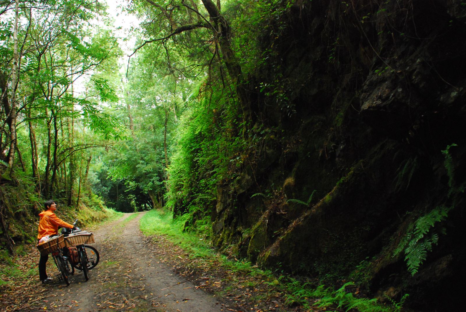 For this reason, the most recommended section to explore begins at the old San Tirso de Abres station, located in the upper part of the town of El Llano. The station is in excellent condition and is currently used as a private home. From here, the route continues along a winding track immersed in dense woodland, soon reaching the first tunnel — a long, illuminated gallery.
If you'd like to spend the night, you can stay at the campsite in San Tirso de Abres and enjoy the wide range of activities on offer—plenty of fun for little ones and adults alike!
Back to the route: around km 1, the track crosses the N-640 at grade. After the crossing, the greenway continues to the point where a spectacular metal bridge once spanned the Eo, at km 4. The absence of this bridge, demolished after the railway closed, was an insurmountable obstacle until quite recently. But the San Tirso de Abres Town Council has built a new pedestrian footbridge at this spot. The new bridge, in its design, subtly evokes the old metal structure that once carried trains across the narrow gorge through which the Eo River flows. Crossing this elegant footbridge will place us on the right bank of the river for the remainder of the route.
From the O Cairo tunnels to A Pontenova
From this point, the path continues through a section where the cavernous darkness of the tunnels takes centre stage. Up to five tunnels appear in succession in very rugged terrain, where the railway had no choice but to hide underground due to a literal lack of space. After passing through the tunnels (all of them lit), we'll cross the local road serving the hamlets of Trasdacorda and Matela, already within the municipality of A Pontenova, in Lugo. From here, the route is paved all the way to the end.
.JPG) Through the tunnels, we'll stroll beneath the houses of the hamlet of Pradas, in the area known as O Cairo. Once we emerge from these tunnels (km 9), the landscape becomes gentler and more serene.
Through the tunnels, we'll stroll beneath the houses of the hamlet of Pradas, in the area known as O Cairo. Once we emerge from these tunnels (km 9), the landscape becomes gentler and more serene.
The valley widens and the track becomes remarkably well suited for pleasant walking. The path is shared with anglers who use the former railway as a launch point for casting their lines in search of the occasional salmon. And in this way, we'll make our way alongside the local folk through the hamlets of Saldoiriña and Herbelle.
Our valley becomes increasingly shaped by human presence, announcing our final approach, at km 12, to the town centre of A Pontenova, which once belonged to Vilaoudriz. Spectacular brick-built kilns, impeccably preserved, form an important piece of industrial heritage, now converted into a tourist landmark for hiking, adventure activities, and exploring local mining history. And don't forget to visit the former A Pontenova railway station, now restored as the municipal tourist information office.
At this point, it becomes clear that the Eo Greenway is far more than a trail: it's a journey into the heart of Galicia and Asturias's industrial and mining history, where every step connects you with the forests, the rivers, and the memory of a railway that today is reborn as a peaceful and accessible sustainable route.