Ruta de la Plata Greenway Nature Trail (Plasencia - Béjar)
Route Description
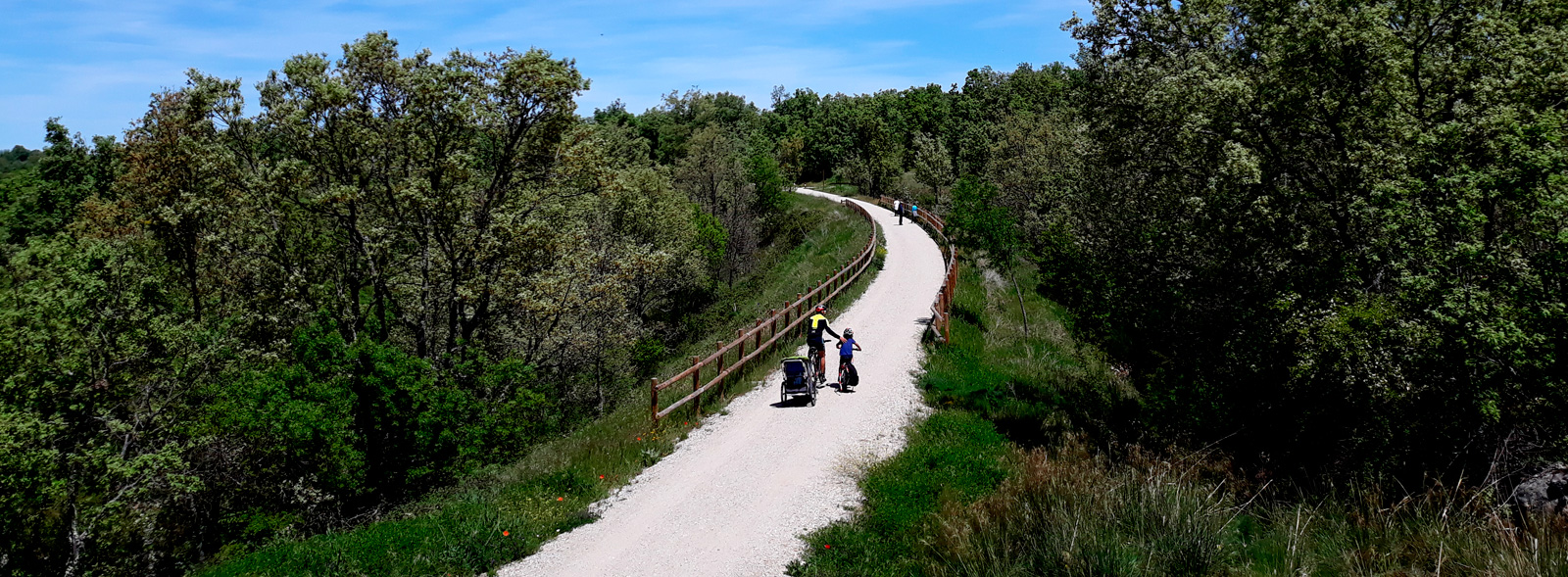
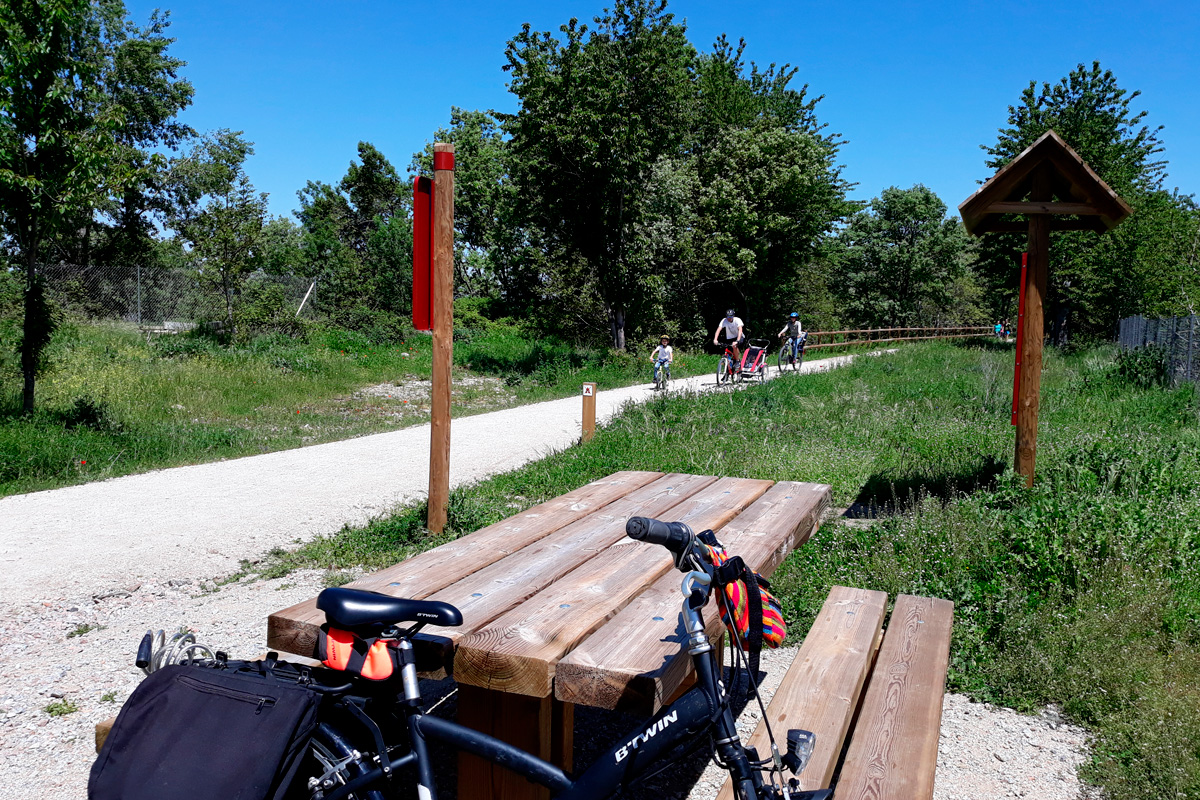 This “vía verde” (greenway) makes it easy to remember its railway past, thanks to the conservation of elements from the old railway line throughout the route: signal lights, signs, switches, etc, and, of course, the 3 restored stations featuring tourist services.
Completing this route is very important because it is part of the European project called Eurovelo EV1. The Eurovelo 1 cycle tourism route is 11.15 kilometres long, from the North Cape, in Norway, to the Portuguese Algarve, passing through these regions of Cáceres and Salamanca.
Let’s get started!
From Plasencia, capital of the Jerte Valley to Casas del Monte
Although km 0 is located at Plasencia train station, the San Lázaro tunnel (km 1) really marks the beginning of the route. Getting there along the river path next to the Jerte River, featuring views of the cathedral, is very easy. The reference point is Cristobal Oudriz Street. However, we have to go up a small slope to get to the level of the railway platform.
From the beginning the way to Hervás is a slight climb but the surface –since it is the last section that has been added to this Greenway Nature Trail– is in very good condition. The San Lázaro tunnel (178 m) is perfectly lit, paved and is undoubtedly a luxurious start to enter the public scrubland of Valcorchero, a Protected Landscape of Extremadura. It should be noted that the tunnel opens at 9 am and closes at 9 pm (at 7 pm in winter). After crossing this railway gallery, a viewpoint on the right offers us beautiful views of the city of Plasencia and the bridge over the Berrocalillo (150 m), which has seven spans.
The next major landmark after the viaduct over the Tejoneras stream is the large Iron or Gastón Bertier viaduct (km 3.8), named after the engineer who designed it. Next to it you can see the enormous ashlar pillars of the first iron bridge that crossed the Jerte and that had to be modified from 1929 onwards with the construction of the "new" one to accommodate more modern trains. The views from the rest area located next to the remains of the old bridge are incredible, featuring the vertical canyons formed by the river. This is a nice place from which to admire these two imposing works of civil engineering.
This first section, in addition to these unique masonry works, is especially interesting and attractive because it runs between the Mediterranean scrub area, the pastureland densely populated with large trees and the high trenches which are even used for climbing.
At km 7 we will then use two bridges to safely cross the N-630 road and the A66 dual carriageway. We continue on a slight climb, now closer to the national road, as far as the rest area of Oliva de Plasencia Station (km 9). We will cross one more bridge over the ravine of La Oliva and then we will arrive at the crossroads known as "El Avión" because of the restaurant with a terrace located at this point. Here the dual carriageway, the road that goes to Cáparra (6 km away, and a highly recommended visit) and the greenway converge at the abandoned station of Villar de Plasencia (km 16). A disproportionate rest area behind the service area on the dual carriageway enables us to stop and regain strength in case we are short of something.
The landscape featuring wooded pastureland and crops with the presence of some posts with storks continues while the villages in the distance can be seen halfway up the hillside. Shortly after we will go through the N-630 underpass and then under A66 again almost without realizing that we are crossing these main roads. We thereby arrive at Jarilla (km 22) and its bars and boarding houses that line the road, very close to the greenway; these places are popular with pilgrims and enable us to make a stop along the way.
From this point the greenway moves away from the road to enter a much more peaceful, natural and attractive section through the scrubland, where it is common to see cattle grazing in the pastures.
From Casas del Monte to the capital of the Ambroz Valley

After crossing the local road that leads to Casas del Monte, we reach the old station (km 25.8), advance between trenches excavated by the railway, followed first an oak grove and then a riverside forest before we come to the bridge over the Garganta Ancha (km 28.3). After the bridge, a trail to the right enables us to reach the town of Casas del Monte away from traffic.
Passing by holm oaks and cork oaks, we reach the vicinity of Segura de Toro, which can be seen in the distance in the Sierra de las Cruces Altas. This village features a bull from pre-Roman times that adorns its square. The village and its natural pools (which also exist in Casas del Monte and Gargantilla) can be reached by a trail after crossing the bridge over the Garganta Grande.
Advancing through wooded pastureland and after crossing the Montesinos Stream, we reach the old station of Aldeanueva del Camino and the station district (km 32). The greenway turns east and goes along the dual carriageway for a while. Aldeanueva del Camino, where it is easy to find the original Roman “Vía de la Plata” route, is nearby and can be reached along a cement path that also provides access to Gargantilla, a village located on the right of the greenway. We will cross the Romanillo Stream (km 35.3) while the landscape changes, with the presence of oaks and Pyrenean oaks being frequent as the greenway enters areas of trenches excavated by the railway in this mountain range.
Hervás is nearby and we will pass by a series of farmhouses before actually entering the capital of the Ambroz, after passing under the CC-102 road. From now on, we will have to be a lot more careful, as we travel along the “street of the Vía” before reaching Hervás Station (km 39). This will be the first of the three stations that have been repurposed; in this case, as a hostel, café, museum and rural house.
We can visit this must-see locality by going down the street called “paraje de la estación.” If you are short on time, we recommend going straight to the Jewish quarter, which was declared a historic-artistic site in 1969. Its characteristic highland architecture features local materials, such as chestnut wood, adobe and granite, which make this Sephardic legacy handed down from 15th-century converts one of the best preserved today. Other attractions that make this a not-to-be-missed destination are the babbling Ambroz running through the locality, where you can refresh yourself on a hot day, and its rich historic-artistic heritage (churches of San Juan Bautista and Santa María, a former castle of the Knights Templar, museums).
From Hervás to Béjar, capital of the Sierra de Béjar
After enjoying our cultural visit, if we go back the same way (the greenway) after crossing the street called Juan de la Plaza (another possible access route), we will come across one of the main features of the old railway line: the so-called “iron bridge.” It is an impressive 110-metre-long viaduct over the Ambroz River, with a metallic central span and granite arches on each side. After crossing the bridge, there is another approach road that leads down to the locality, featuring impressive views of Hervás and the houses on the street called “Sinagoga” (obviously part of the Jewish quarter), which hang above the Ambroz River.
With our camera and retina full of images, we continue on our way, passing by farmhouses and then through pastureland. We cross over the EX-205 road and the Balozano River, an affluent of the Ambroz, in a sector in which the railway line bends towards the west. We continue our ascent, which is now a bit steeper. The striking views of the valley make it worthwhile stopping beside the Baños Reservoir, with the village of Hervás in the background.
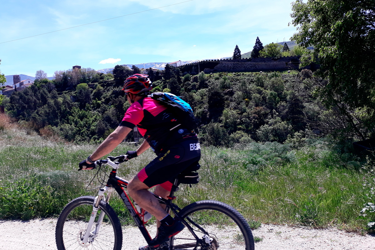
Our next stop: Baños de Montemayor Station. Although it has been restored, the station is no longer in use. Of course, Baños is another one of those charming localities in the north of Caceres. Its spa, which has been declared a Cultural Heritage Site and features the remains of old Roman thermal baths, and the “Vía de la Plata” interpretation centre are two good excuses for going down to visit the village (but remember: you will have to go back up again!).
After a level crossing (be careful!), the route follows the road to La Garganta, going through an area of deciduous woodland carpeting the foothills of the Béjar mountains. Hazelnut trees, maples, chestnut trees and oaks provide striking colours in autumn and pleasant shade in summer. We cross the Garganta River along a magnificent walkway and immediately enter the route’s first tunnel (a 200-metre-long curved one), which is well equipped and illuminated. On leaving the tunnel, accompanied by views of the valley, we enter the province of Salamanca and soon come to Puerto de Béjar Station (km 27.5), which has also been restored and provides different services, as well as the station neighbourhood.
The “small station,” which appears in Jose Luis Cuerda’s film “El bosque animado” (The Enchanted Forest), is now a pleasant cafeteria and restaurant featuring a flowery terrace, railway details and a lounge car inside. There is also a bike rental service.
After passing the station, on our way down, we will have to cross the N-630 road near Puerto de Béjar. If we are careful, we can go along this road as far as the village. Puerto de Béjar stands out due to the remains of the original Roman road that gave rise to the “Vía de la Plata” route. We continue on to Cantagallo (km 54.8), where the view widens out and we come to a rest area. From here, there is a road leading to this small village.
Curiosity: José Luis Cuerda shot “El bosque animado” (1987), a critically acclaimed film that won five Goya awards. Although most of the shooting took place in the municipality of A Coruña, the film’s first scene features a steam engine travelling along the railway line between Cantagallo and Puerto de Béjar. The train is one of the film’s themes. Since this railway had closed in 1985, the installations that were still operational could be used for the film. Moreover, a new halt was built in Puerto de Béjar’s station.
On the way to Béjar, the capital of the homonymous Sierra de Béjar region, the railway line, road and dual carriageway run alongside each other. However, you can hardly notice. Thanks to the forest’s presence, the other communication routes do not detract from our tranquil journey. Furthermore, we can enjoy and relive the old railway line’s past thanks to elements such as signals, signs… A real attraction!
At about km 60, do not miss a track leading to an outstanding natural landmark, namely the old “cedro de la Francesa.” It is an enormous Atlas cedar that has withstood the passing of time, being more than twenty metres tall with a girth of around nine metres. The married couple formed by Monsieur Papau and his wife, known as “la Francesa,” lived on the estate where the cedar is located. Although the tree’s exact age is unknown, it is believed to be more than 150 years old and is one of the biggest trees in the Castile and León region.
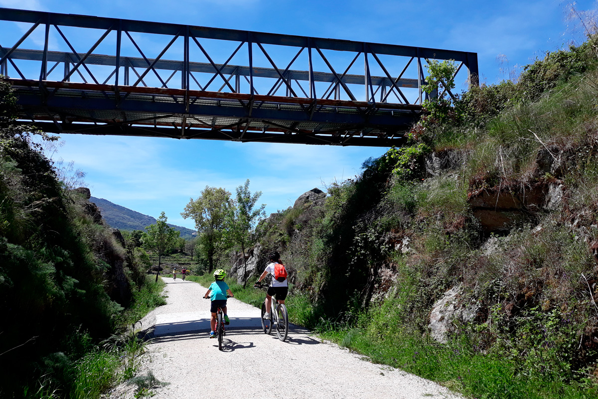
Back on the railway line, a new iron bridge over the N-630 road takes us to the entrance of the emblematic Béjar Station (km 36), a place for stopping and spending the night. The station’s buildings house the so-called “Estación Béjar Verde” (Green Béjar Station), which has been renovated to be used as a restaurant, cafeteria and hostel with 40 beds. There is also a bike rental service, as well as other active leisure options for enjoying in the surrounding area. The station likewise features a nice rest area, fountain and the possibility of exploring the remains of its railway past: water cranes, tanks, buffer stops and sidings in the rail yard. Undoubtedly, a place where you can have a good time imagining the old railway line.
Béjar is another or the route’s key points. It features all the services and important cultural heritage that is well worth visiting: its walls, Romanesque churches, museums, lively main square and an interesting legacy linked to its old textile industry. We can enter Béjar from the station or a little further on, before coming to the tunnel.
From the station, and following the railway line, we will see that the mound on which the town is built is crossed by a 372-metre-long curved tunnel (km 60.8), which, curiously, is located 50 m under the level of the main square called Plaza Mayor! Although there is lighting inside the tunnel, the gate at the entrance is closed at night. This is also a good place for visiting the textile industry museum and touring the factories that made this a booming industrial town, in the 19th and 20th centuries, on the banks of the Cuerpo de Hombre River.
We continue on by crossing the river, whose name means Man’s Body, via another bridge before entering a second tunnel (200 m), going under the dual carriageway, bordering an industrial estate and emerging into the countryside, where ash trees, Pyrenean oaks and meadows bid farewell to the landscape of deciduous trees. Looking back, a picture-perfect scene is almost guaranteed: the mountain tops that stand out in the background are covered with snow almost all year round. The photo is almost a certainty.
It is worth mentioning that there is a signposted urban route that enables you to tour the town of Béjar’s entire historic district, which is of great interest to travellers.
Shortly after the level crossing over a local road, the route ends at the boundary of the municipal district of Navalmoral de Béjar (km 66). There are railway tracks from here on, although the route has been cleared. It is therefore easy to reach this village, which is one kilometre away. It is a bit more difficult by bike, especially if you do not have good suspension.
New projects underway plan to extend, in the following years, this itinerary both northwards, to link up with the section between Alba de Tormes and Salamanca, and southwards, to reach as far as the town of Plasencia.
This route in Extremadura section was awarded the Blue Flag Trail distinction in 2024 by the Association of Environmental and Consumer Education (ADEAC), a prize and recognition for the conservation and restoration of trails and itineraries, transformed into valuable resources for environmental interpretation and education, as well as for enjoying nature through sustainable recreational, sporting and tourist activities.
