Val de Zafán Greenway Nature Trail
Route Description
 North Teruel
The Val de Zafán Greenway begins in La Puebla de Híjar Station. We start our journey along a section of asphalt road for about 600 metres. We then take an agricultural road, also used by vehicles, for two kilometres that connects with the greenway's original route.
Two railway structures stand out in this section, giving the itinerary an air of adventure. The bridge known as "Puente de la Torica," which is called after an old steam engine that used to travel along this line, rises up imposingly 3.5 km from the start of the route. It is a viaduct built at the end of the 19th century to bridge the profound trench through which the railway runs. A few metres further on, the greenway enters the tunnel known as "Túnel del Montecico," which was built to go through the hill that takes us as far as Samper de Calanda.
On the way to Puigmoreno
After coming out of the tunnel, we pass under the viaduct on the Madrid-Barcelona railway line and then over the viaduct crossing the Martín River, which is called "Puente Negro" or "Puente de San Carlos." The GR-262 road, which accompanies the Martín River on its way to the sea, passes under the viaduct. Right after the viaduct, we come to Huerta de Samper Station, which is currently in a state of abandonment. This point is ideal for a stop along the way. From there you can see the town of Samper de Calanda and the fertile plain of the Martín River.
We continue on our way and go over several bridges and the viaduct on an agricultural road, as far as the crossroads between the current Madrid-Barcelona railway line and the abandoned Andorra-Escatrón steam railway. Two more bridges and we arrive at Puigmoreno Station (km 18.7)
Then, from Puigmoreno to Valdealgorfa via Alcañiz, there is another 30.5-km section that, although it is passable, has not yet been prepared as a greenway and is used by motor vehicles. Hopefully, this Alcañiz section, which is currently at the planning stage, will soon become part of the greenway.
Since the kilometre signs posted throughout the Val de Zafán Greenway originate in the city of Tortosa (although people normally start the itinerary at La Puebla de Híjar Station), this description begins at km 83 and ends at the border with Catalonia, around km 49.
From Valdealgorfa to the Ebro Delta
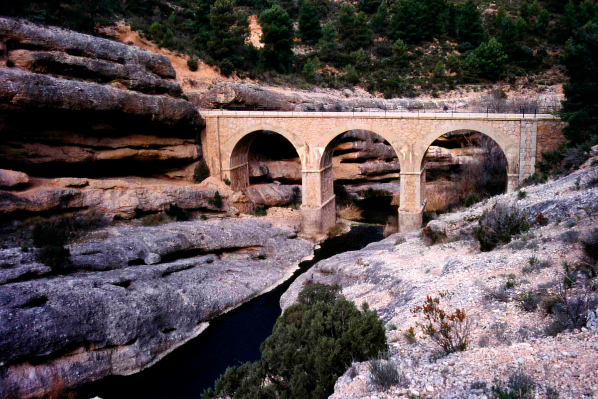 Before continuing on our way, it is worth noting that the kilometre signs posted along the greenway originate in the city of Tortosa. Therefore, in this description we will be counting down kilometres from 83 to 0.
The Pinada mountain range
The Val de Zafán Greenway starts in the old Valdealgorfa Station, located in the surroundings of this small locality (km 83). Its Aragonese Neo-Mudejar style stands out and we will see more of this style in some other Aragonese stations. The village, with its traditional houses on high ground, is a source of food supplies, which is an exception along the journey that should be taken advantage of before starting. The first metres of the greenway bring us to the Equinox tunnel, which is more than 2 km long and reflects a special magic. Only twice a year, on March 26 and September 17, you can see a slender, mysterious and ephemerous beam as the light of daybreak penetrates this straight tunnel. A truly unique experience.
On leaving the gallery, the landscape changes, which we appreciate now that we are starting a gentle climb –it is a rugged and wooded Mediterranean landscape dominated by a pine forest accompanied by kermes oaks, holm oaks, junipers, rosemary and mastic trees; the small valleys, on the other hand, feature terraces dotted with olive and almond trees. In such rugged terrain, the railway had to level the route through continuous watercourses and hills with tall embankments and deep trenches. This section features another curiosity: at around km 80, travellers will cross the Prime Meridian, which means that they will have one half of the planet on either side of them, while standing on this imaginary line.
Towards Matarraña
The ascent comes to an end at the abandoned Valjunquera Station (km 77). Made of masonry, with an abundance of ornamental brick tops, it reflects the same Neo-Mudejar style –these first two stations stand out from the others, which have a plainer appearance.
After passing the dividing line between the Guadalope and Mantarraña basins, the greenway starts going down towards the latter river, surrounded by the same rugged, solitary scenery. A long descent featuring the uninhabited village of Mas del Labrador, on the left, the abandoned, simple Valdeltormo Station (km 71.7), the turn-off to the Iberian settlements of Torre Cremada and Tossal Montañés, and a long, curved tunnel. From the station, a small road leads to the village of Valdeltormo 2 km away.
The turn-off to the Iberian settlements is signposted on the left (km 70.4), followed by the eighth tunnel (km 69), which is illuminated. The descent, which has a lot of bends in its final section, ends at the impressive viaduct over the Matarraña River (km 67), which features an extensive fertile plain. The concrete structure, supported by four 20-metre sections and four arches, features a magnificent view of La Fresneda, a locality on high ground crowned by the remains of a castle. It is worth stopping to visit this village and contemplate the Chapel of Santa Bárbara and the Church of Santa María la Mayor.
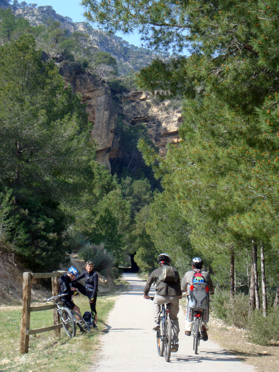 Ascent through the Barranco del Regall and descent to the Algars
Having reached the bottom, we now come to Torre del Compte Station (km 66.7), which has been restored as an evocative four-star hotel with a restaurant. The greenway will start ascending again through mountainous terrain.
Above our heads, the solitary belfry of San Pedro Apóstol gives way to a view of the locality of Torre del Compte. A little further up (km 64.3), there is the flyover of the TE-V-310 road, which is the best way of reaching this village.
At km 60, terraces of almond and olive trees and vines cover the heart of the Regall. The deep ravine and its enclosing walls gradually give way to a plateau featuring fields of vines, fruit and olive trees, and wheat.
The greenway, bursting in spring with colours and floral aromas, reaches Valderrobres Station (km 57.7). We cross the dividing line between the Matarraña and Algars basins and then start a gentle descent featuring open horizons, with views of the mountainous massif called Puertos de Beceite and the hamlet of Cretas, crowned by its church. Starting from Cretas Station (km 55.3), which has been restored as a youth hostel, the greenway does down through rolling terrain, surrounded by crops and pine trees struggling to occupy marginal spaces.
The descent ends at an impressive concrete-and-stone viaduct over the crystal-clear Algars River (km 49.7), which is very similar to the one crossing the Matarraña with its five 20-metre sections and four central arches. Finally, on the other bank, there rises up the ruinous station of Arnes-Lledó. We are now in Catalonia.
Terra Alta section: between Romanesque and Cubism
Arnes-Lledó Station (km 49) was conceived as a logistics centre for this line, featuring a locomotive depot. This station is just one kilometre from the town of Lledó, easily visible from the station. On the other hand, that of Arnes is about 6 km away.
We leave the Algars behind and head towards Horta de Sant Joan. In these 5 km we will cross this section’s first tunnel and skirt the hill on which the town of Horta de Sant Joan stands. A wide curve brings us closer to the buildings of the ruined Horta Station (km 44). Before reaching the station, the road that crosses the track, to the right, takes us, after two kilometres of ascent, to the town centre of Horta. Strolling through its historic centre, perched on a hill, takes us back to medieval times. These picturesque streets and surroundings served as inspiration for the painter Pablo Picasso, who spent several seasons in this town, at the height of his Cubist period. The town now features a centre that houses this pictorial memory.
Back on the greenway we enter another tunnel that brings us out to this region’s impressive landscape: huge mountains dominating the horizon, covered with almond and pine forests. And in front of us rises up the Muela d'en Canar, in which the Agulla stands out, a towering limestone crag.
Now our greenway seeks the proximity of the Canaletas, the main river until the end of the section. We will have to cross up to five more tunnels until the next station. Some of them are up to 600 m long and others feature a double bend.
But if tunnels are important, viaducts are also of special interest because of their great originality. Two of them seem to want to appeal to our Roman past with structures that recall those ancient aqueducts.
At Bot Station (km 35.4) it is advisable to make a stop to visit an old diesel car that now welcomes visitors as a cafeteria. Several barrels used outside as tables clearly invite you to try some of the famous wines belonging to the Terra Alta Designation of Origin. Bot is the closest town to the greenway; an obligatory stopover for obtaining supplies, since we will not find any fountains until Fontcalda (km 30).
Following the Canaletas
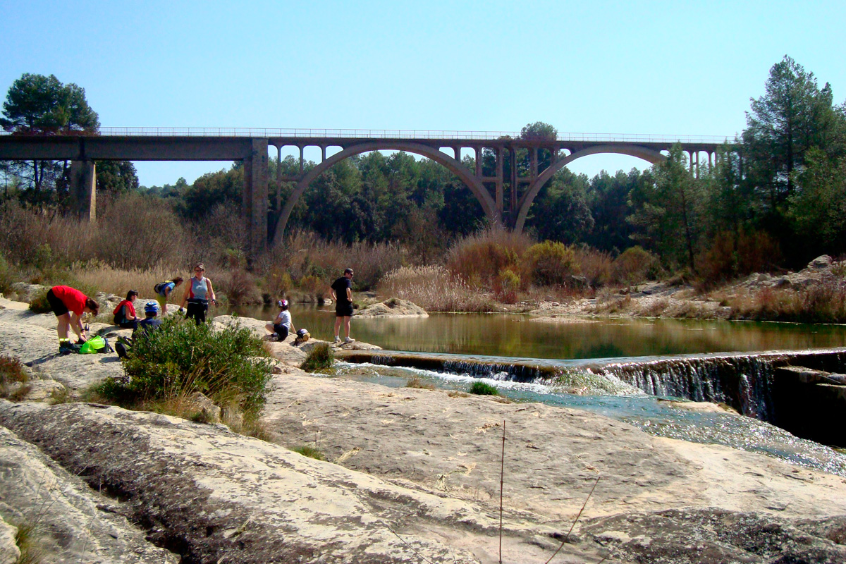 The Canaletas will be, from now on, the protagonist of a spectacular stage. The river accompanies us after passing the third tunnel after Bot (300 m), which precedes a spectacular viaduct. Although the river does not have a large volume of water, it has cut through the calcareous masses of these mountains, carving a spectacular gorge of great length, which was largely used to lay the route of the railway. Travelling along the greenway, featuring vertiginous trenches, viaducts and numerous tunnels through these mountains, we pass under the Muela d'en Canar. In some sections, this succession of tunnels and viaducts makes us almost feel dizzy!
The arrival between pine forests at Prat de Comte Station (km 30.5) is preceded by two tunnels, the second of which has a curved shape that is 739 metres long. The village is about 4 km away on a steep but quiet road that begins at the station. Prat de Comte, with its friendly residents and its welcoming hostel has a special charm that can compensate for the distance.
Two short tunnels lead to La Fontcalda (km 30), a recommended bathing place due to its attractiveness. From here there is an access road to the Sanctuary of La Fontcalda, one of the route’s biggest surprises along with the Els Estrets de Dalt, a spectacular place where the river is embedded in a narrow gorge. There, a trail carved into the rock enables us to travel along this narrow passage. Thanks to this varied mix of stones and water, we will leave La Fontcalda rejuvenated in body and soul.
Back on the greenway we will see more proof of the engineers’ skill, with a grandiose viaduct crossing the Fontcalda Stream.
Along the PR-C-98 route to go around the tunnel
As far as the station of El Pinell de Brai, the greenway is used as part of the Terra Alta trekking route: the PR-C-98. Nearby is the tunnel that was "blamed" for the railway’s closure, when there was an important collapse in its centre. While the railway closed –among other reasons– due to this collapse, the modest greenway did not dare to rebuild it either. For this reason, the greenway makes use of the track, which does not have any steep slopes, that goes around the tunnel.
We return to the route’s customary peacefulness, following, as always, the Canaletas along kilometres of more scenic beauty. A few tunnels further down we reach Pinell de Brai Station (km 25.5), which as now been converted into as a restaurant. The town centre is about 6 km away along winding (and beautiful) mountain roads.
Following the great Ebro River to the dam
The Baix Ebre section begins at this station, which is linked by an asphalt track to the N-230b road (km 24). Accompanied by the pleasant sensation of going downhill, the greenway, in its effort to follow the Canaletas, advances over embankments and through large trenches as well as a series of tunnels of various shapes and lengths. One i even 500 metres long.
Although the longer ones have lighting, it is recommended, as always, to bring flashlights, headlamps or lights on your bike.
This stretch between mountains and pine trees reaches a magical moment on the superb Riberola viaduct over the Canaletas Canyon. With an aesthetic central arch, the concrete structure is so high that it is an exceptional viewpoint. Benifallet Station (km 21) is a stopping point. It provides accommodation and food, even musical dinners in the summer months.
The town of Benifallet located on the other bank of the Ebro River reflects its Moorish past with narrow and winding streets, where we can take an excursion along the Ebro River or visit the Maravillas Caves.
After the station, the greenway changes from the Canaletas Ravine to the Ebro River, going through three tunnels separated by large trenches. On coming out of the eleventh tunnel we finally look out over the Ebro, Spain’s longest river, the real protagonist of this last section of the greenway that advances powerfully towards the sea between mountainous slopes covered by the pine forest of the Cardó and Boix mountain ranges.
The greenway, located above the riverbed and its fertile plain, enables us to enjoy wide panoramic views of the river. This narrow passage and the difficult terrain culminate in the Xerta Dam (km 15), an engineering work that retains and channels the waters of the Ebro. The dam’s dike, which has a unique diagonal layout, is 310 metres long and 6 metres high. It has a large central overflow and gates at the ends that feed the irrigation canals. On its right bank is the old mill, one of the few industrial examples of the Renaissance that still exist in Catalonia.
The Xerta turn-off and arrival in Aldover
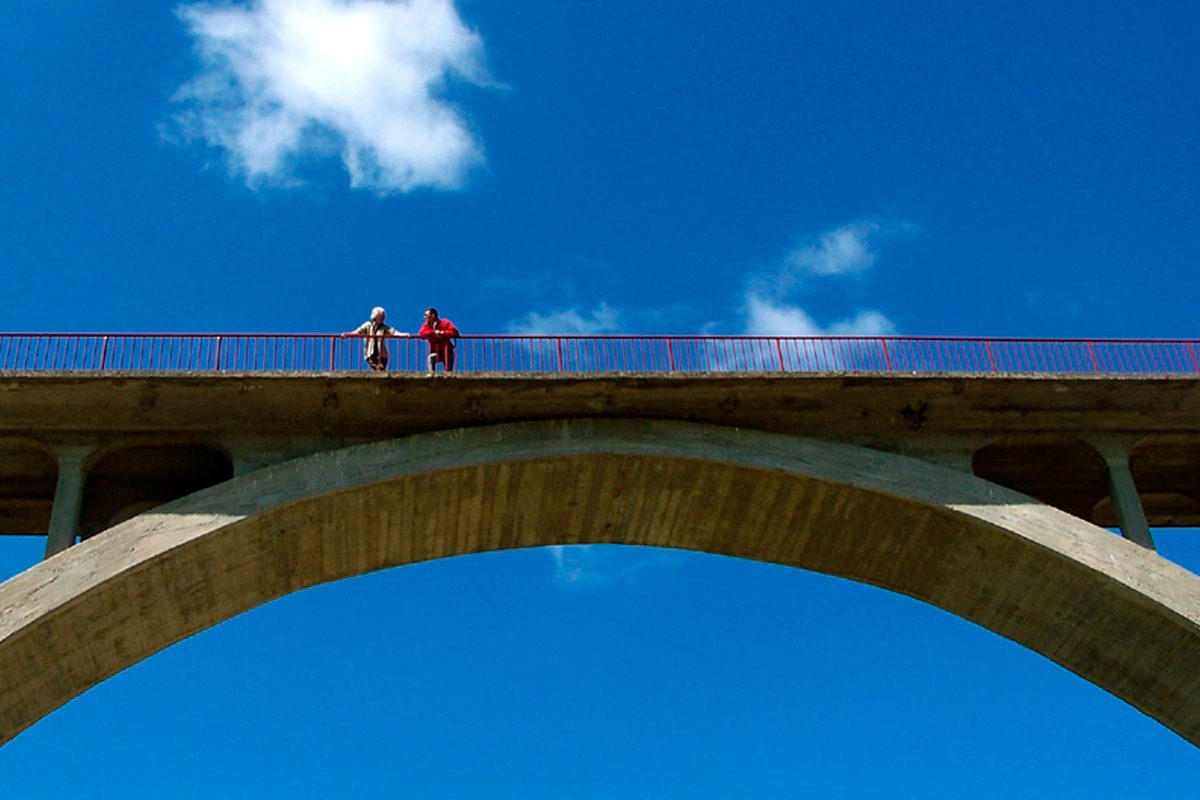 The greenway arrives, bordered by fruit trees, at Xerta Station (km 13) and its refreshing fountain. As usual in this section of the Baix Ebre, the stations have acquired a new life, and this one in Xerta offers bicycle rental, including electric bicycles, and a transfer service. The route continues along L'Estació Avenue, winding through the narrow streets of the town centre to the square and the church, featuring a staircase indicating different flood levels. Flooding of the Ebro has been a constant phenomenon throughout history, and it is difficult to imagine that this space was submerged under 10 metres of water in 1787. All the floods that have occurred since the 15th century are reflected in the tiled staircase that forms part of the church façade.
Opposite the church, with its curious bell tower crowned by four dogs, we follow the signs that lead us to an asphalt track, surrounded by oranges tress, that borders the right channel of the Ebro. We pass a shaded recreation area and, following the sign, we continue along a concrete track that passes under the C-12 road and goes up to the original railway route.
About 50 metres away, on the right, we find a tourist sign to visit the old trenches of the Spanish Civil War located in the Fornets Ravine; they form a closed fortification system that surrounds a small mountain, designed to control and defend this old railway line. There are signs providing more information.
Back on the greenway, the route enters a straight section featuring viewpoints overlooking the Ebro. We go around the C-12 road above the Conca Ravine, where the spot known as Las Olles is located, a highly eroded, rocky place that forms a reservoir throughout the year. Following the route, we cross under the bridge of the C-12 road and, in accordance with the indications painted on the ground, we return to the original route of the old railway, travelling along a straight stretch full of plants and flowers as far as the village of Aldover, which is surrounded by orange trees. We cross it and arrive at the old Aldover Station (7.8 km), which has been restored and fitted out with a restaurant service, bike rental and rest area.
Along the Ebro’s fertile plain
Leaving Aldover behind, the greenway enters the fertile Ebro Valley along straight stretches featuring orange trees. At the foot of Torre d'en Corder, the remains of medieval defensive structure and now a rural hotel, the mountainous slope on the right bank diminishes and merges into the landscape. On this terrain, the railway ran along an extensive, straight stretch through an undulating, varied and open landscape, featuring fruit orchards, huts and farms, that will take us to the Terrer Roig rest area, in Jesús (Tortosa).
At this point, the original route continued along an old bridge to avoid the road that collapsed. Thus, the route continues along a protected bike lane. Then there is a short stretch along a very steep ramp to finally reach the Vall del Marqués bridge, an old bridge that crossed the ravine. The route is signposted above the pavement, to separate it from the route of the cars. Be careful at the road crossing! You must use the pedestrian crossing that is a few metres from the end of the bridge. We arrive directly at the information centre of the Els Ports Nature Reserve in Roquetes (km 2.6).
An urban ending: Tortosa
From the information centre, a short and straight section shared with the bus lane awaits us. We will cross over what remains of a Val de Zafán bridge and continue along the bike lane that forms part of the pavement that takes us to the original railway line. Here we find signs for the Ebro Observatory.
At the end of the street, the greenway recovers its appearance and surrounds the urban area of Roquetes through farmland. The greenway is again interrupted by the crossing of a road; there is a pedestrian crossing and a sign indicating the crossing for vehicles.
We now continue along the old route and contemplate the view of the monumental Historic-Artistic Site of Tortosa, towards the old iron bridge (224 m), featuring latticework and stone pillars that have been restored and painted red, which crosses over the Ebro and leads us to the historic town of three cultures. The bridge over the Ebro is the most significant masonry work on the railway line. Its construction was very laborious and delayed the final inauguration of the line, which was opened on June 21, 1868, and rebuilt after the Spanish Civil War.
More kilometres as far as Ebro Delta
The Val de Zafán Greenway, in its 83-km route, ends here in Tortosa, but from this point you can continue along the bike lane to the new Carrilet de la Cava Greenway (7 km), opened in 2021, as far as the municipal district of La Aldea.
Once you reach the end of this new greenway, you can connect with the Ebro Nature Trail as far as the mouth of the Ebro. Another 50 km that enable you to reach the Biosphere Reserve at the mouth of the Delta. The route is circular and connects again with Tortosa, offering a lot of possibilities!
And in the future, hopefully soon, a single route of more than 175 km from Puebla de Híjar to the mouth of the great Ebro River will be linked together.
